Touch "Go" for instant driving directions. Travel along the stream with GPS tracking on topographic maps. Mark your favorite spots for your next trip.
Stream Map USA is a complete GPS mapping and navigation tool featuring the most comprehensive searchable stream map ever made. Designed specifically for anyone spending time on the nation's waterways, this edition maps the states of Minnesota, Wisconsin, Michigan, Ohio, Indiana, and Illinois..
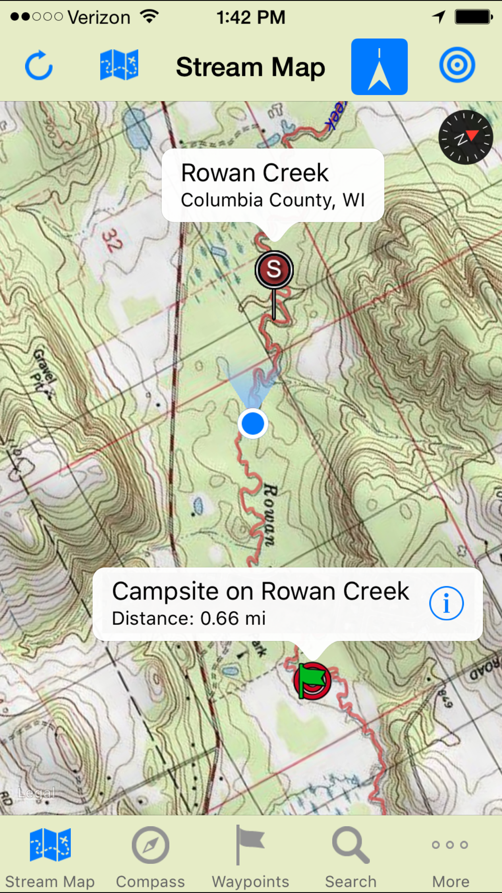
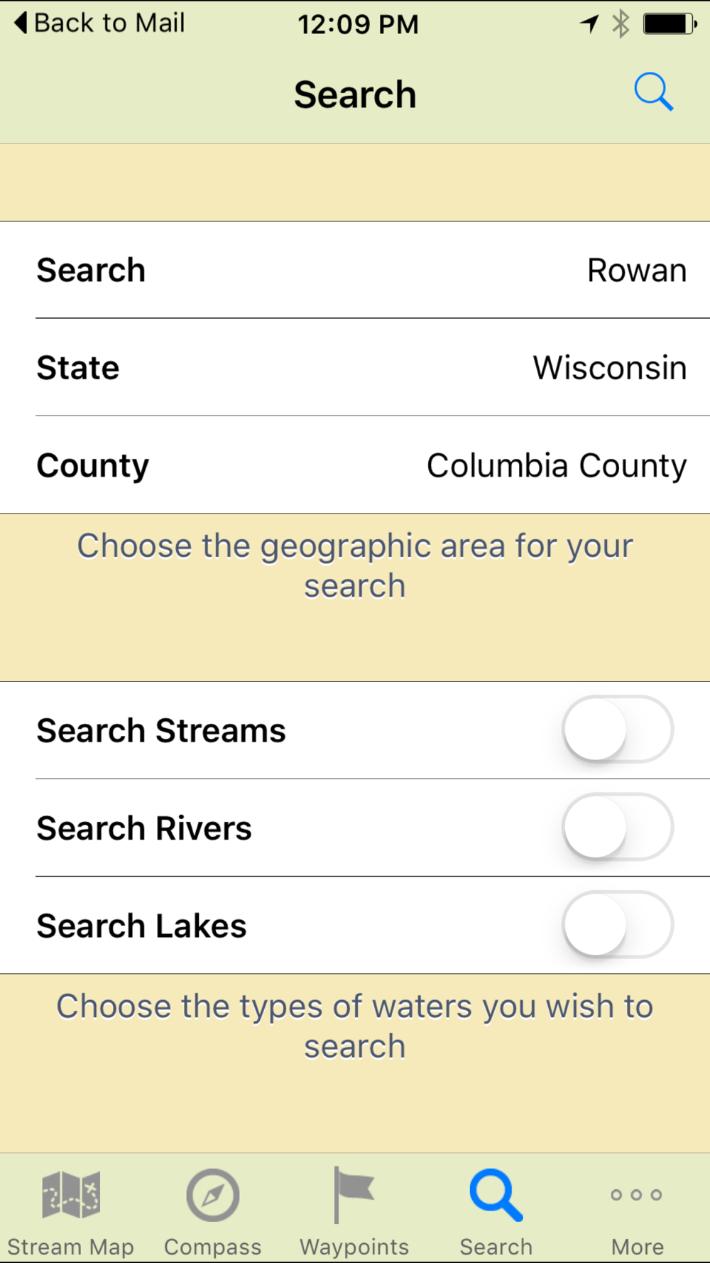
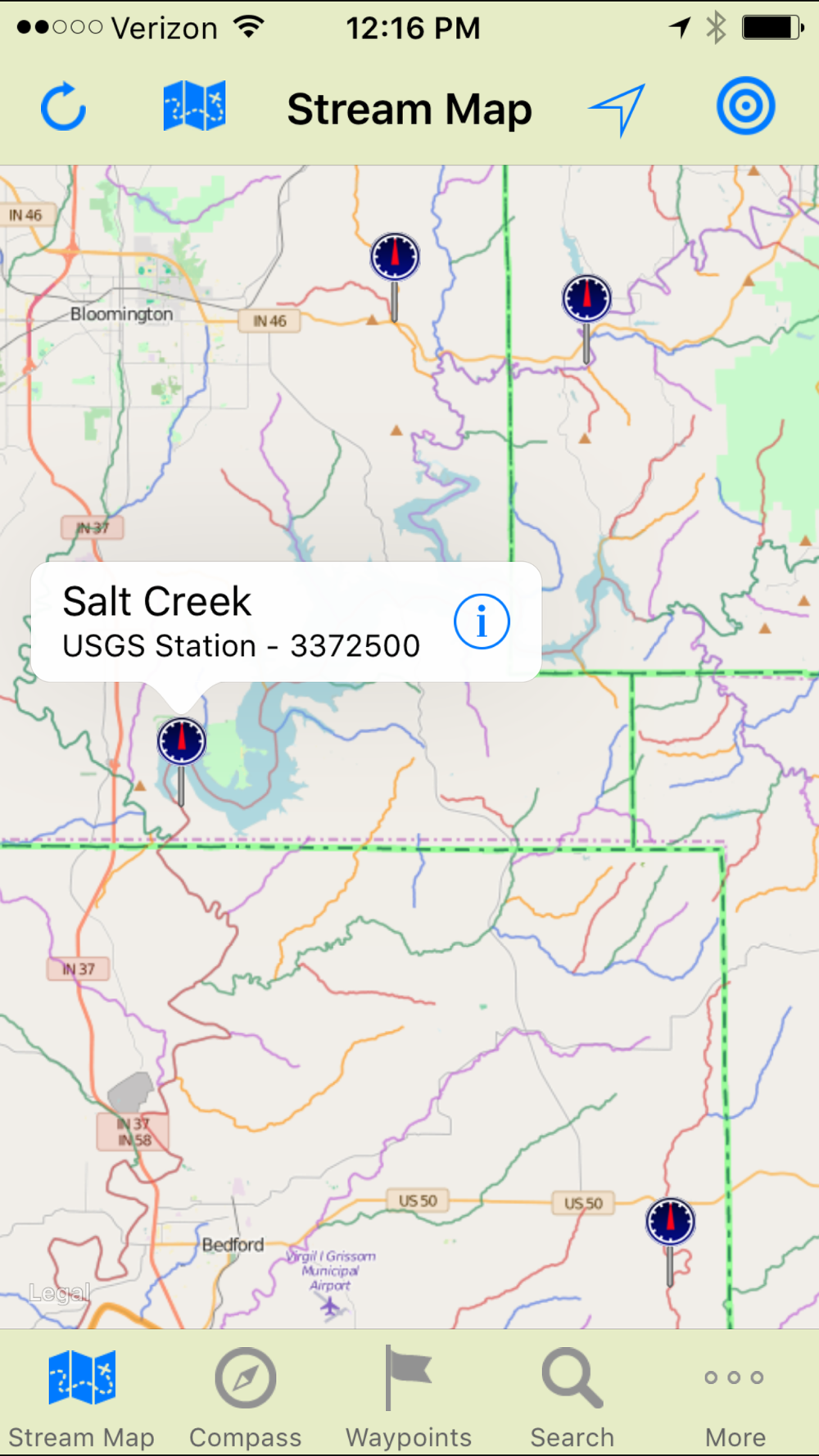
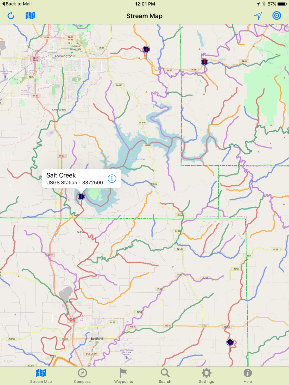
Stream Map USA features a searchable color coded map of America's rivers, lakes and streams that can be viewed on roadmaps, satellite images or topographic maps. As you travel, the map displays your location and tracks your progress even when there is no service. Both roadmaps and topographic maps can be stored on the phone for offline use.
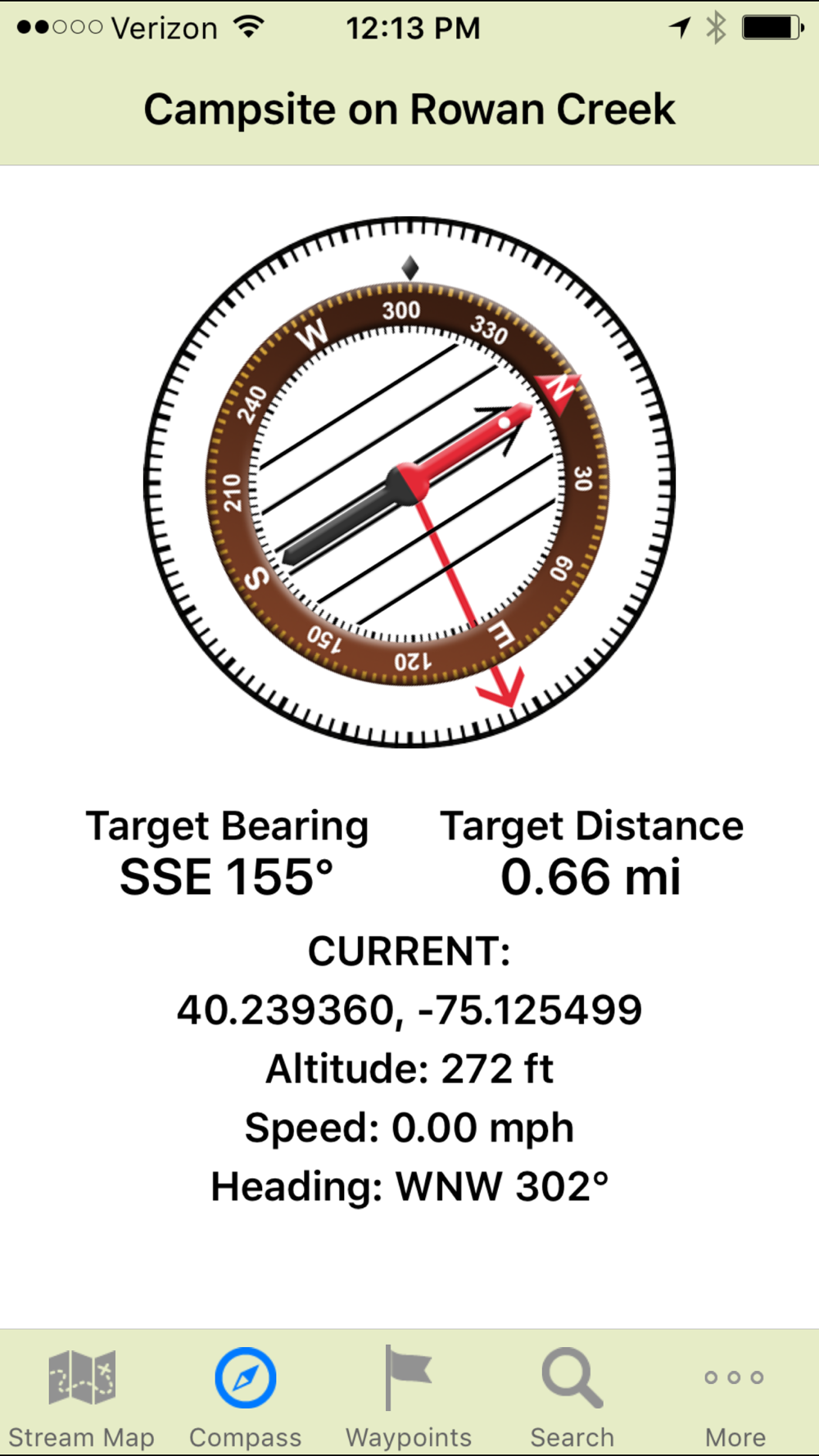
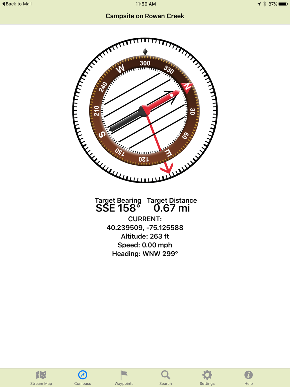
Custom waypoints provide navigation and allow you to plan your trip. Add a waypoint where you'll access the water, then tap "GO" for turn-by-turn driving directions right to that spot. Add additional waypoints for campsites, fishing holes, trailheads, equipment caches, pickup points and more. Now "Target" your next waypoint and the built-in compass points the direction and counts down the distance right to that destination.
When planning a trip on the water, it is always wise to know the water conditions in advance. As an added feature, Stream Map USA includes the ability to access real time stream gage and flow data for many streams and rivers.
No matter what activity you enjoy on the water, we're confident you'll find Stream Map USA a helpful addition.