Simple and intuitive operation GPS navigation iOS app. It is the concept of SkyWalking.
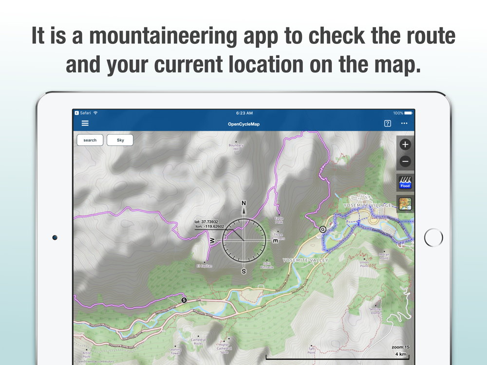
Such as mountain climbing, trail running, even in the mountainous area that can not be connected to the net, if in advance to create the offline map data, display the current position and altitude without having to worry about the network connection, you can display your present location, altitude, direction, route and destination on the map.
SkyWalking, by overlay display the tile image on top of the base map, you can take advantage of the map from a new perspective.
For example, by overlaying the aerial image of the 1950s, and bird's-eye view of the previous situation, it can be compared to the current map. By overlaying the aerial images taken at the time of eruption or disaster occurs, you can increase the knowledge on disaster prevention.
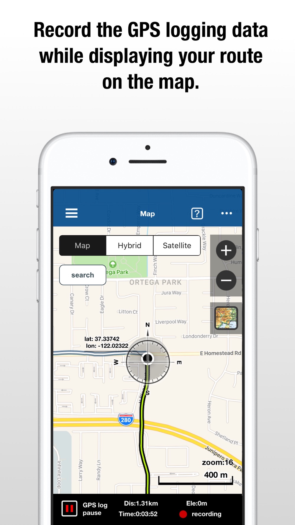
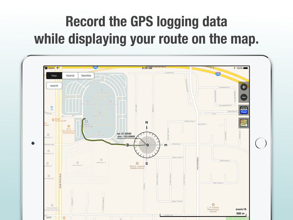
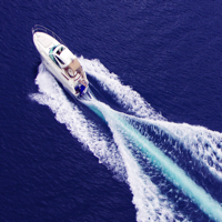
Get your act as a GPS log, can be displayed on the map in real time. To share friends and GPS logs exported to GPX format, it can also be displayed on the map to import GPX of other people to SkyWalking. It helps prevent distress and road hesitation in climbing.
It corresponds to FlyOver that has become available since iOS 9. Popular cities such as Tokyo, New York or such as the European Alps or Yosemite National Park, let's try the bird's-eye view of the attractions in the Sky mode. You can enjoy a sense of realism, such as was the bird.
For in GPS logging app continues to operate GPS is also in the background, so you consume the battery, please note.
====== User that is assumed and how to use ======
* The person who would like to check the route, the present location, the altitude and the direction in an outdoor activities.
Climbing, hiking, Trekking, camp, outside rock climbing, bouldering, trail running, cycling, drive, running, marathon, paragliding, fishing etc.
* The person who would like to upload route data in a GPS route sharing site.
* The person who would like to download a GPX file and indicate a route on the map.
* The person who would like to check the present location and altitude on the off-line map, even in the environment that it can't be connected to a net (like mountain range).
* The person who would like to make a plan of travel, make a route of mountain climbing, trail running, GPX route is indicated on the map beforehand.
* The person who likes looking at a high details three-dimensional view map and Topographical map.
====== The features of SkyWalking ======
* 3D view. (Flyover)
* Stores map-data off-board (downloads from internet. only in Japan. GSI Map.)
* Stores cache data off-board automatically from the showing map tile images once inside the application.
* Display support of OpenStreetMap.
* More than 40 kinds of GSI ortho images obtained by photographing the crustal movement of disaster stricken areas and eruptive activity.
* Bookmark any location as a favorite point.
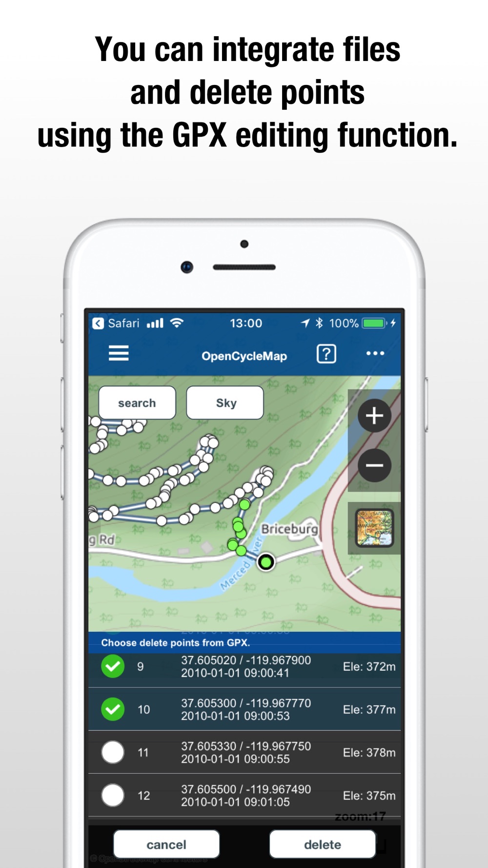
* Ability to import GPX from the other service you can download the GPX file.
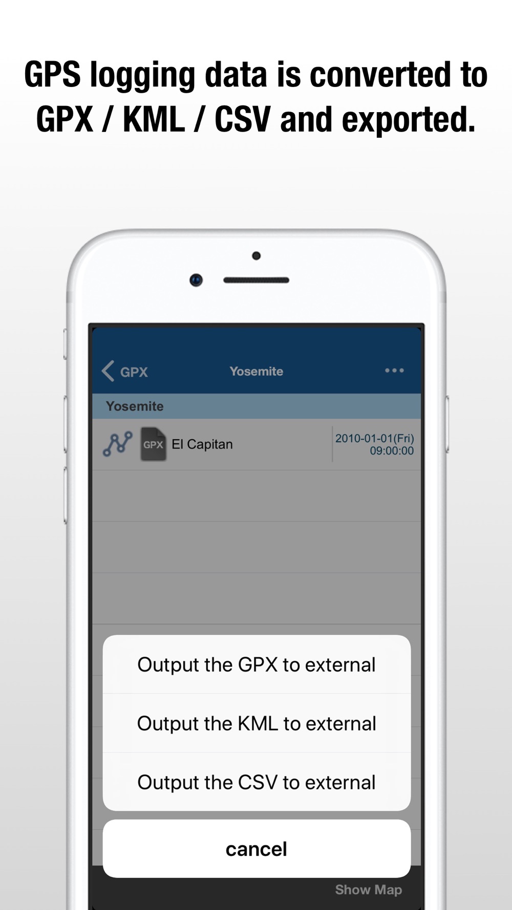
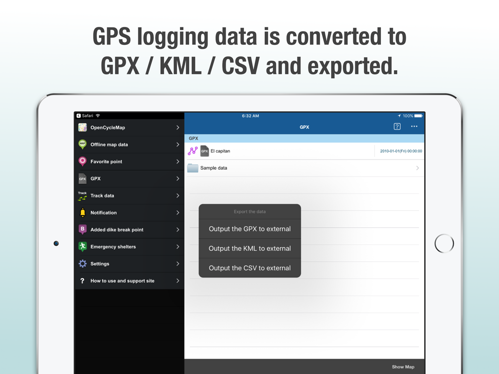
* To export the acquired GPS log to GPX, KML and CSV file.
* Exporting KML, you can import the logging data to Google Earth and Google Maps.
* Control of detailed parameters of the GPS log recording. (Editing ActivityType, GPS accuracy, Distance Filter)
* Real-time viewing of the GPS logging on the map with track line.
* Display of altitude graph visualized the distance, time and altitude data of the GPS log and GPX data.
* Multiple display of GPX and GPS data.
* Flood simulation with time sequences and max area. (only Japan)