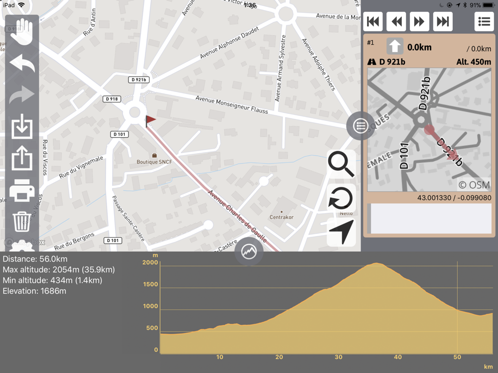
Create the route on the map that you are going to.
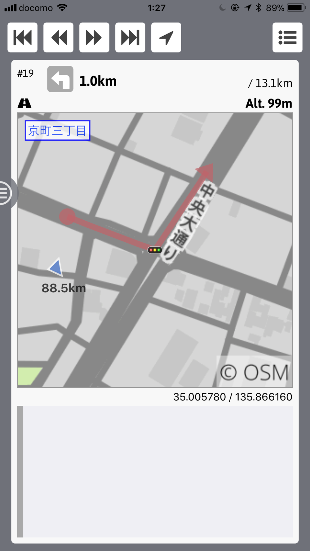
It is easy to check altitudes.
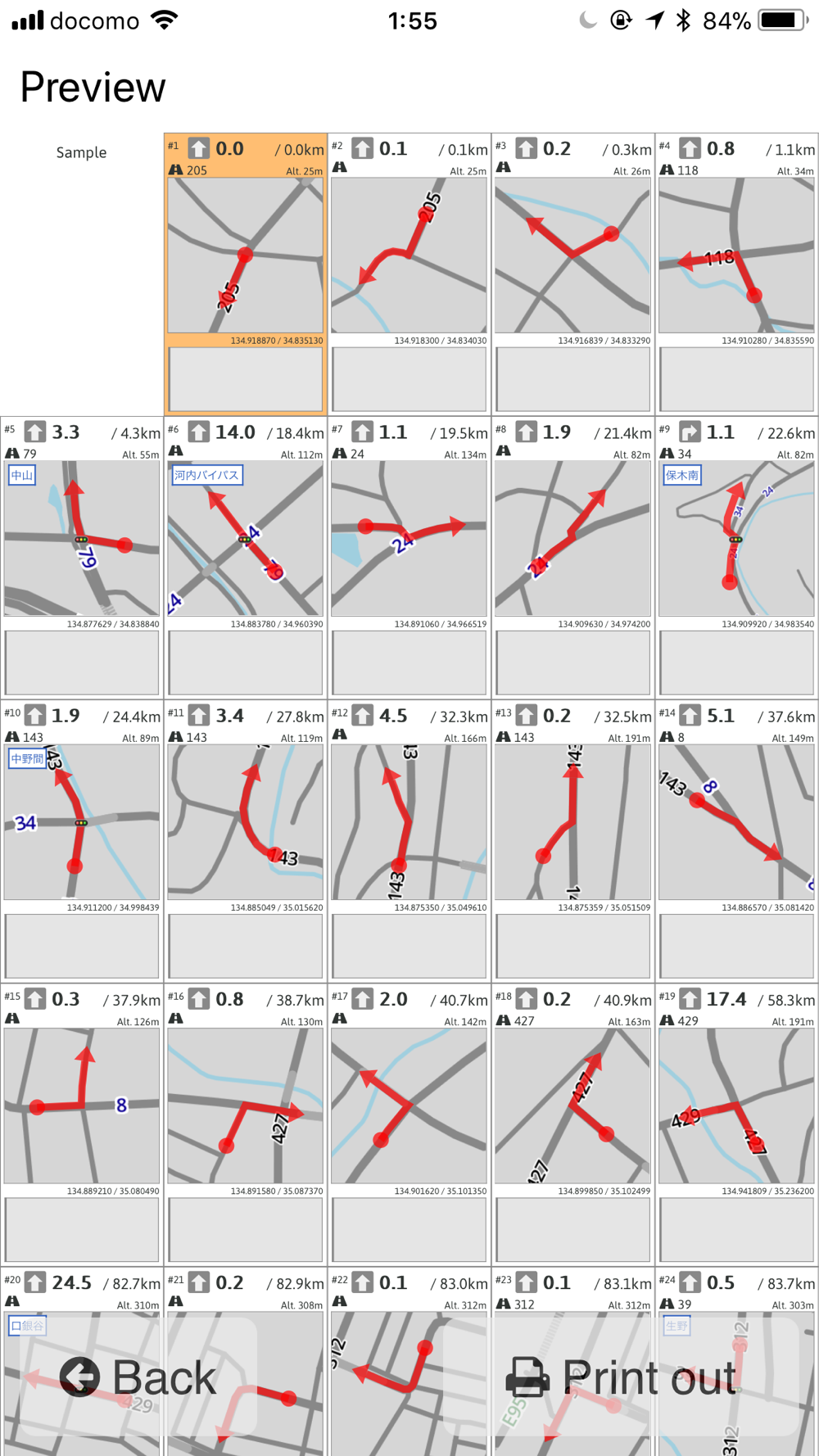
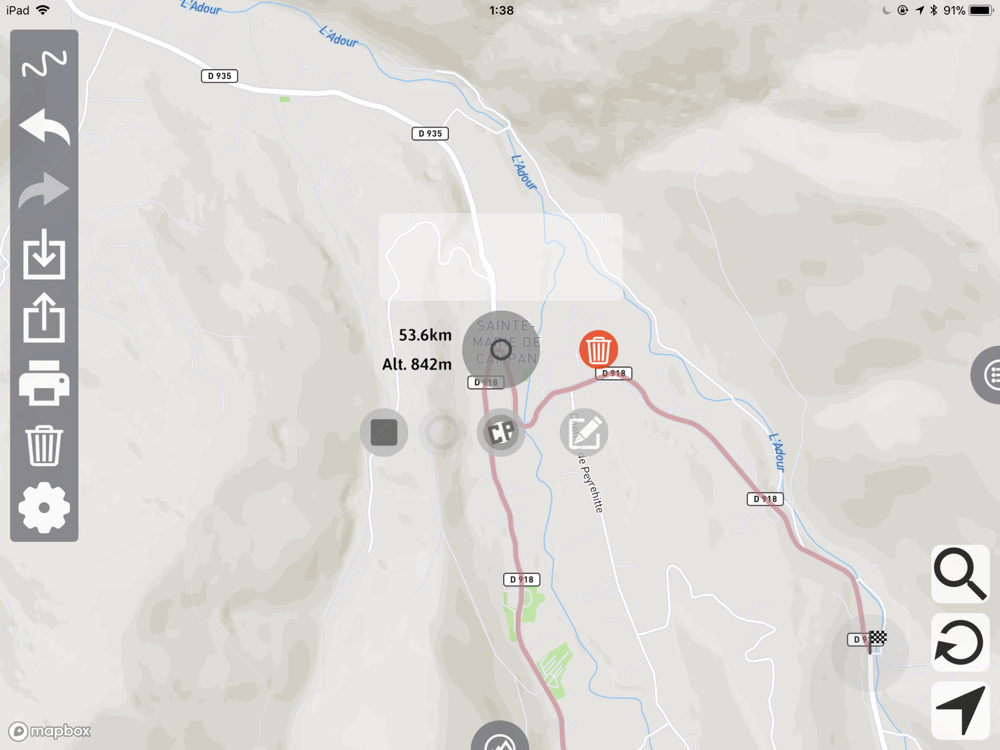
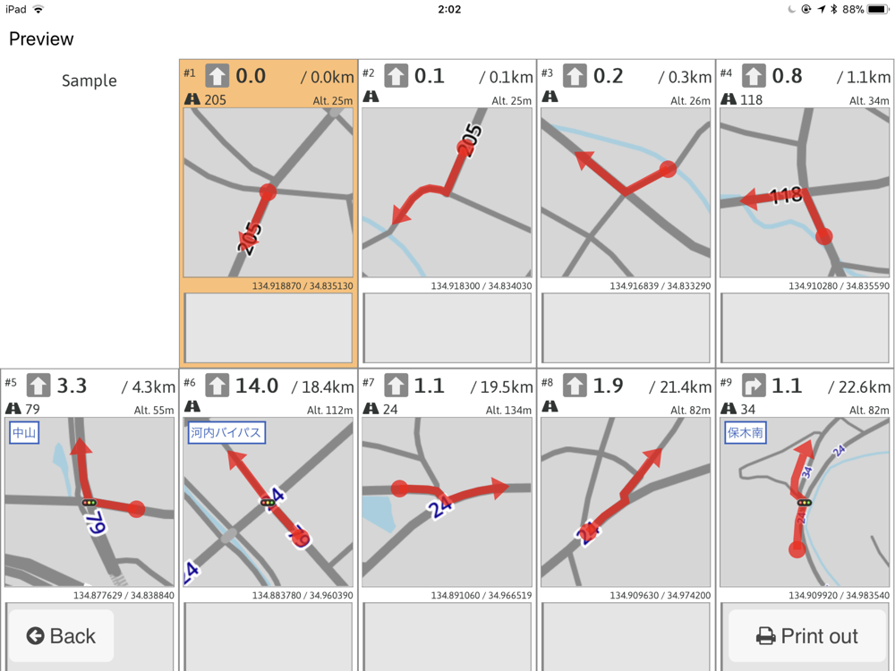
Turn, checkpoint list is automatically created.
# It is easy to create the route along the road.
# Turn, checkpoint, start and goal list is automatically created.
# It is possible to check route altitudes.
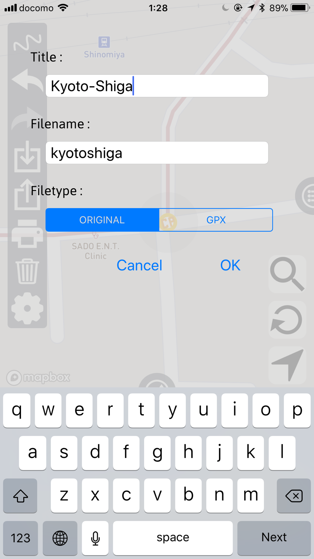
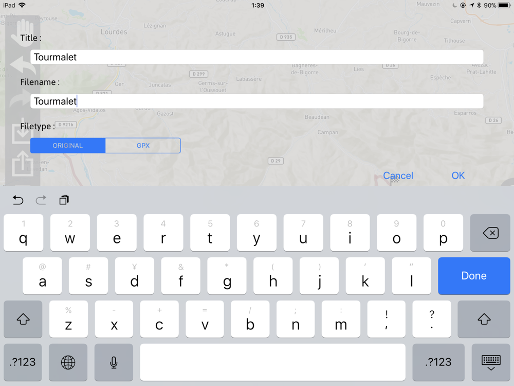
# Created route can be exported to iCloud Drive or others.
# Of course, you can import create route from iCloud Drive or others.
# Exporting GPX format is available.
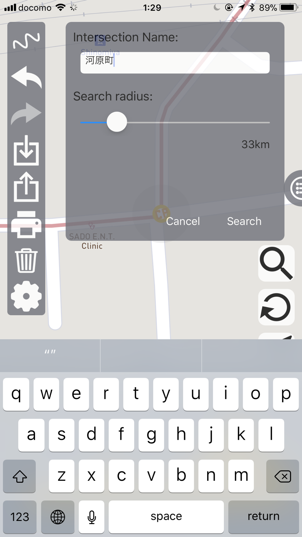
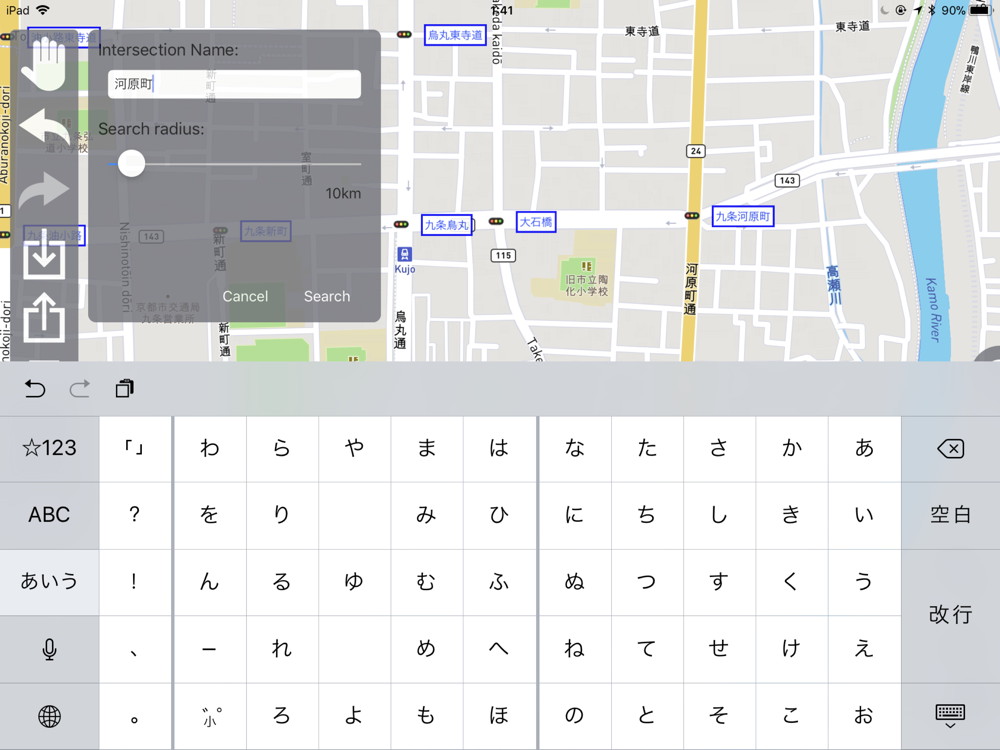
# You can search intersection names in Japan.
# Print out PDF from iPhone/iPad directly.
# Finally, supported GPX data importing !!!
# Supported route direction mode. You can choose automobile, bicycle and walk mode.
# Supported initial distance.
# Displayed check point on the profile graph.
# Supported turn direction, intersection name and signal existence editing.
# Added point insert mode.
# Supported colored cue/pace-notes sheet. Background color becomes red when turn is left, right is blue.
# pinch in/out the lower half area of the chart, you can enlarge and reduce the x-axis scale.
# swipe the lower half area of the chart to scroll.
# tap the upper half area of the chart, you can select the graph and it is snapped to peak and trough automatically.
# swipe the upper half area of the chart, you can select the graph continuously.
# tap the x-axis, distance and altitude marker is displayed.
# support rpt type GPX data.