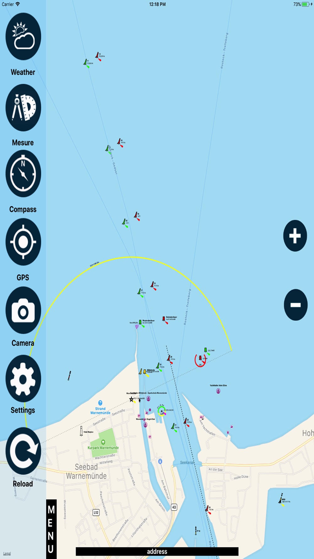
OpenSeaMap App contains information on oceans, rivers, and topography. OpenSeaMap provides access to a wealth of information for skippers of sailing and motor boats and much more.
App Features:
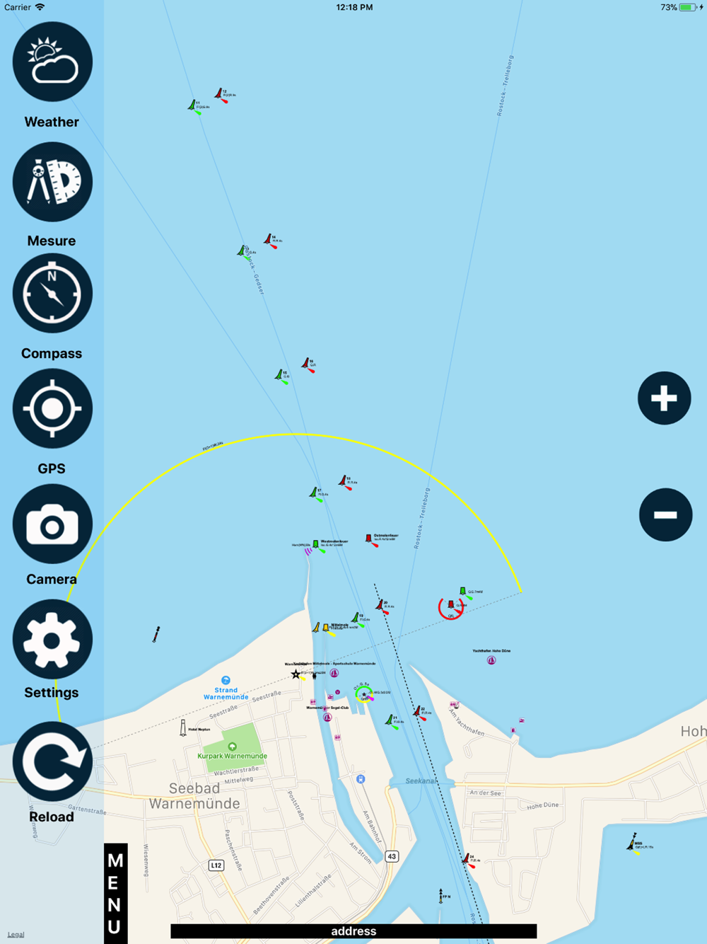
Shows your current location on the map (turn on GPS)
Displays worldwide sea chart
Search for geolocations
Chart plotting with continuous tracking
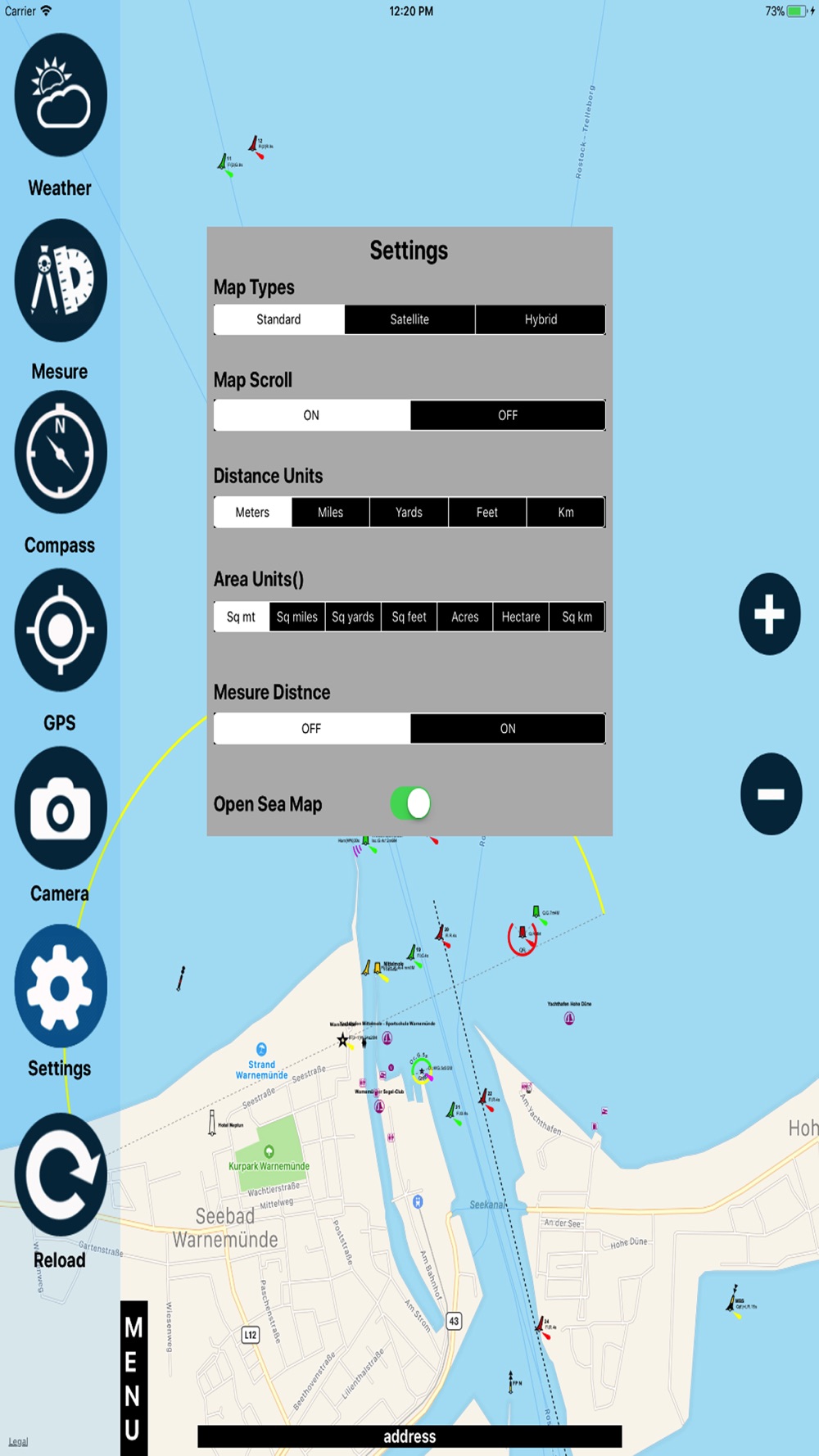
Settings (units/Compass/Map related functions)
Create, edit & deleted waypoints
Zoom in/out
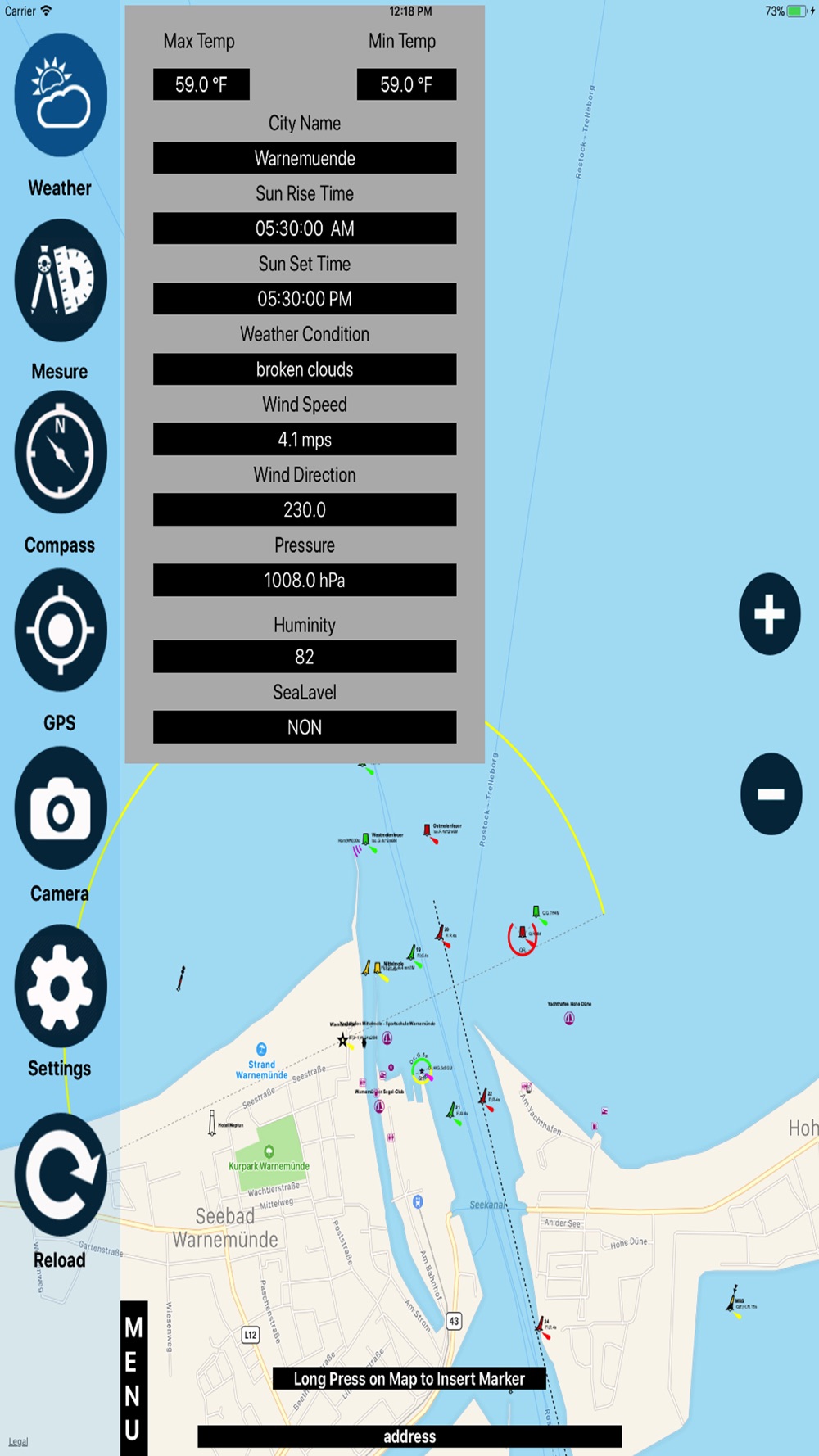
Weather (Current conditions)
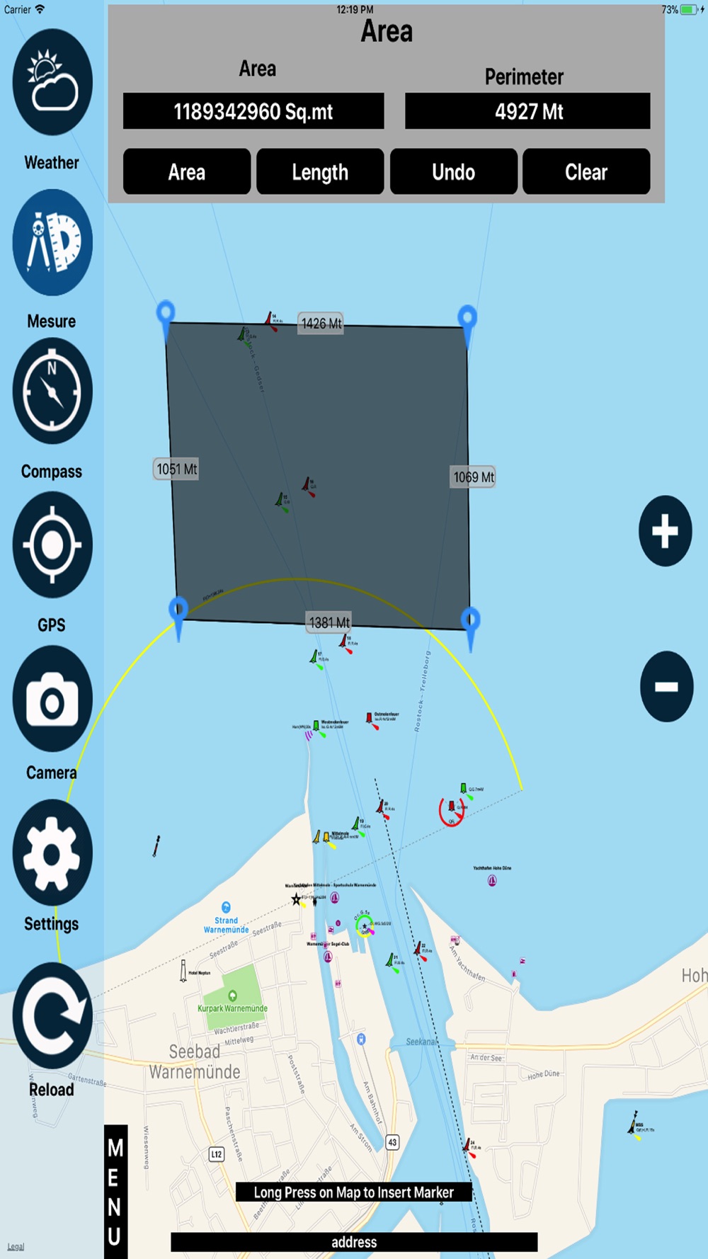
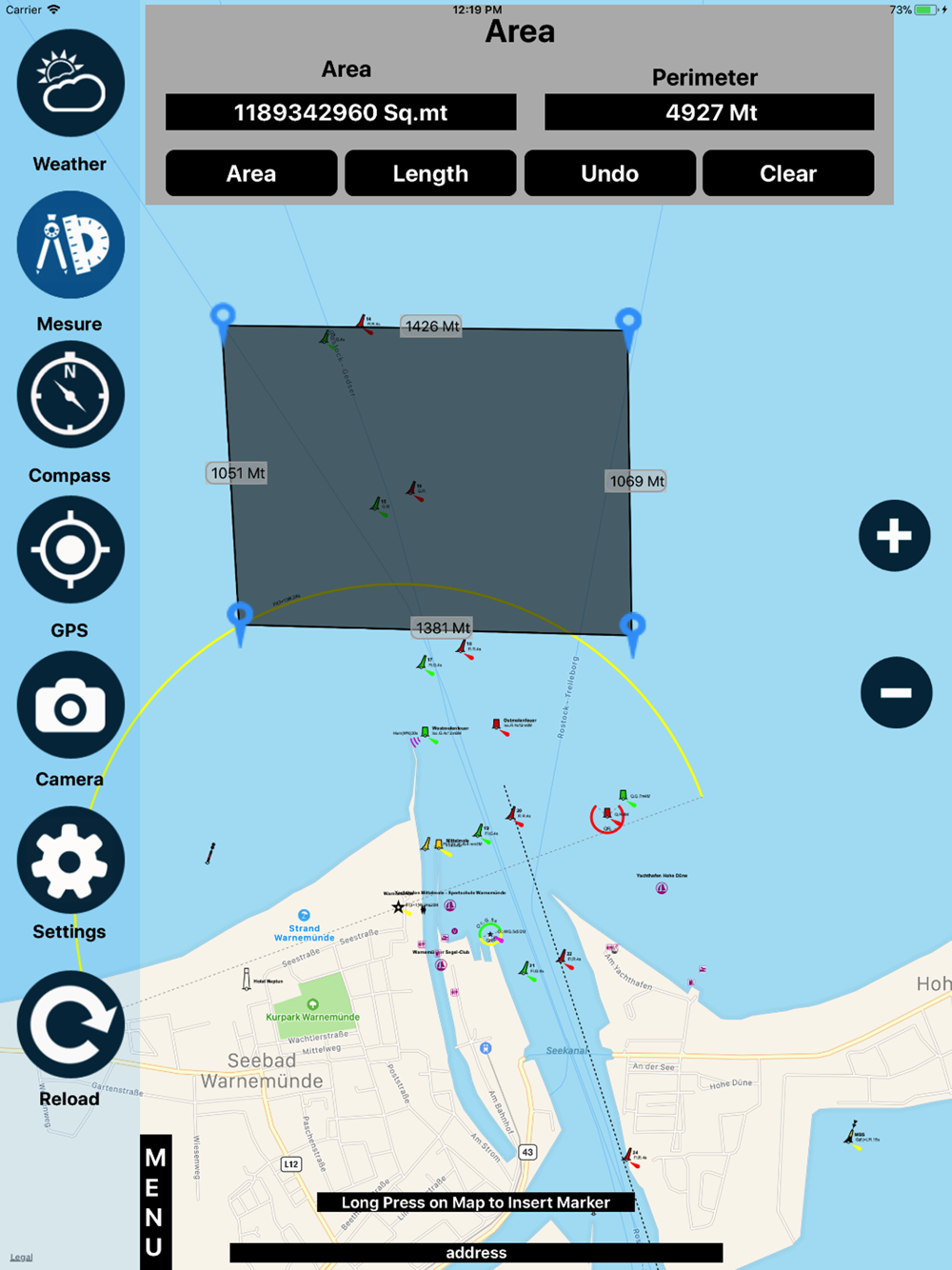
Measure (Area/Length)
Favorites (add/Delete)
GPS Info (Lat/Lon Speed..)
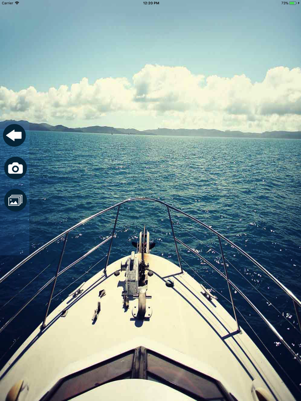
Camera (Photo/video)
OpenSeaMap is part of OpenStreetMap.
---------------------------------------------------------
Simple graphic & Easy to use
Developed with latest technology
Supports all devices
All updates are free
Disclaimer:
Users need Proper Network connections or Wi-Fi to play this app.
Continuous use of GPS running in the background can reduce battery life.