Don't be caught off-guard—download Bushfire.io now to stay informed and make better decisions during natural disasters.
Our Story:
At the height of Australia's worst-ever bushfire crisis in 2019-2020, our founder found himself nearly trapped by a devastating fire on Australia's south coast. Tragically, not everyone was so fortunate. In such critical times, key information was lacking: the direction of the fire, its intensity, when to evacuate, and the status of escape routes. Even firefighters were struggling to get a clear picture. Motivated by this experience, we created Bushfire.io with a simple goal: to provide the vital information people need to make better decisions during natural disasters. Over time, we've incorporated user feedback to make Bushfire.io the go-to platform for emergency information in Australia and beyond.
Key Features:
• Real-Time Alerts: Receive immediate notifications for bushfire warnings and other emergencies near you.
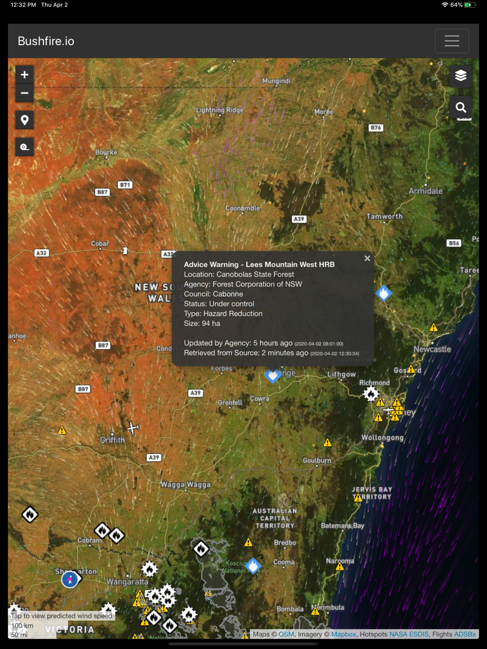
• Interactive Map: Explore an up-to-date map with hotspots, warning areas, and live weather conditions.
• Easy Sharing: Instantly share emergency information with friends and family via social media, SMS, or email.
• Trusted Data: We collaborate with local authorities to bring you verified and real-time data.
• User-Friendly Interface: Designed for quick and easy access to crucial information during emergencies.
• Secure Login: Fast and secure login.
Our Coverage:
• National Warnings: Bushfire warnings, fire incidents, floods, storms, hail, and damaging winds in Australia, the US, and Canada.
• Emergency Aircraft: Positions sourced from Flightradar24.
• Wind Forecast: Particle overlay with NOAA or BOM wind forecasts for our Pro users.
• Hotspots: Data from Geoscience Australia or NASA.
• Real-Time Weather: Near-real-time weather observations.
• Road Conditions: Closed or hazardous roads are displayed, minus inconveniences like roadworks.
• Burnt Areas: Recently burnt areas in select locations.
Terms of Use: https://docs.disasterscience.co/terms