Light Trail GPS is a hiking-oriented navigation app with many unique features.
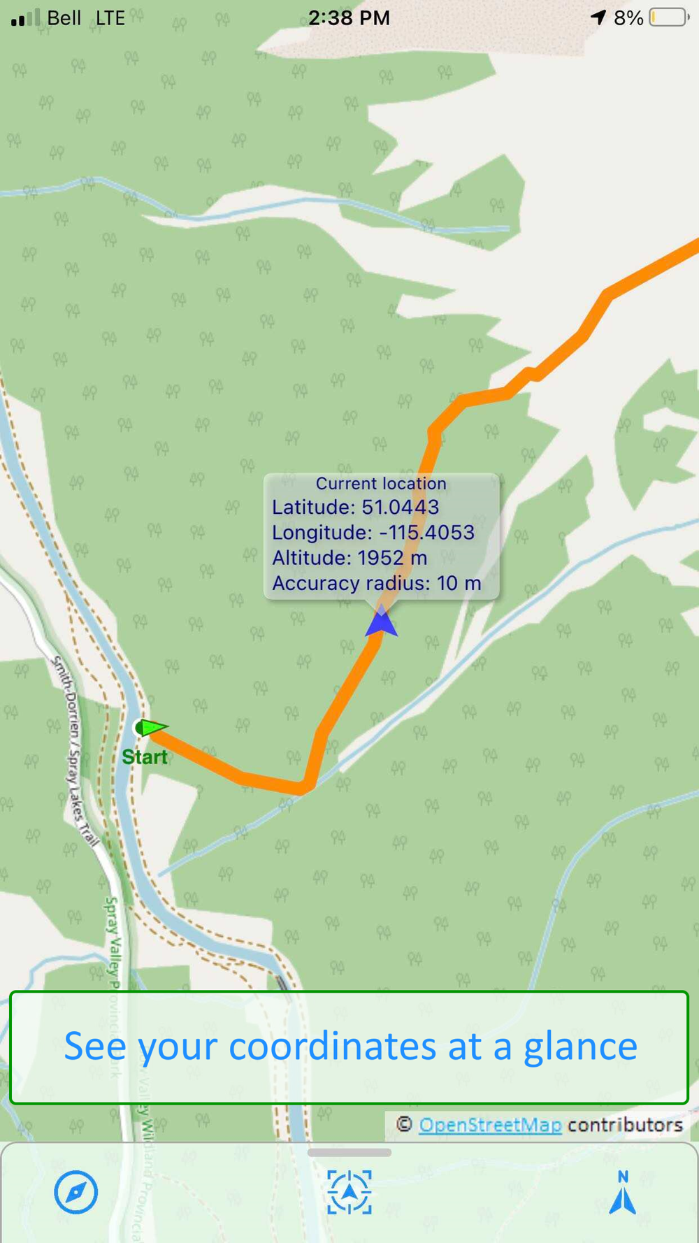
- Navigate map with various orientation modes and compass overlay
- Use map interactively
- Tap any trail on the map to get its name and length
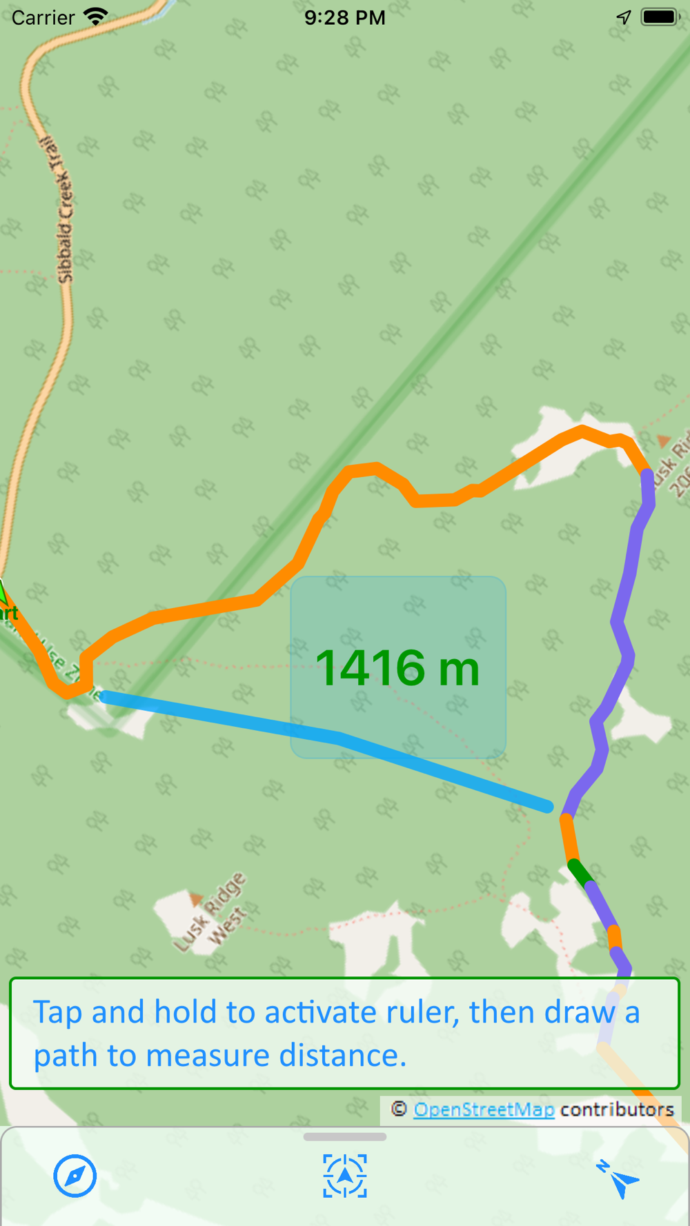
- Use tap and hold gesture to activate ruler indicator, then draw free path on the map to measure its length
- Draw on selected trail to measure full or partial length as the trail goes
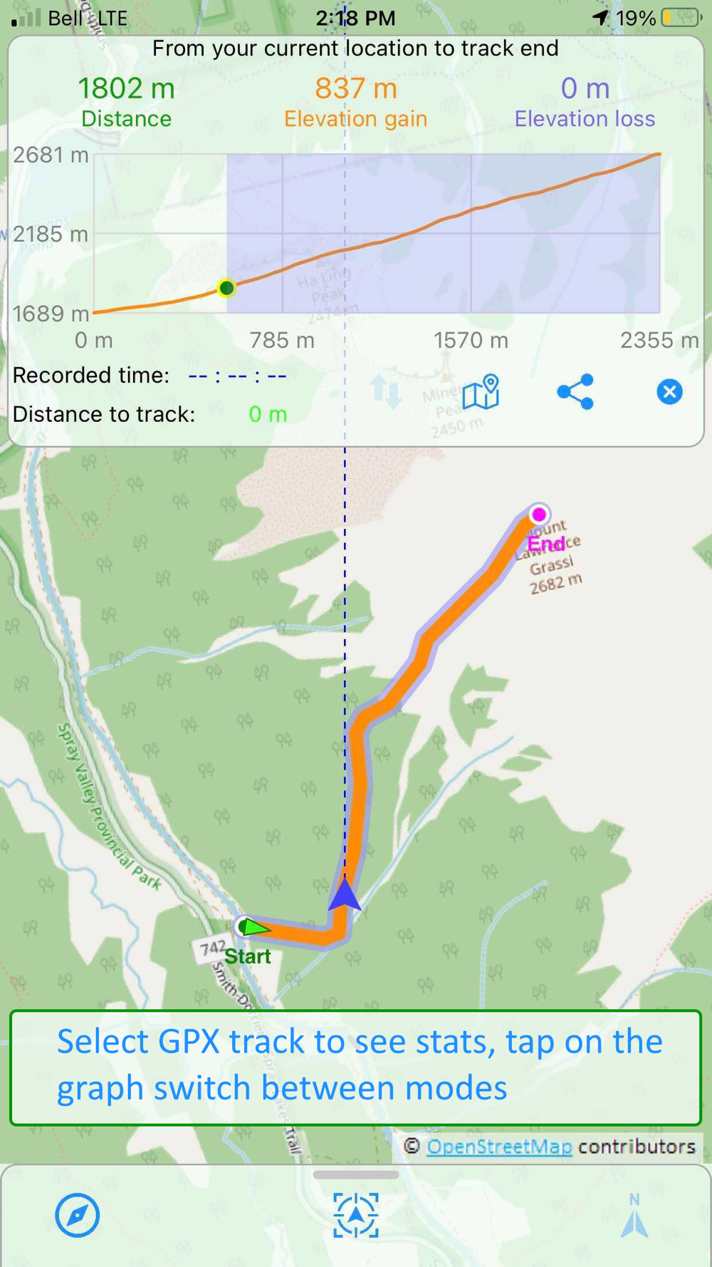
- Draw on selected GPX track to measure it full or partial length and also elevation gain and loss
- Comprehensive support for GPX tracks
- Load multiple tracks simultaneously
- Download offline map for given tracks
- Filter out forward or return portions of the GPX track
- When on track, get stats for remainder of the way and for the portion already traveled
- Record your own GPX tracks.
- Plan and build your own routes from existing trails on the map
- Join existing trails or their segments into a single route
- Swap start and end of the route
- Convert to GPX track
- Search trails by name in OpenStreetMap database
- Mark your favorite places with globally stored waypoints
- In-app purchase to permanently disable all ads