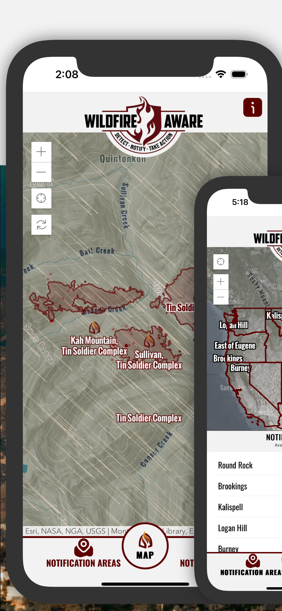
As a subscriber, Wildfire Aware provides near real-time alerts for Wildfires in the areas you care about. With Fire Weather information built into the alerts, know the Temperature, Winds, and Relative Humidity immediately when a fire starts. As fire agencies provide authoritative updates, we deliver those directly to your phone. As the National Weather Service (NWS) issued watches and warnings related to Wildfire, we push notifications directly to your phone.
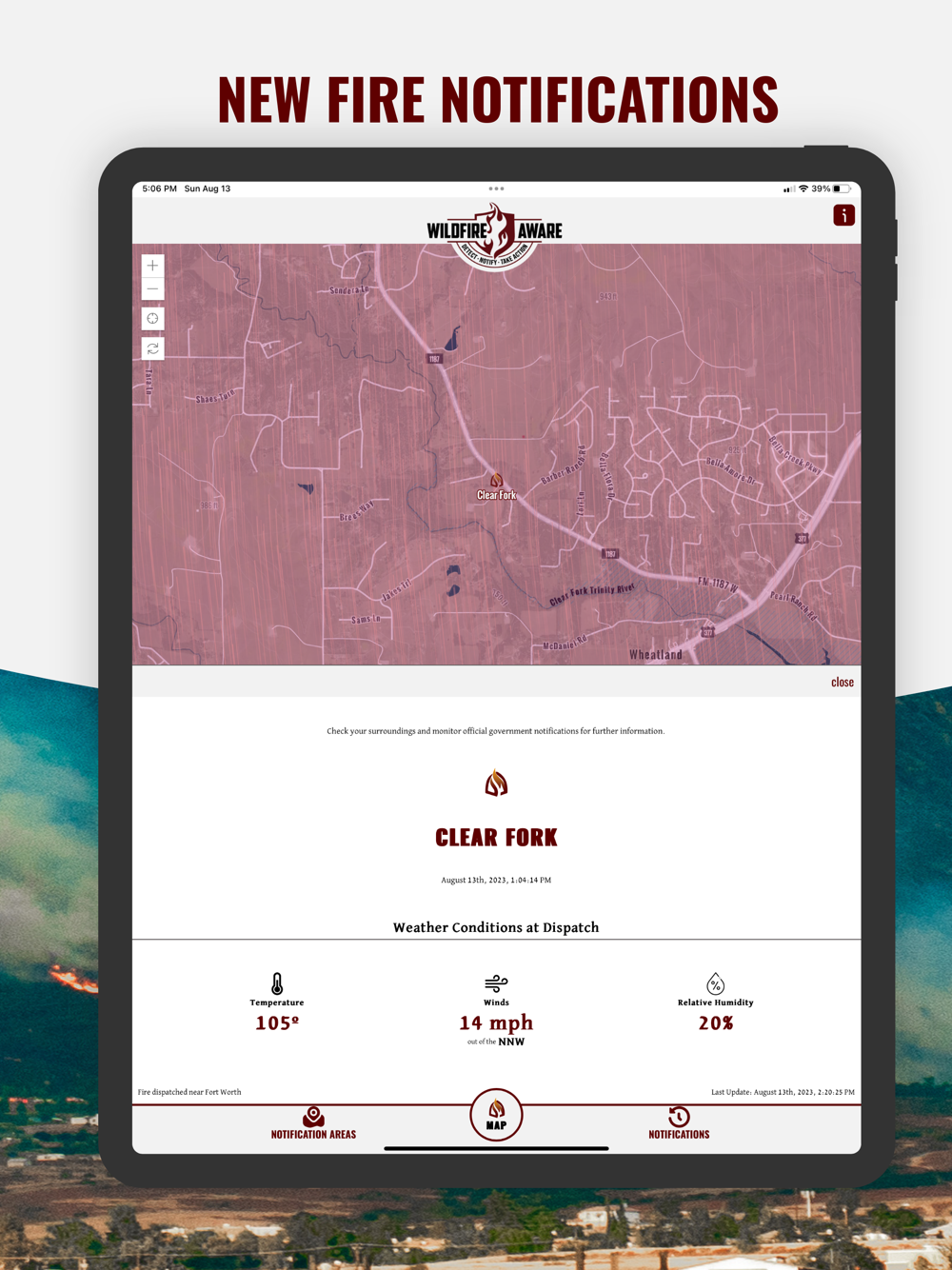
As a Premium feature of Wildfire Aware, we provide near-real-time notifications of wildfires in areas you care about. When a fire is dispatched by a NIFC participating agency anywhere in the United States, you are notified as quickly as possible. We provide wildfire alerts quickly and supplement that with the most current Fire Weather information, providing Temperature, Wind Speed Direction, and Relative Humidity at the time of the fire.
As fires burn for days or months, Wildfire Aware not only provides you notifications about perimeter updates but also provides authoritative supplemental agency data as well. Letting you know where the fire is. We source information from NIFC, IRWIN, InciWeb, CAL FIRE, US Forest Service (USFS), Bureau of Land Management (BLM), Department on Interior (DOI), and Texas A&M Forest Service, to name a few.
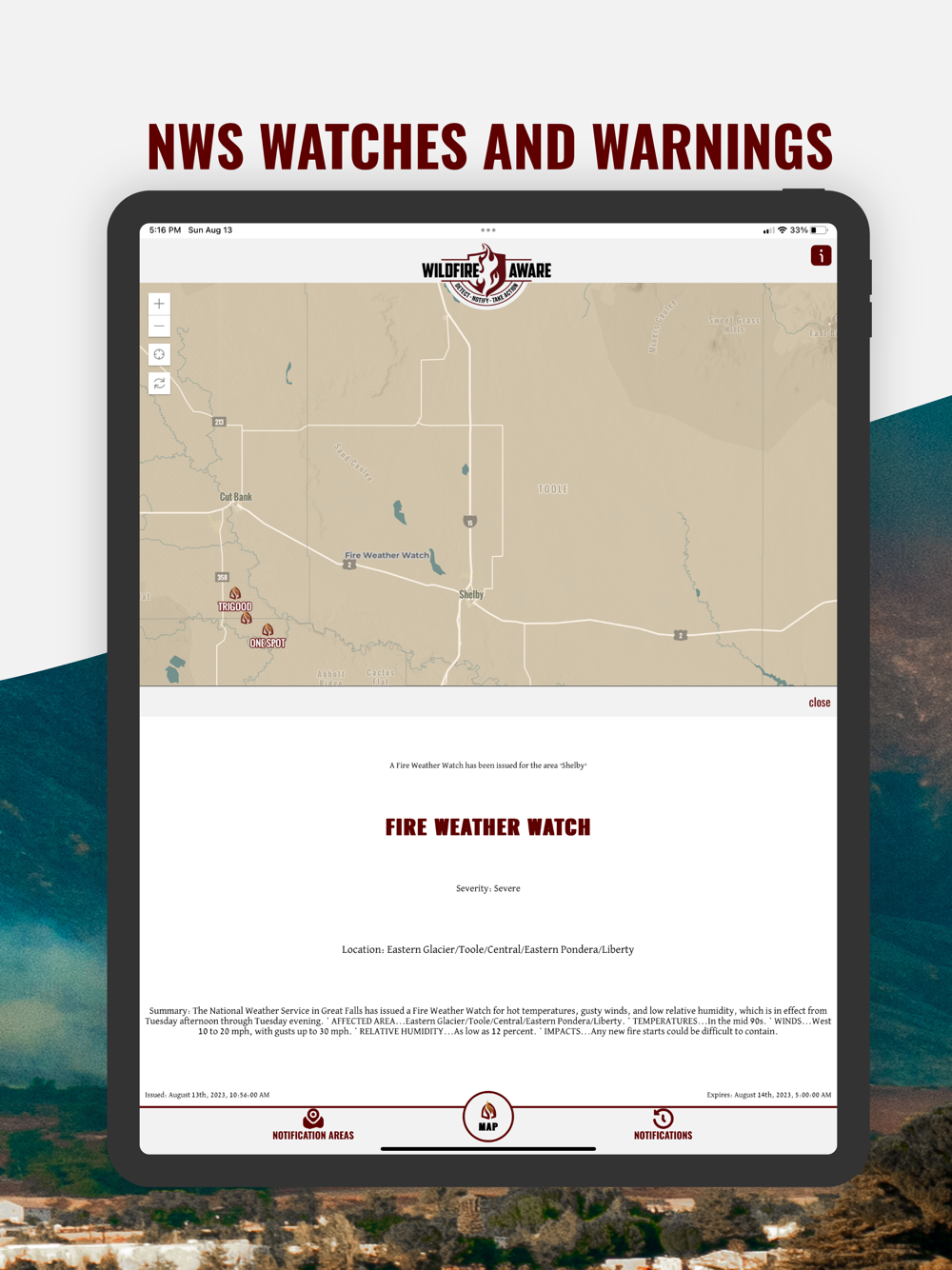
Anyone who has lived through a fire knows that Fire Weather is just as important as fire information. Wildfire Aware provides you with National Weather Service (NWS) Alerts related to Wildfires as soon as they are issued. From Fire Weather Watches and Red Flag Warnings before a fire, to Flash Flood Warnings and Watches after a fire we keep you Wildfire Aware at all stages of a wildfire.
While alerting is the Premium Feature of Wildfire Aware, we also provide additional information within the map like the ALERTWest (which includes the ALERTCalifornia) camera network, detailed information about fires as it is updated, and the FIRIS (California Only) perimeters as they become available. We incorporated NASA VIRS and MODIS thermal hotspots and NOAA HMS Fire Detections. Access to the map is provided for Free.
While wildfire alerting is not yet available for Canada yet, we provided as much of the equivalency information as possible for Canadian Wildfires as well. The reported active fire locations are updated daily as provided by fire management agencies (provinces, territories and Parks Canada). The wildfires data is managed through a national Data Integration Project (DIP) coordinated by the Canadian Interagency Forest Fire Centre (CIFFC) and Natural Resources Canada with participation from all partner agencies. Environment and Climate Change Canada issues public weather alerts about weather-related hazards in order to notify those in affected areas so that they can take steps to protect themselves and their property from harm. Alerts are classified depending on the severity and timing of the subject event and include warnings, watches, advisories and statements.
We do not provide detailed information from radio traffic like Watch Duty, but instead, we provide information from authoritative sources as soon as it is published. We also provide links, whenever possible, to the appropriate social media platforms for additional authoritative data. We strive to give the most reliable information to the public as quickly as possible.
Our founder not only survived a deadly and destructive fire in 2020 but also spent 13 years with CAL FIRE as a dispatcher and GIS specialist. Wildfire Aware provides authoritative and vetted information, which is essential during any wildfire. When misinformation runs rampant during and after a wildfire, we strive to give you the most authoritative information available.