Get the best experience from your next outdoor adventure in the most astonishing places of UK !
Try the ultimate App to turn your iPhone/iPad into a true GPS MAP navigator.
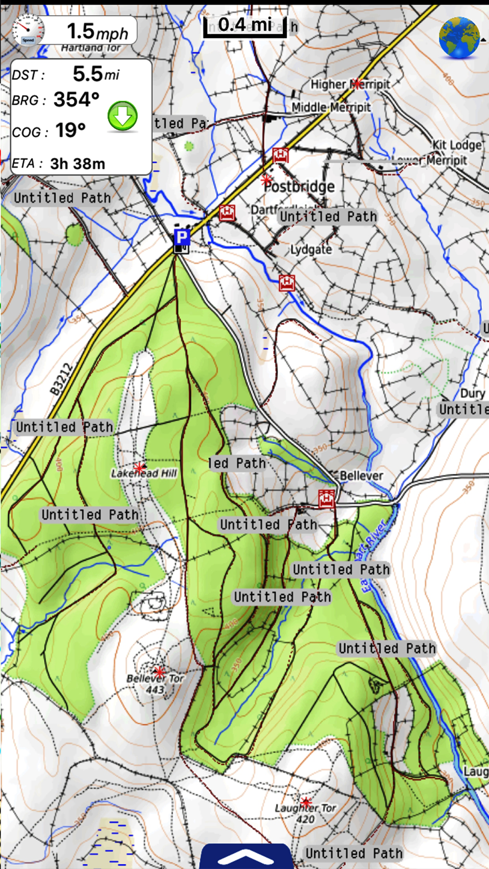
With its unique features UK Park Maps is ideal for hiking, backpacking, climbing, biking or just walking in the UK National Parks.
MAIN FEATURES
- Online and Offline modes
- Highly detailed charts
- GPS tracking
- Name searching (also in Offline mode)
- Custom Topographic chart
Park Map shows you incredible chart and terrain details, topographic maps and aerial images, with points of interest, natural attractions, trails, paths & Guide, like nothing before.
- Before you go: plan your trip, check the trails and points of interest, discover the best attractions and services.
- During your trip: record your tracks, check your position and view direction to display what is in front of you, by using the compass and the gyroscope of your device.
- When you come back home: review your paths, share your saved tracks with your friends via email, save them for future use.
Maps are stored offline on your device, so you will always follow the best path, no matter if the mobile signal is poor.
PARKS COVERED:
Dartmoor National Park,
Exmoor National Park,
The Lake District National Park,
North York Moors National Park,
The Peak District National Park,
Yorkshire Dales National Park,
Brecon Beacons National Park,
Cairngorms National Park,
New Forest National Park,
Northumberland National Park,
Pembrokeshire Coast National Park,
Snowdonia National Park,
The Broads National Park,
Ashton Court Estate - (Bristol) & Hyde Park (London)
..........Your favorite park is not on the list? Let us know writing to
[email protected] and we will strive to add it at the soonest!
Follow us:
▶Twitter @flytomap
▶Web Site flytomap.com
▶Web App viewer.flytomap.com
▶Facebook facebook.com/flytomap
Note:
"Continued use of GPS running in the background can dramatically decrease battery life."
"Turn off GPS when not in use"