Your iPhone or iPad becomes a high-performance GPS receiver with USA NOAA Raster Nautical Charts, even where there is no cell signal!
Rated “Best Choice — Excellent” by Practical-Sailor.com
On the water in a bad storm and your chart plotter just failed? Download this app now. You will have full navigation capabilities to get safely back to port. Better yet, buy iSailGPS today so you will already have it if you find yourself in this situation, even in an area with no cell service. No sign up, ads, subscription, or in-app purchase required, making this less expensive, less hassle & more privacy respecting than the “free” or subscription apps.
TRACKS, WAYPOINTS, ROUTES
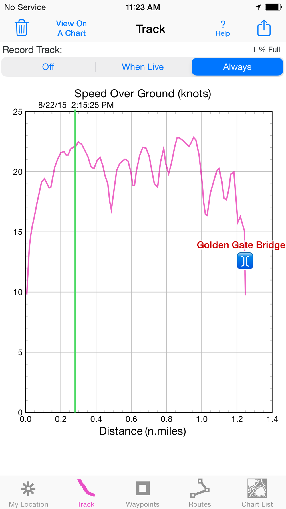
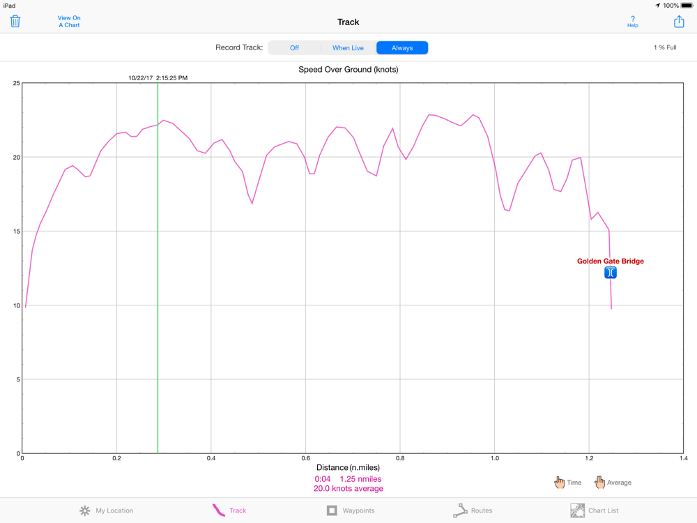
Record a track. View it on the chart and in a speed graph. Record in the background. View time of track points.
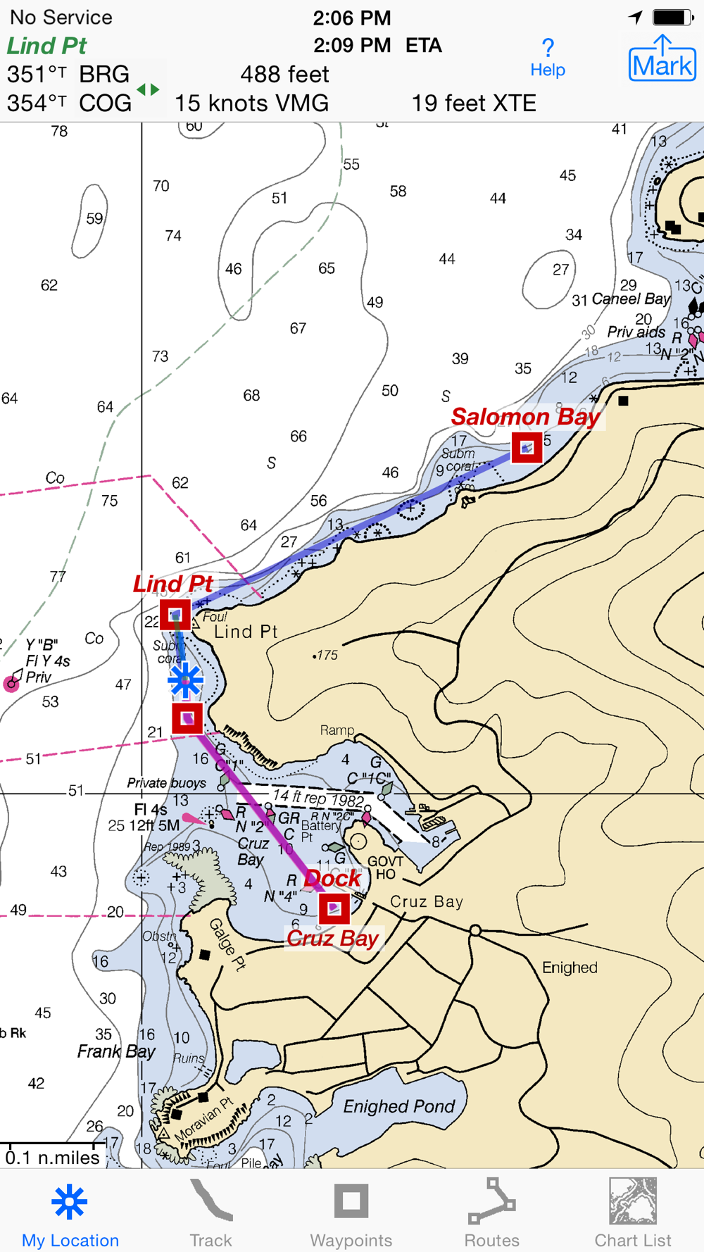
Mark waypoints by their position on a chart, by tapping a geotagged photo, by projecting from a known point, or by searching place names. Refine a waypoint position when you arrive.
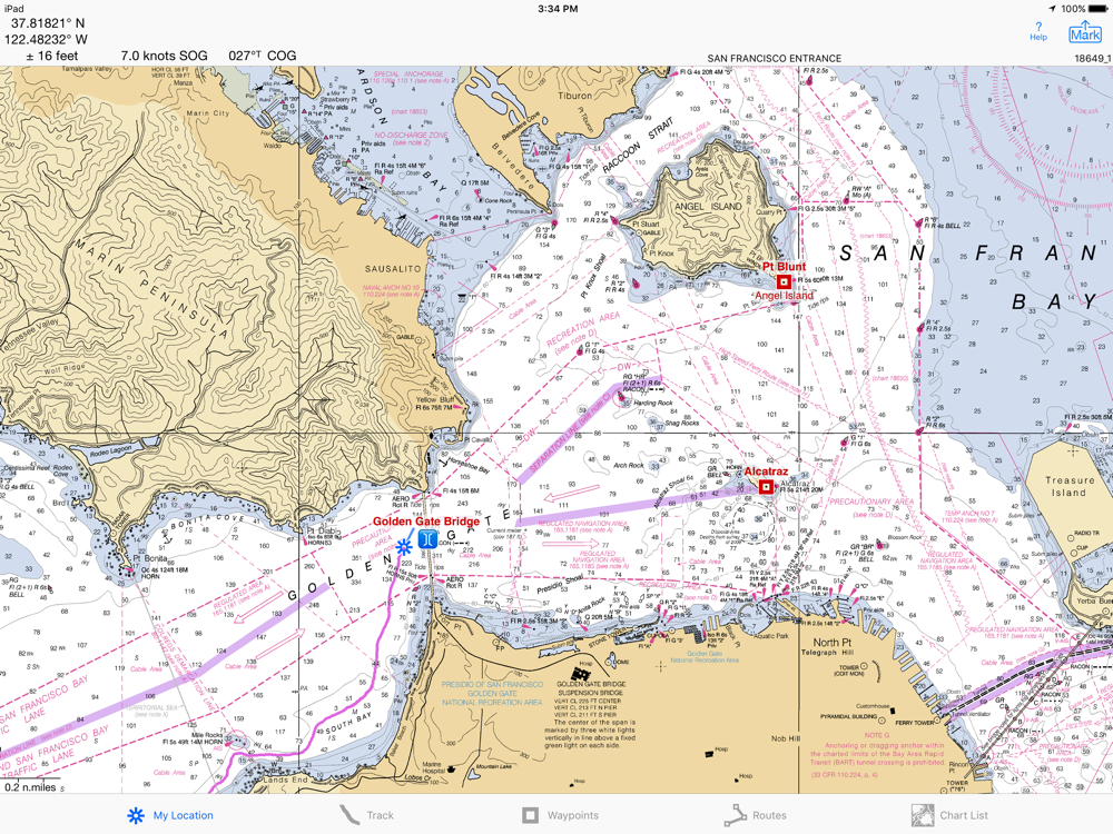
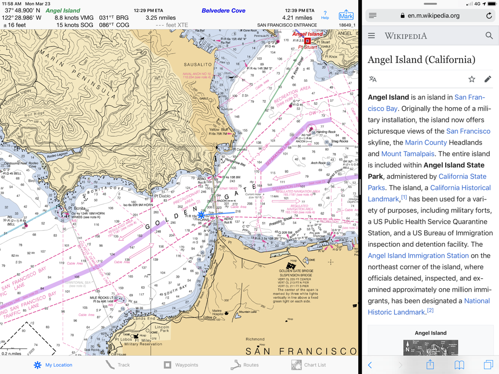
Set a quick GoTo waypoint or a full route and see the course (COG), heading (HDG), bearing (BRG), direction, distance, cross track error (XTE), Velocity Made Good (VMG) and Estimated Time of Arrival (ETA) at your destination and intermediate points.
Man Overboard (MOB). With one button push, mark your current position & start navigating to it.
Create routes using waypoints, recorded tracks, or imported GPX or KML files. Advanced route editing.
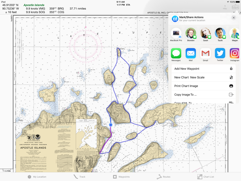
Export GPX and KML waypoint, route & track files via eMail, Messages, Import With, AirDrop, iCloud Drive, Dropbox or iTunes.
Send KML files to display immediately in Google Earth. Receive KML files from Google Earth.
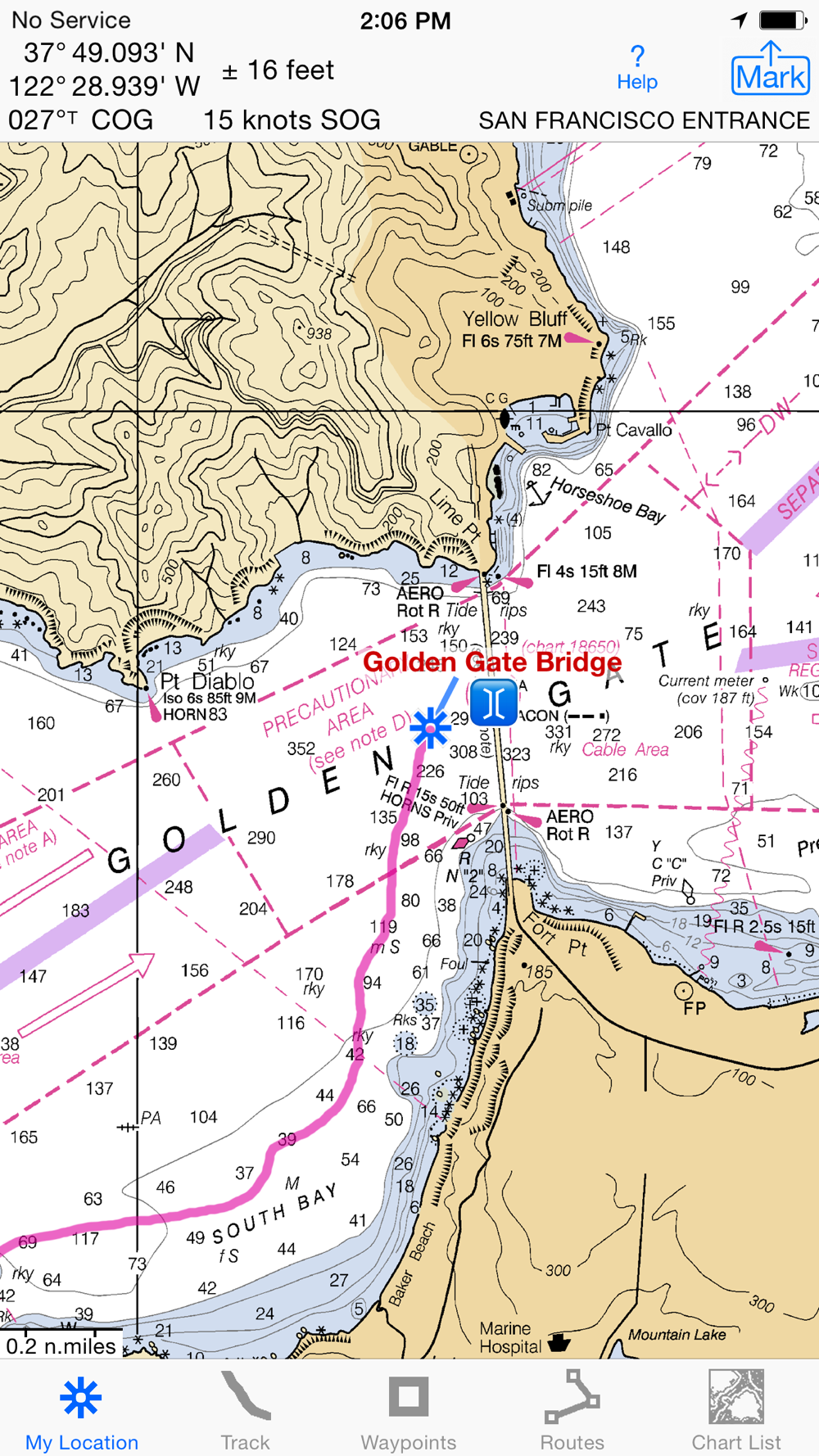
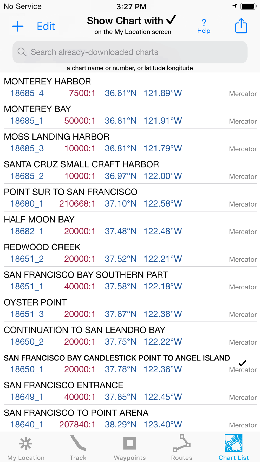
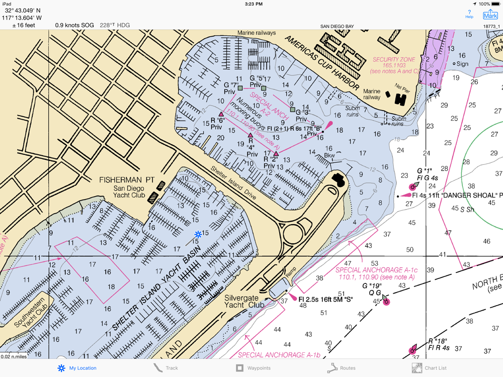
USA NOAA RASTER NAUTICAL CHARTS
No extra charge for access to all NOAA RNC Charts for USA waters. Download using WiFi or cell service.
Store up to 1024 charts to use anytime at sea without cell service. Charts from our server download faster & use less of your monthly data allotment.
Stitches charts and automatically switches between downloaded charts as you sail. Choose detailed or overview charts.
Print and Share map images overlaid with waypoints, routes & tracks.
Measure distance and direction between any 2 points.
NOAA charts don't include most inland rivers & small lakes. Use our iHikeGPS app for these.
HOW TOS
Tap Help in the app.
Online Manual: isailgps.com
Email developer:
[email protected]
RASTER CHARTS VS. VECTOR CHARTS
The National Oceanic & Atmospheric Administration provides both RNC (raster) and ENC (vector) charts.
The great advantage of the high resolution RNC charts used by iSailGPS is the high level of detail produced by professional cartographers that is unobtainable on any vector-based chart. ENC Vector Charts only show a coastline, water depth, navigation aids & minimal details.
These RNC Charts differ from vector charts in that each chart covers a specific area, just as paper nautical charts do. Switches automatically to a new chart when your boat leaves the area covered by the previous chart. For most locations, there are multiple charts at different scales with different levels of detail & areas of coverage.
Paper charts can have multiple panels, each showing a different area or scale. Each digital panel is individually displayed by iSailGPS with a north-up orientation.
Other, more expensive over the long run marine software uses these same RNC charts. iSail GPS is priced to make it readily available to all boating enthusiasts.
DEVICE REQUIREMENTS
No device requires a cellular data plan to use iSailGPS.
WiFi+cellular iPad 2 or later, & iPhone 4S or later support full navigation.
iPad 2 or later with WiFi-only, & iPod touch (5th gen or later) require an iOS-compatible external GPS receiver to show your location on the water and to record tracks. View charts using the iOS device alone.
Winner of the Practical Sailor Editors’ Choice Award.
Sailing becomes safer and more fun with iSailGPS!