Terrain Radar Altimeter 2
Install Now
Terrain Radar Altimeter 2

Terrain Radar Altimeter 2

Altimeter with elevation chart

App Size: 28.5 MB
Release Date: 2012-11-16
Price: FREE
4.6
5577 Ratings
Size
28.5 MB

Screenshots for App

iPhone
iPhone X
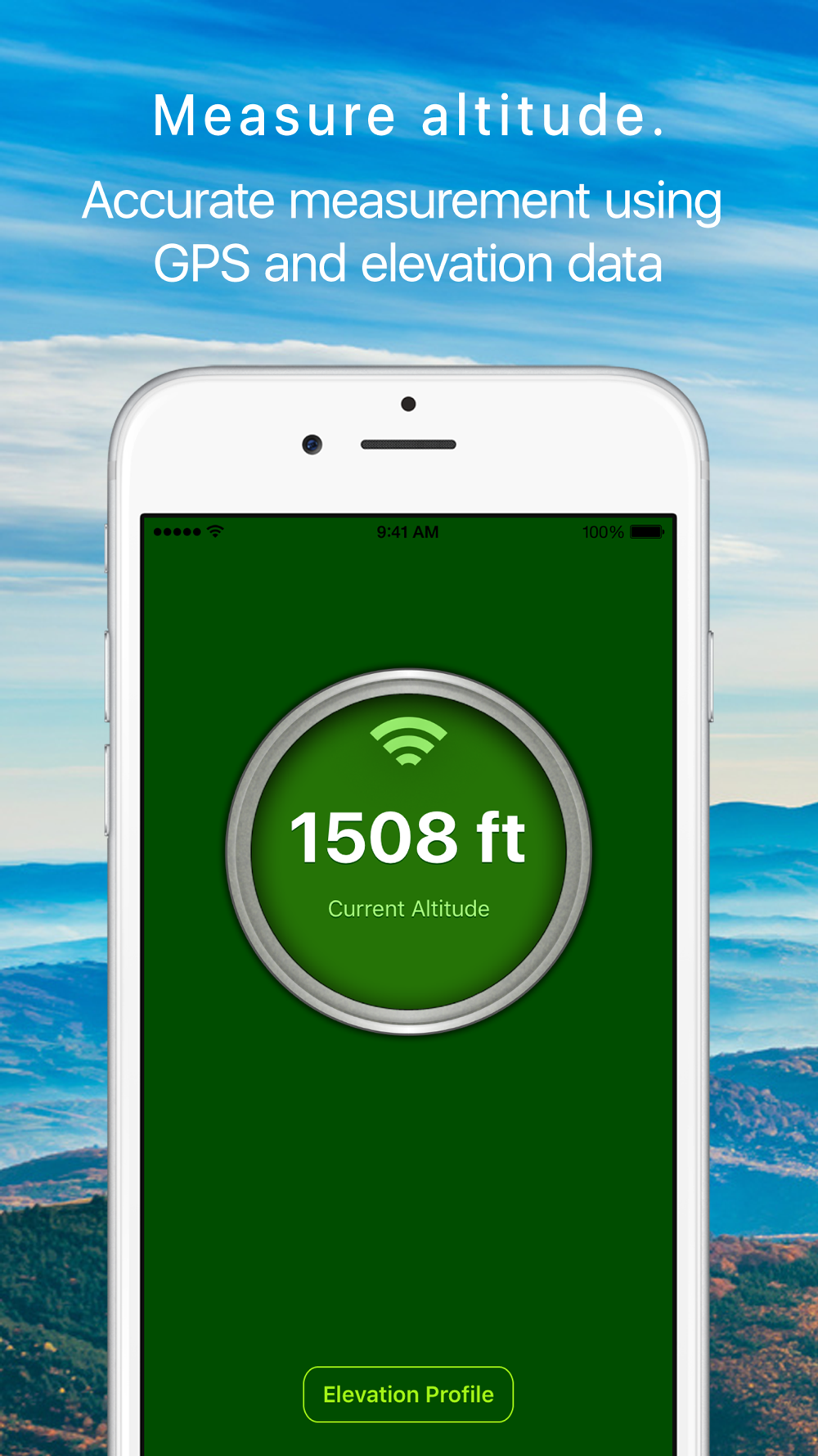
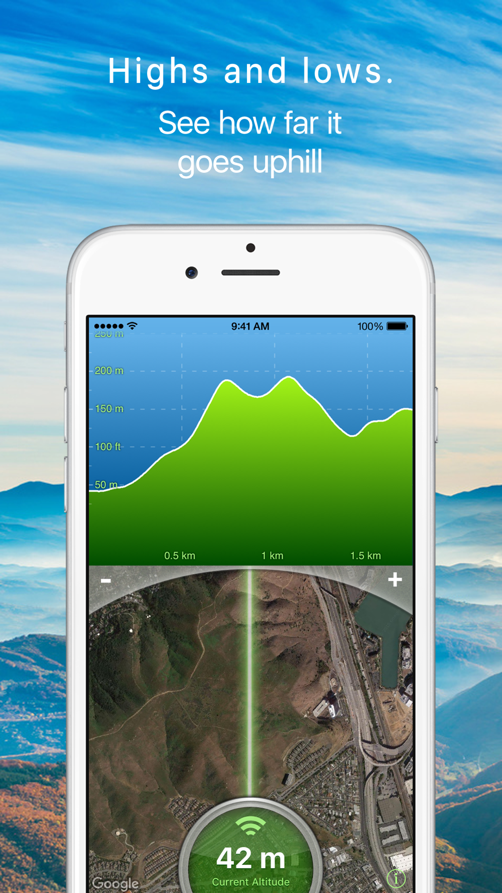
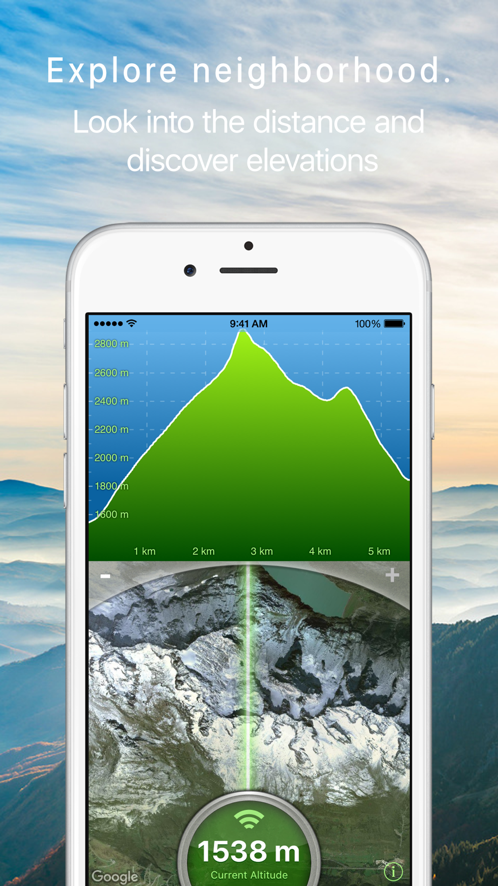
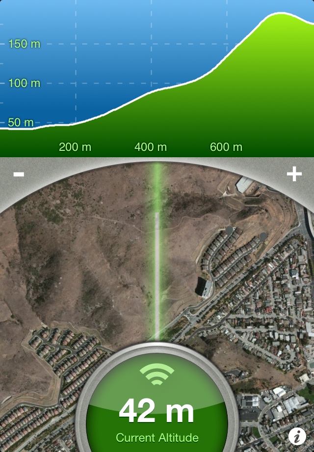
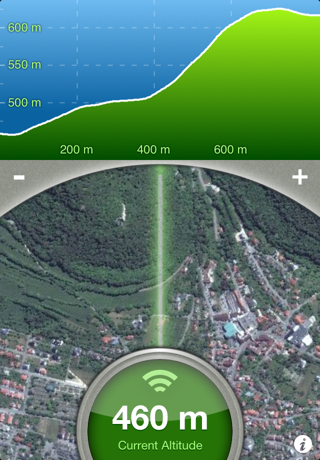
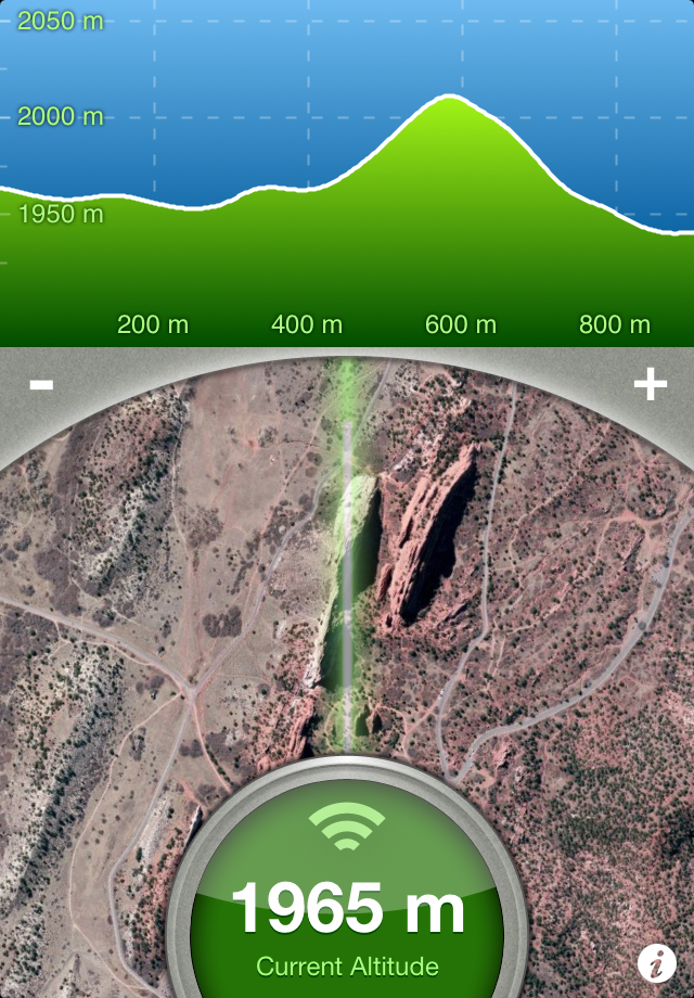
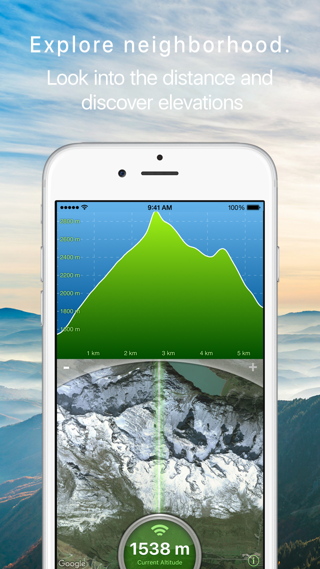
Measure the elevation of each location within a radius of 500 meter. With Terrain Radar Altimeter you can discover the height of hills in front of you or take a look at further away mountains. The unique combination of device sensors and internet-based geo informations makes Terrain Radar to the best altimeter app in the store.

FEATURES:

• High accuracy digital elevation model
• Range up to 500 meter (1600 ft)
• Calculation of altitudes in real time
• Precise elevation chart
• Display in meter or feet

The altitudes are calculated through online services, based on your GPS position and compass direction.

Whether biking, hiking or walking - with this altimeter app every trip is a journey of discovery!
Show More
Show Less
Terrain Radar Altimeter 2 2.4.0 Update
2018-04-07 Version History
Update for the new outdoor season. Go outside and use Terrain Radar to find the highest mountains in your area.You like Terrain Radar? Write us your opinion in the AppStore.

~Nestele Engineering
More Information about: Terrain Radar Altimeter 2
Price: FREE
Version: 2.4.0
Compatibility: Requires Requires iOS 9 or later
Bundle Id: com.terrainradar-free
Size: 28.5 MB
Genre: Navigation
Release Date: 2012-11-16
Last Update: 2018-04-07
Content Rating: 4+
Developer: Nestele Engineering
Language: English - German -


Whatsapp
Vkontakte
Telegram
Reddit
Pinterest
Linkedin
Hide