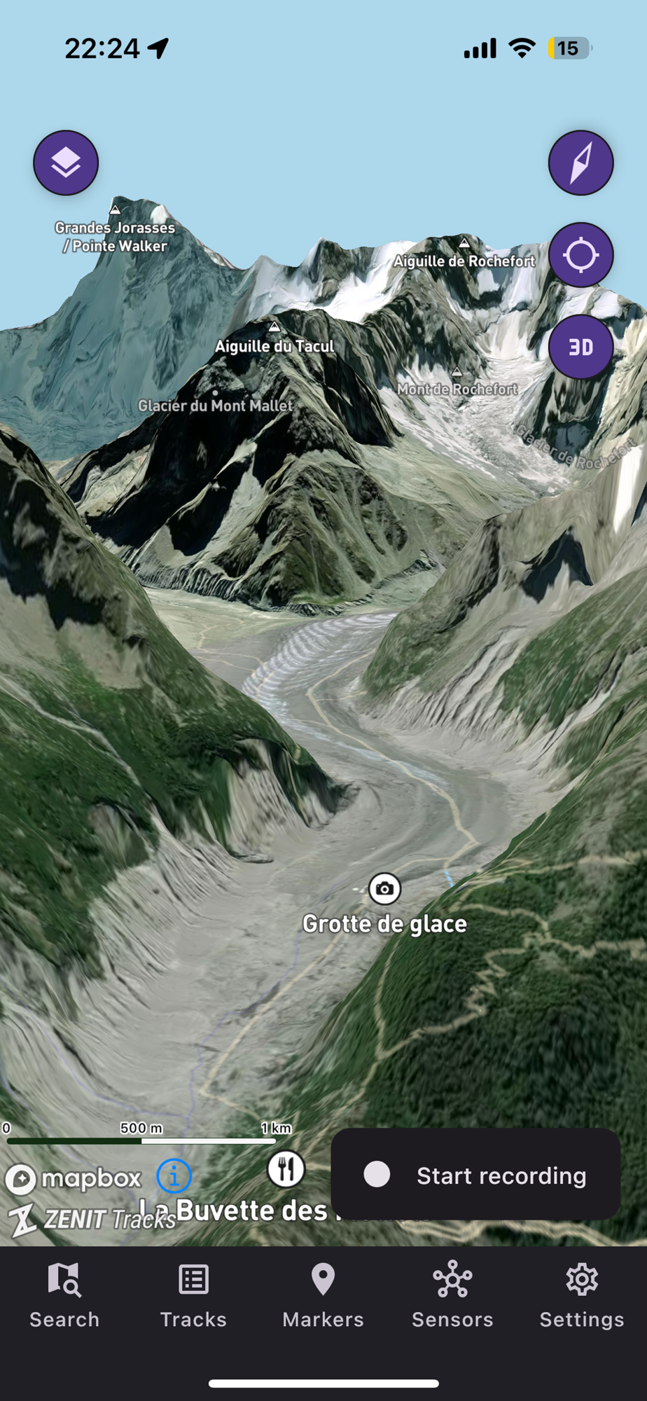
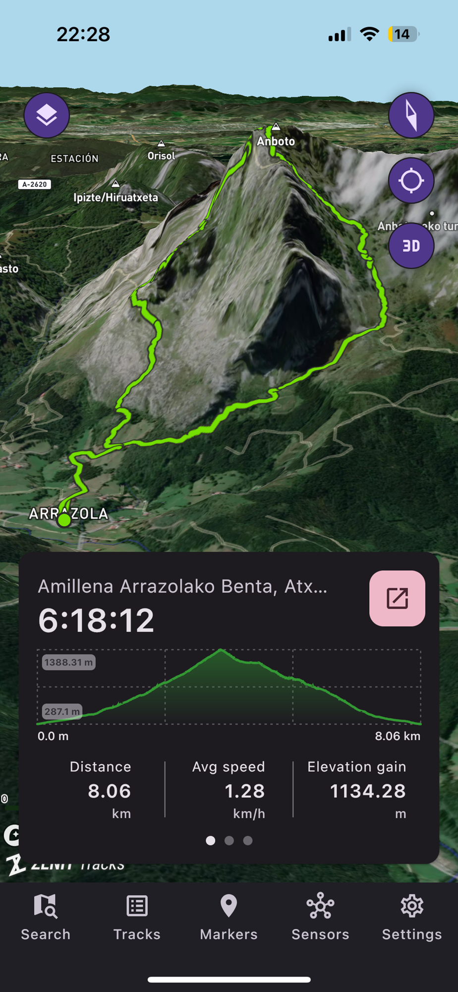
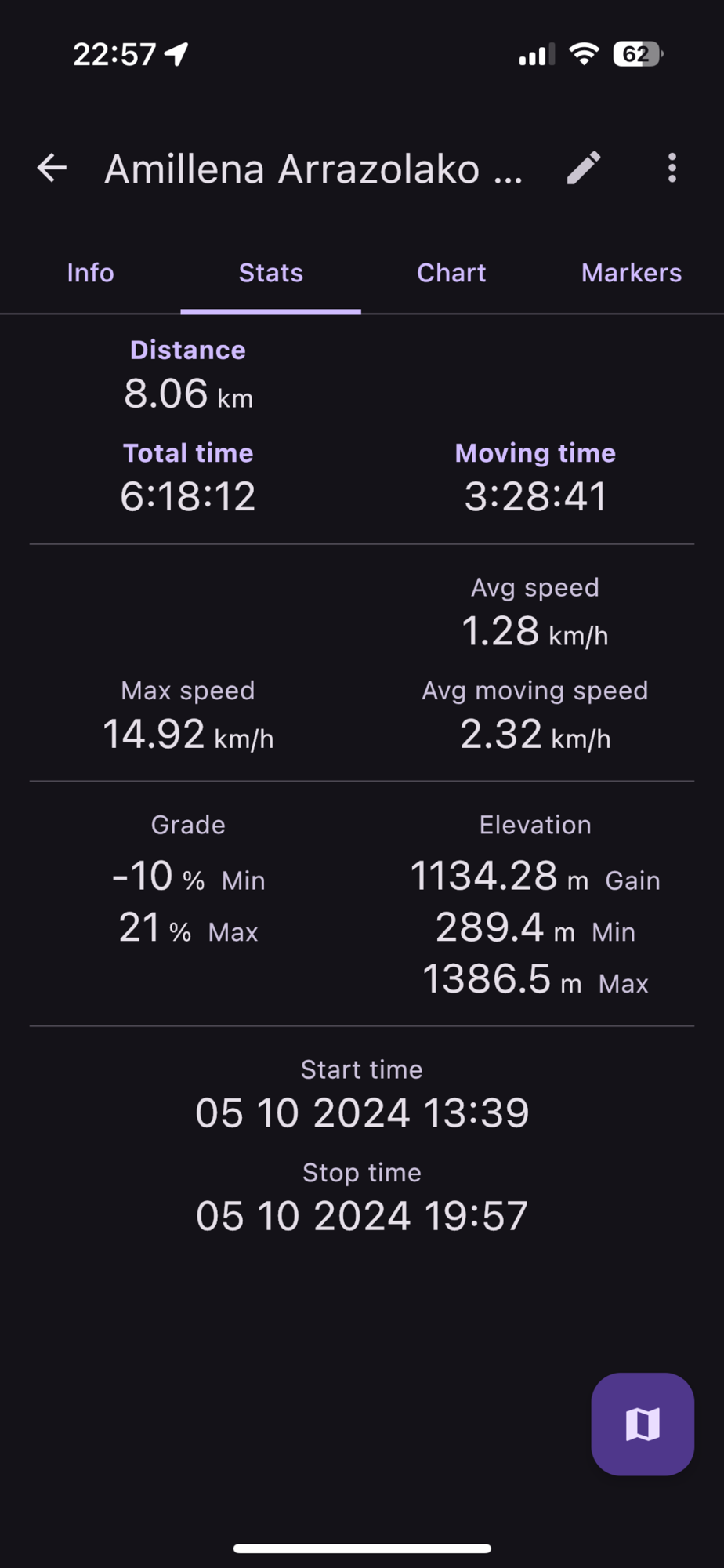
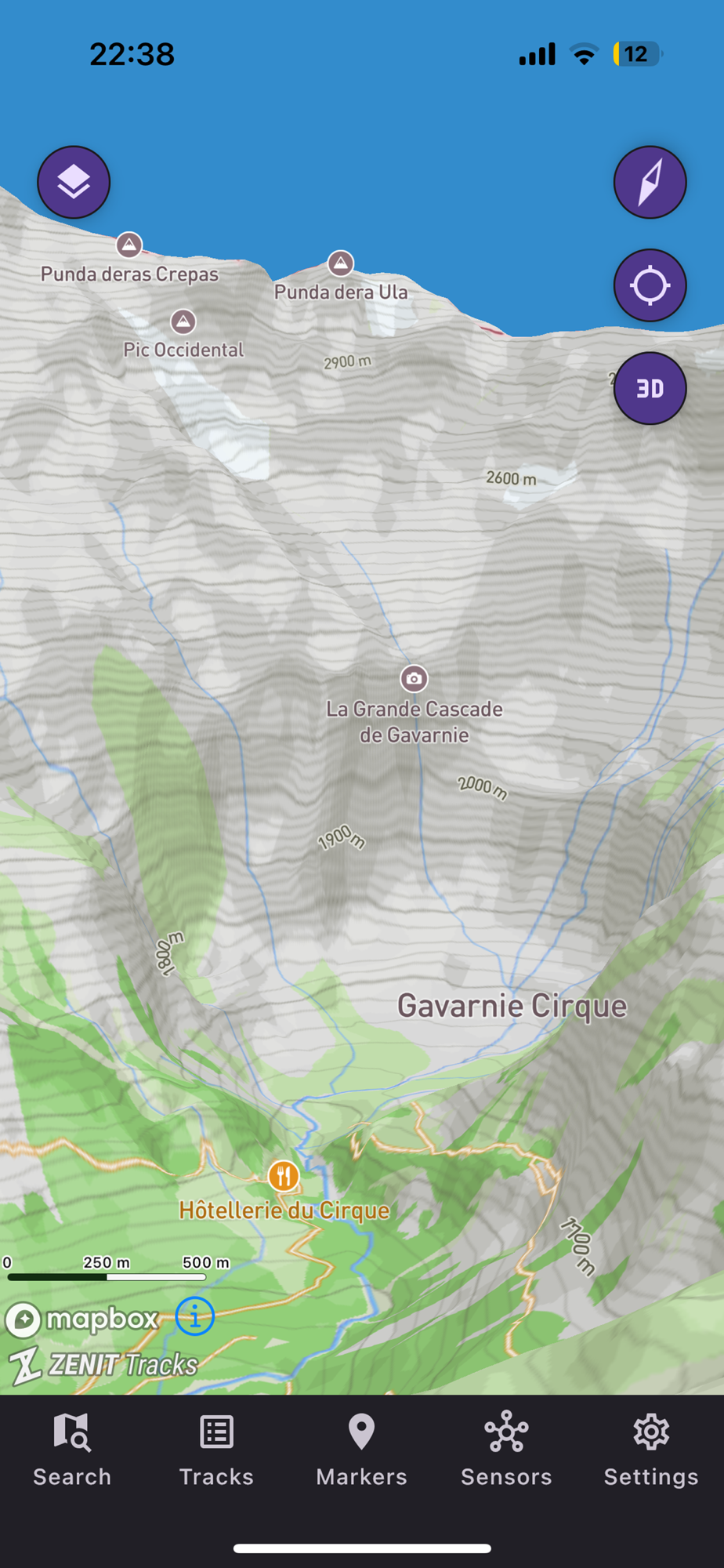
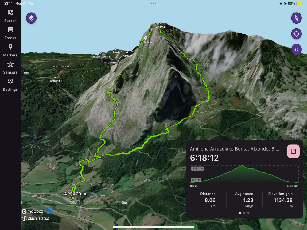
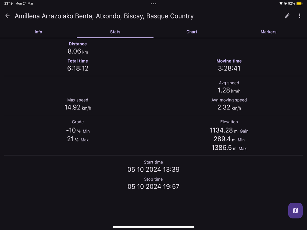
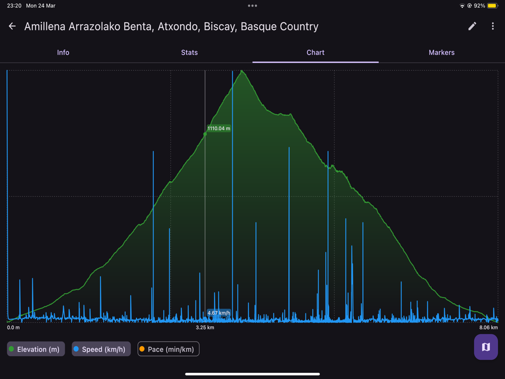
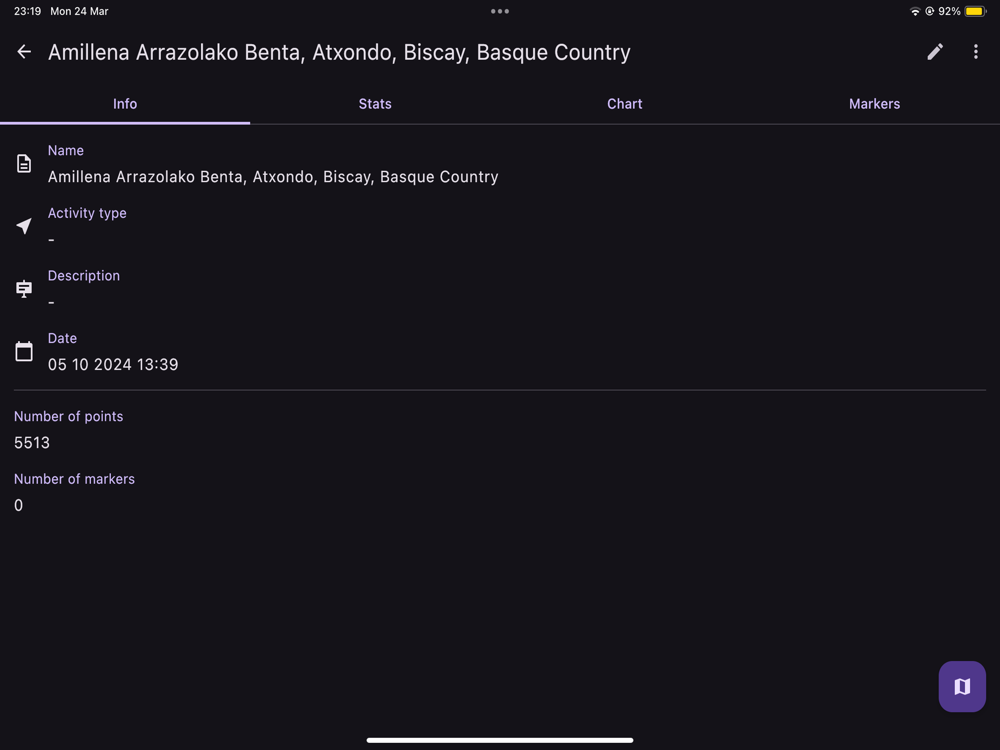
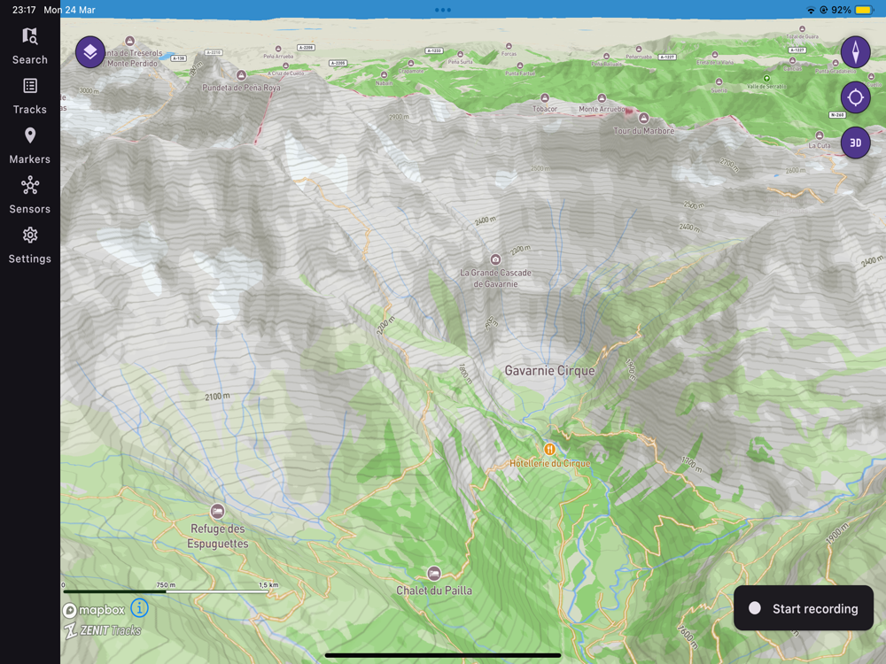
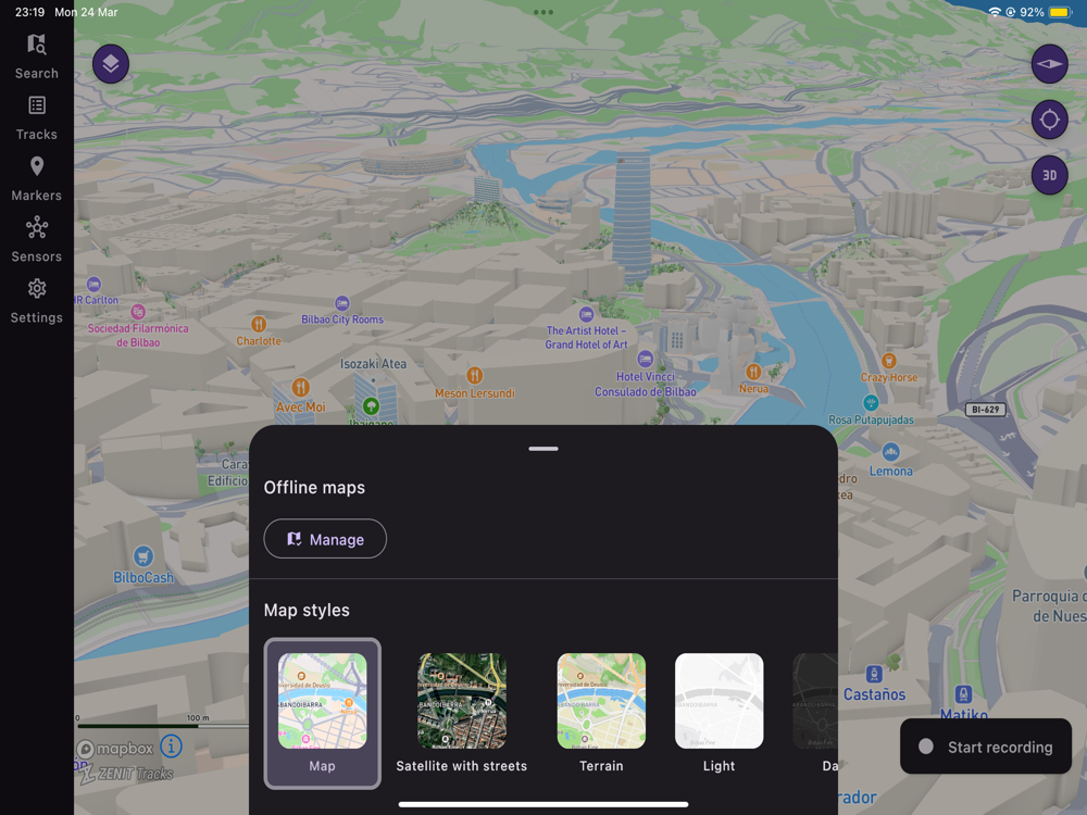
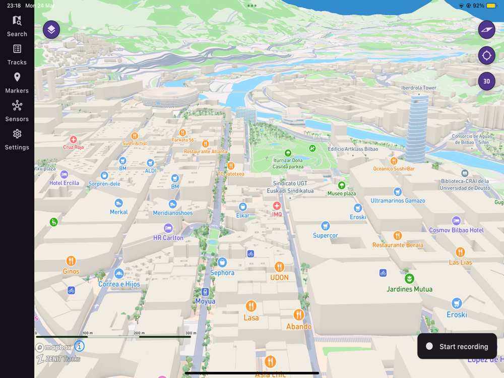
ZENIT Tracks is the tool for route tracking by using the GPS location. You can see your routes plotted in a highly-customizable map and all stats like distance, speed, route gradient are recorded so you can see them as stats or in a beautiful chart
ZENIT Tracks allows to import track files wherever you get them from, from Google Earth, Wikiloc or Strava for example, as it has support for GPX and KML files for GPS tracks and routes
With ZENIT Tracks you can export your tracks, to analyze them in a GPX Viewer, see in Google Earth or share them to networks like Wikiloc or Strava. You can export your recorded tracks as: GPX, KML, CSV or TCX
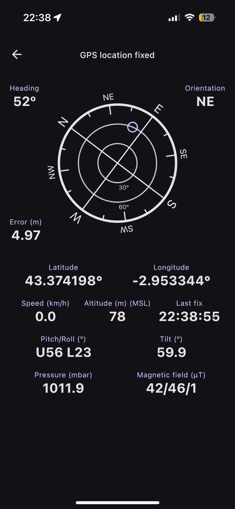
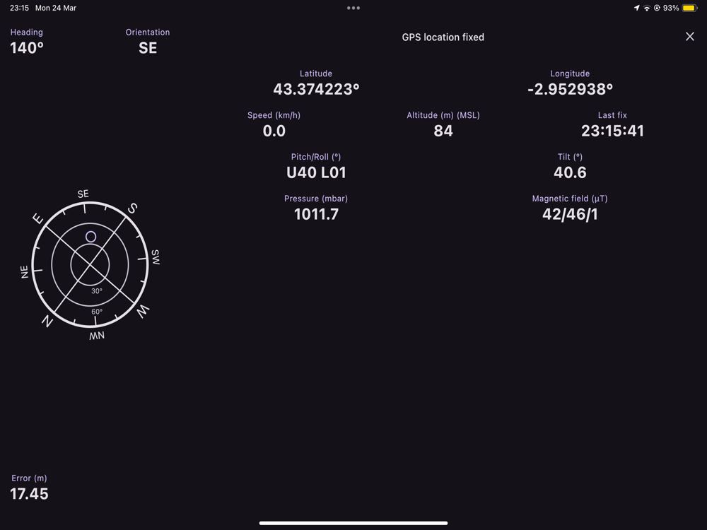
It also offers a sensor screen, which displays the readings from the various sensors on your device. You can see compass values, GPS status, altitude, GPS coordinates, atmospheric pressure and even the strength of the Earth's magnetic field. It also allows you to check the slope of the terrain you are on, to provide further information when assessing avalanche risk.