GPS Area Calculator Live Maps:
GPS Area Calculator Live Maps is your ultimate all-in-one measurement and geo-utility app! Whether you need to measure areas, check real-time weather, use a live geo camera, or perform quick unit conversions, GPS Area Calculator Live Maps has got you covered.
Key Features:
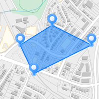
Area Measurement – Accurately measure land, plots, or any area using advanced mapping tools. Perfect for real estate, agriculture, and outdoor planning.
Geo Live Camera – Capture real-time photos with GPS coordinates, compass direction, and location details overlaid on the image. Great for surveys, construction, and travel documentation.
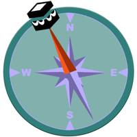
Compass & GPS Navigation – Never lose your way with a highly accurate compass and real-time GPS navigation assistance.
Weather Updates – Stay informed with real-time weather forecasts, temperature, humidity, and wind speed at your location.
Unit Converter – Convert length, distance, weight, temperature, and many other units quickly and easily.
User-Friendly Interface – Simple, intuitive, and easy to use for professionals and casual users alike.
Worldwide Support – Works anywhere in the world with precise GPS accuracy.
Whether you're a surveyor, traveler, engineer, or just someone who needs quick measurements and conversions, GPS Area Calculator Live Maps is the perfect tool for you!