RIDGID Trax
Install Now
RIDGID Trax
RIDGID Trax

RIDGID Trax

Underground Utility Mapping

App Size: 33.9 MB
Release Date: 2014-06-04
Price: FREE
4
8 Ratings
Size
33.9 MB

Screenshots for App

iPhone
iPhone X
More Screenshots for iPad
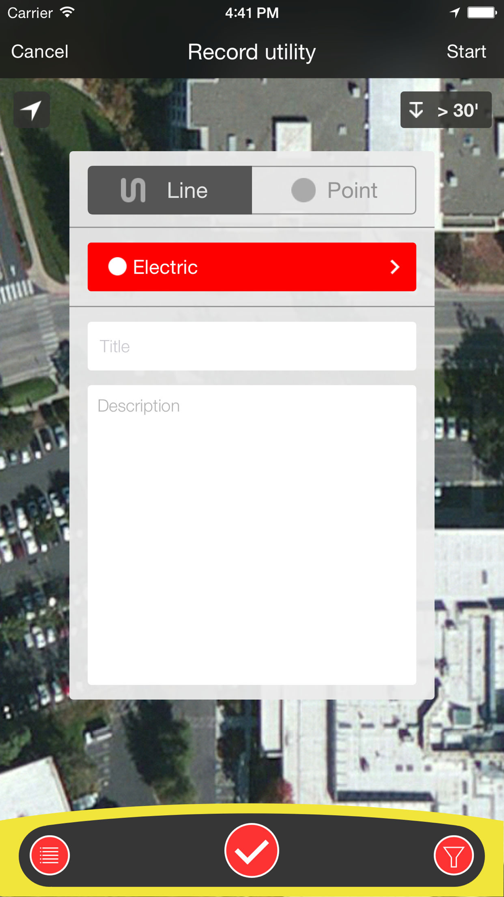
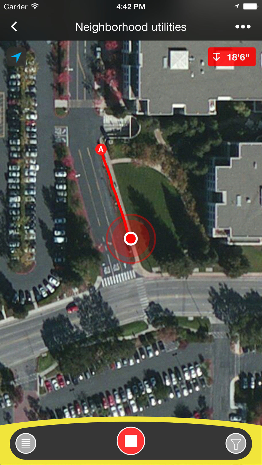
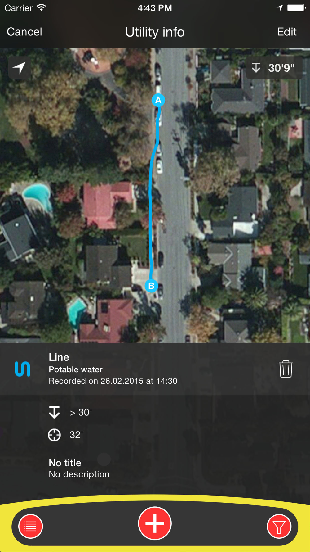
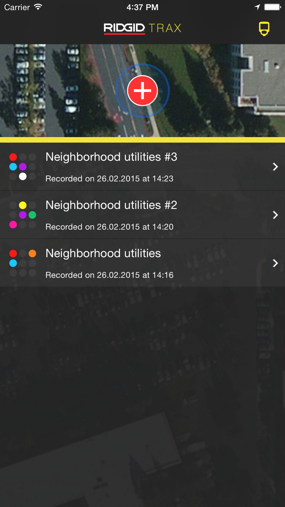
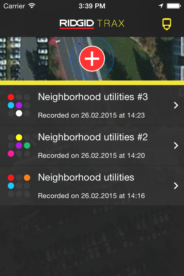
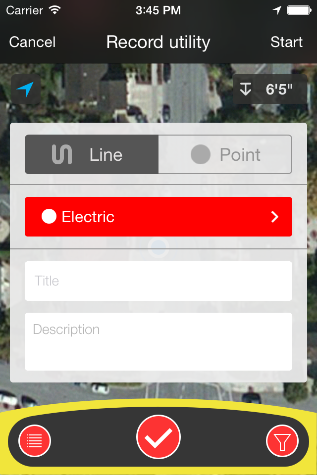
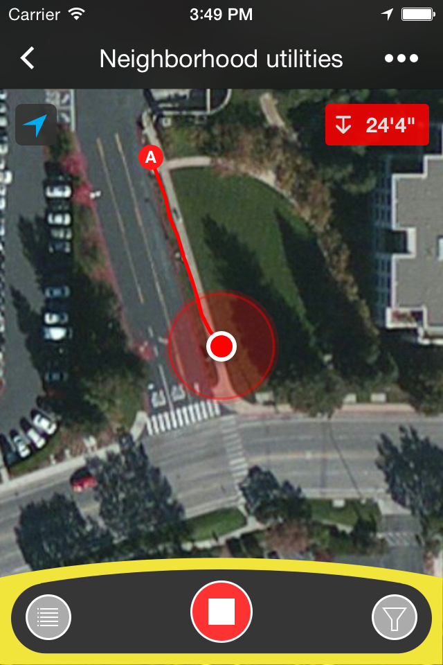
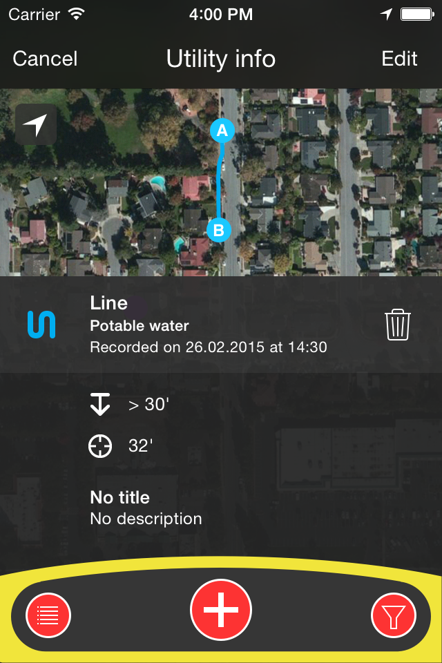
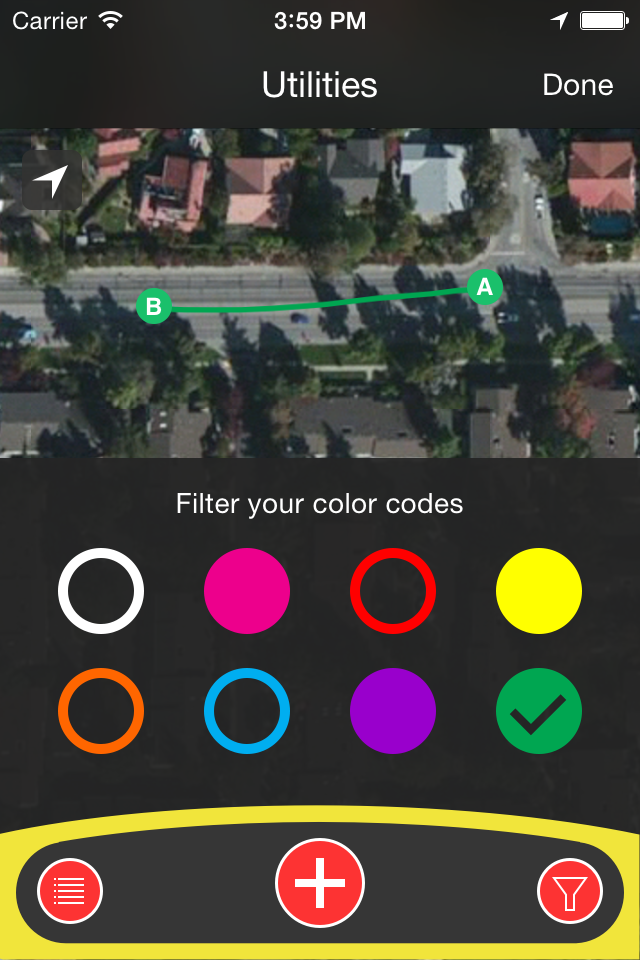
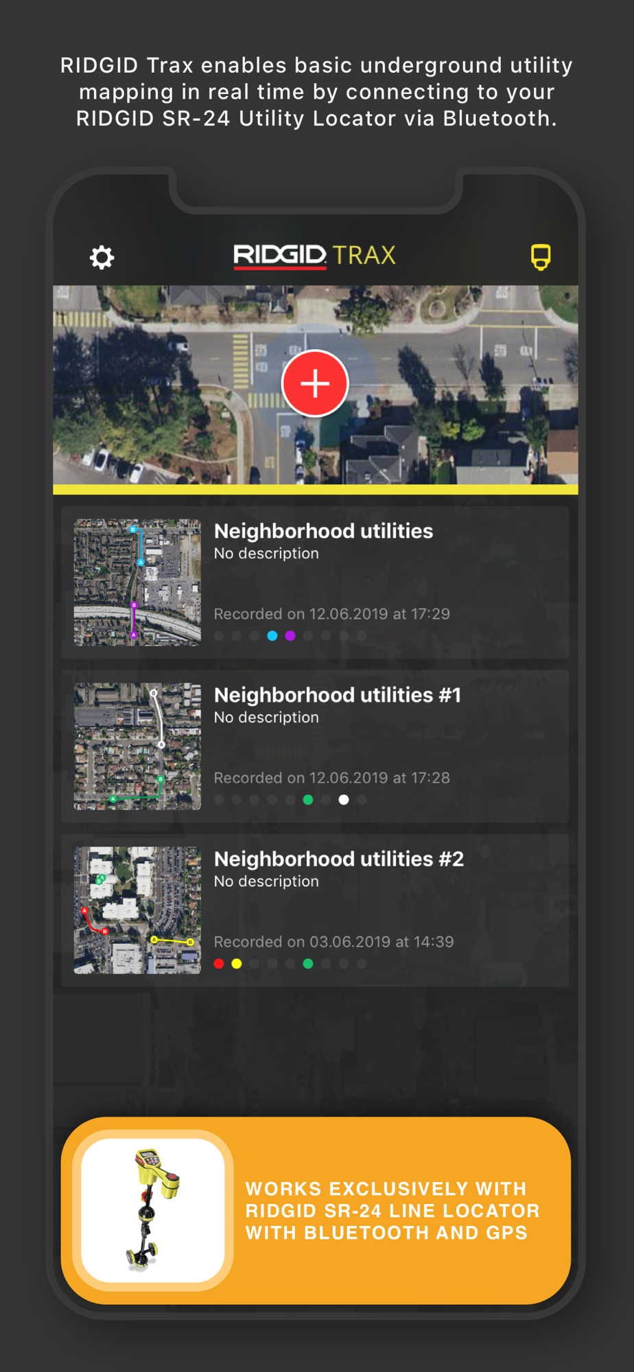
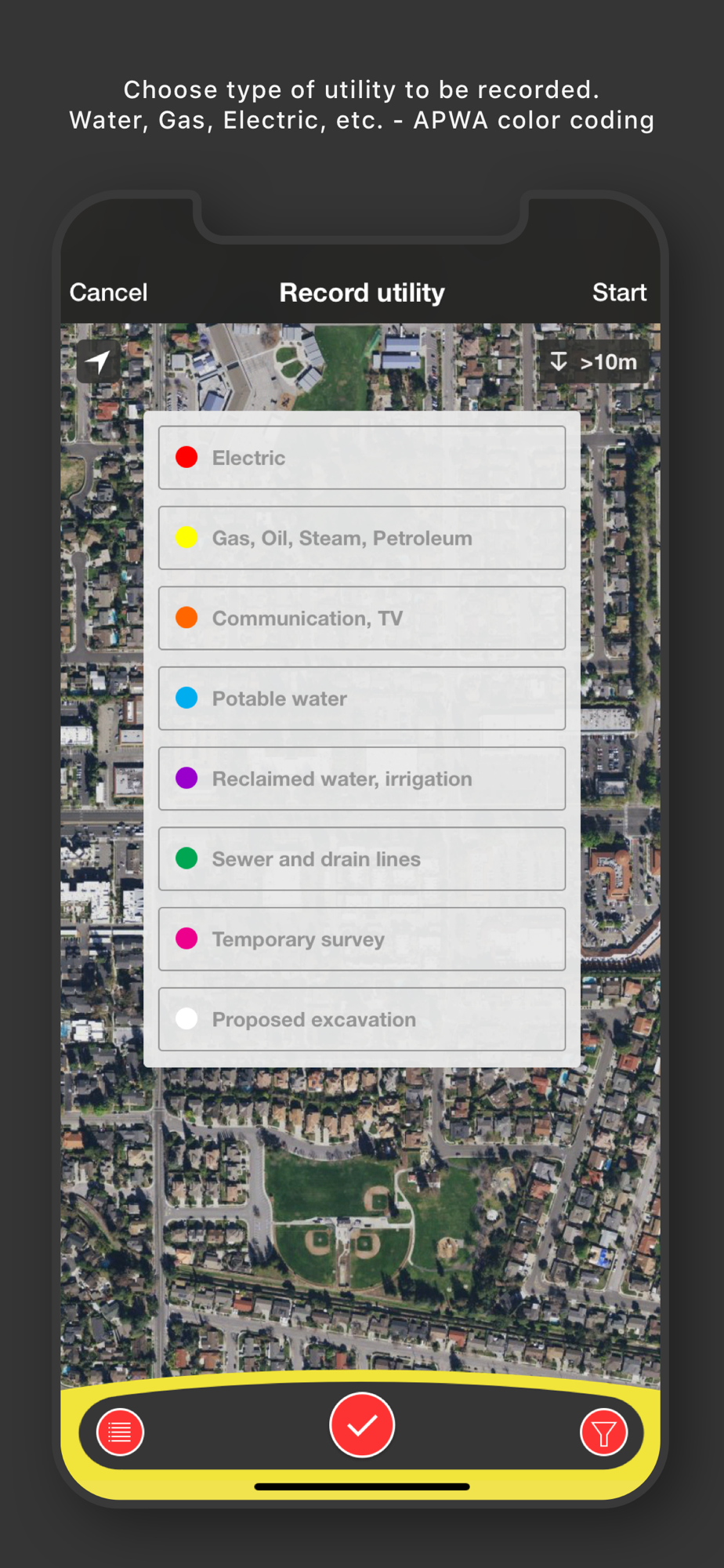
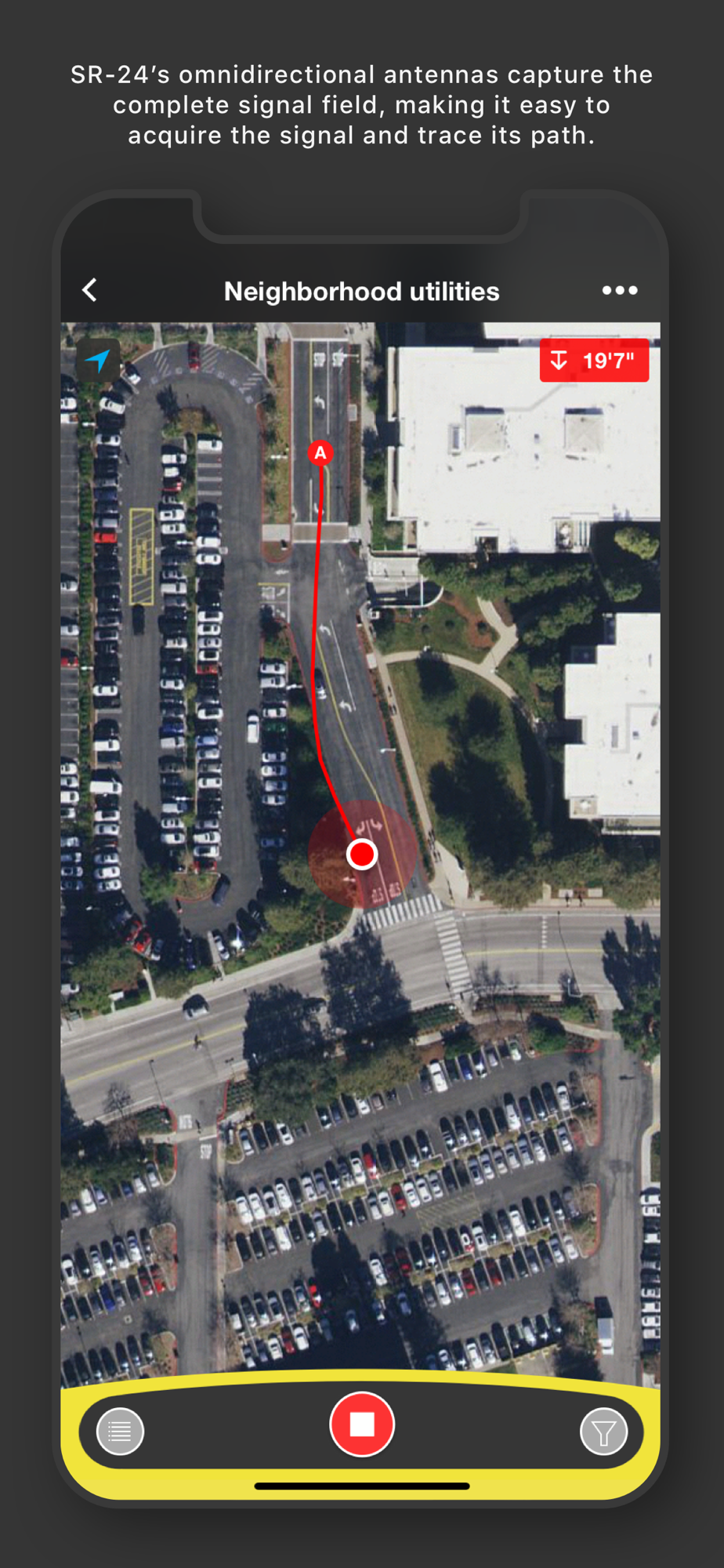
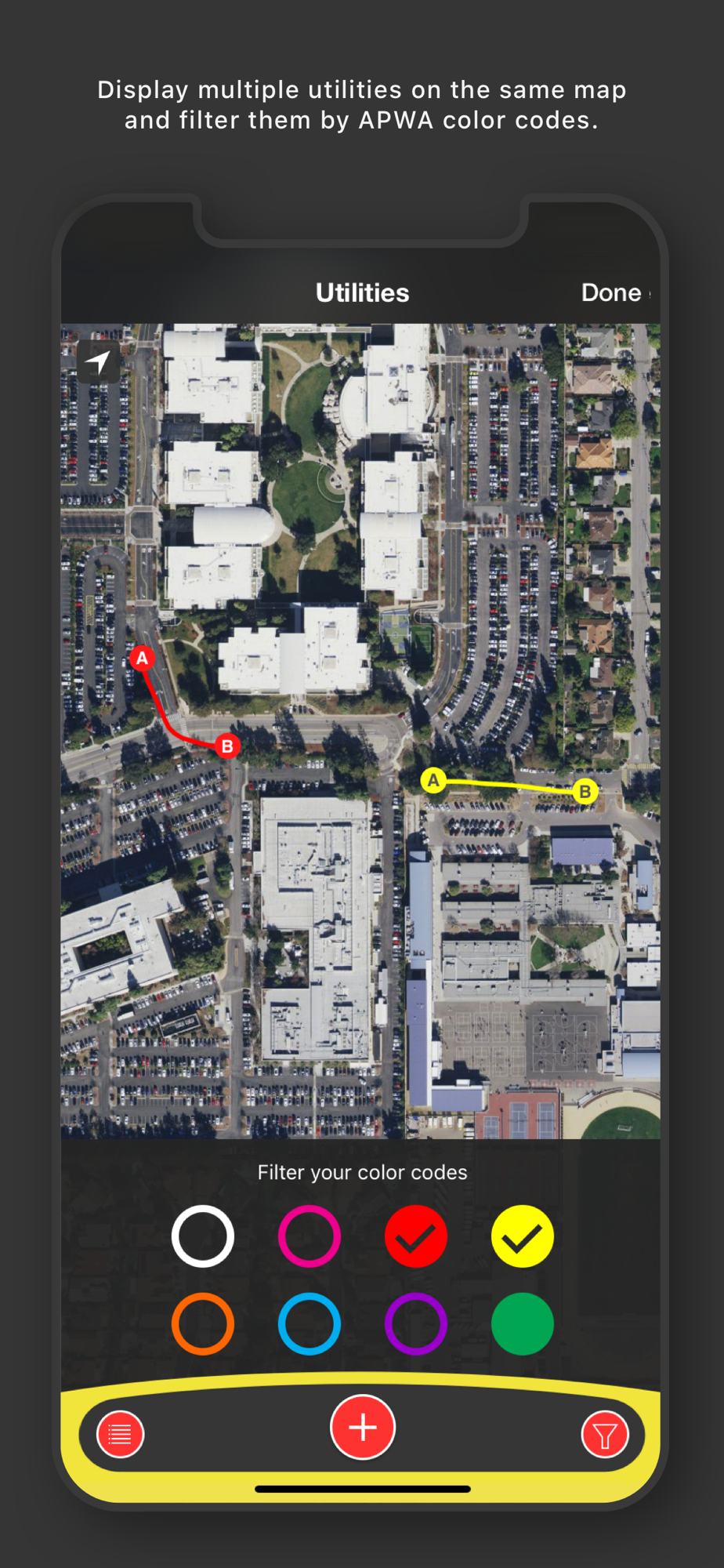
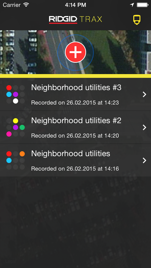
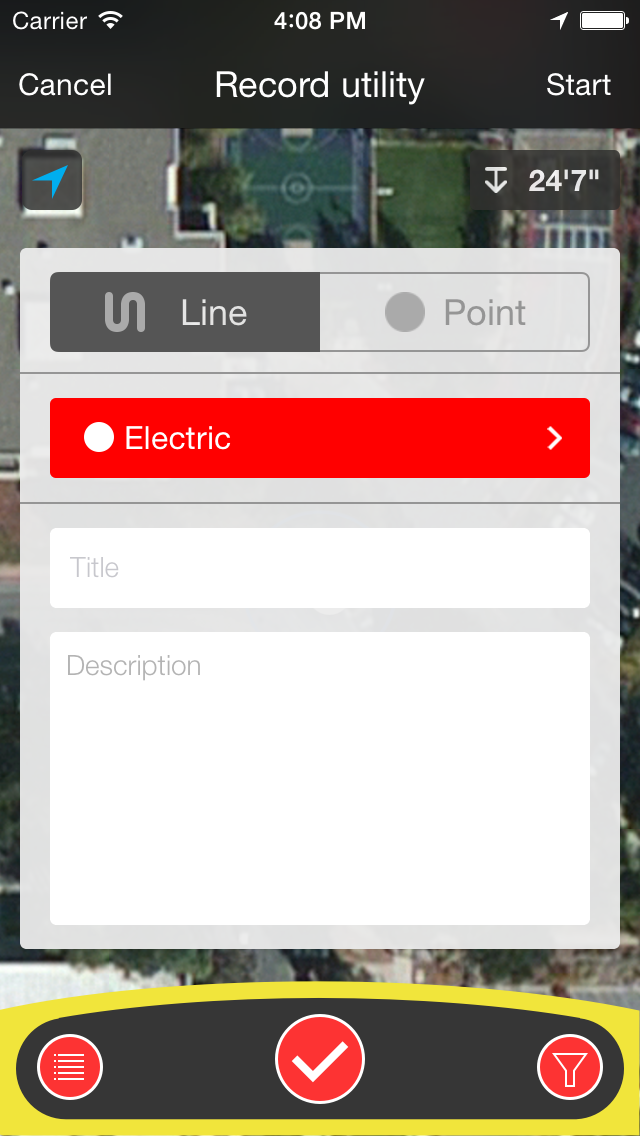
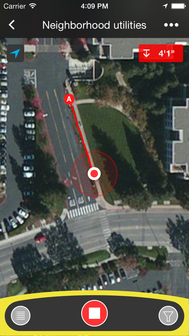
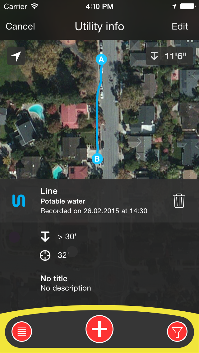
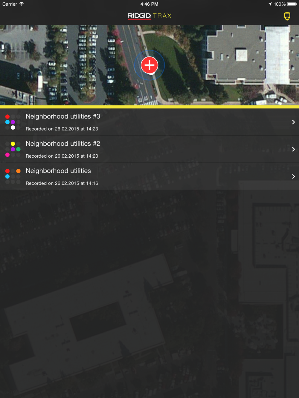
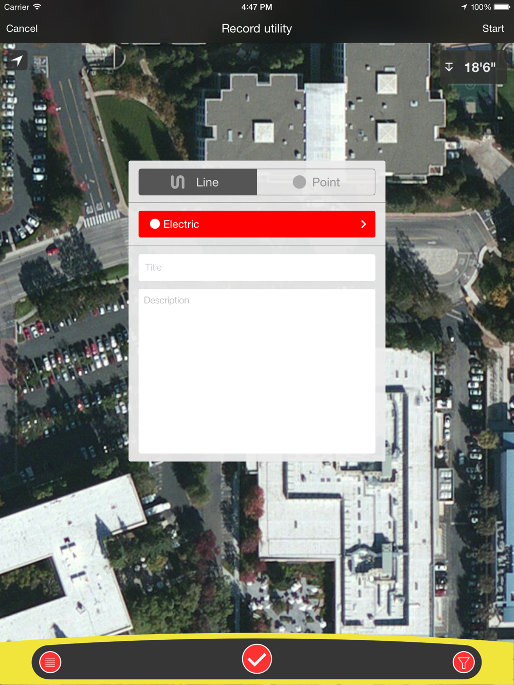
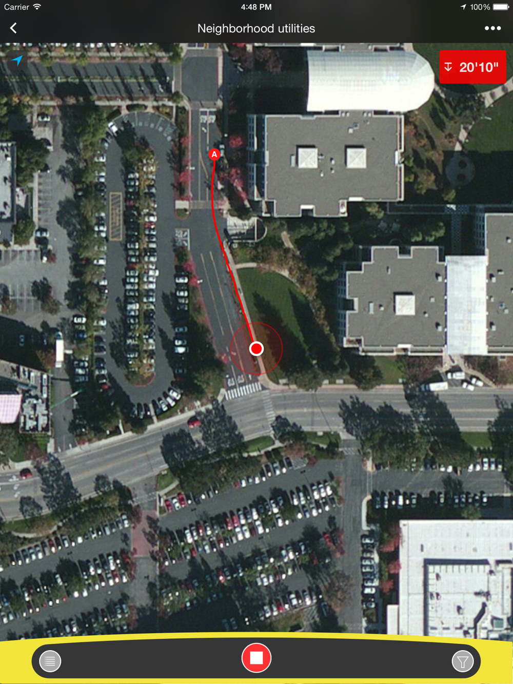
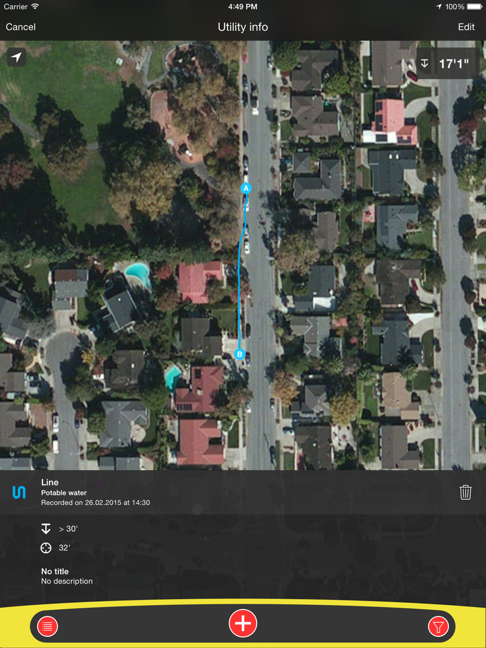
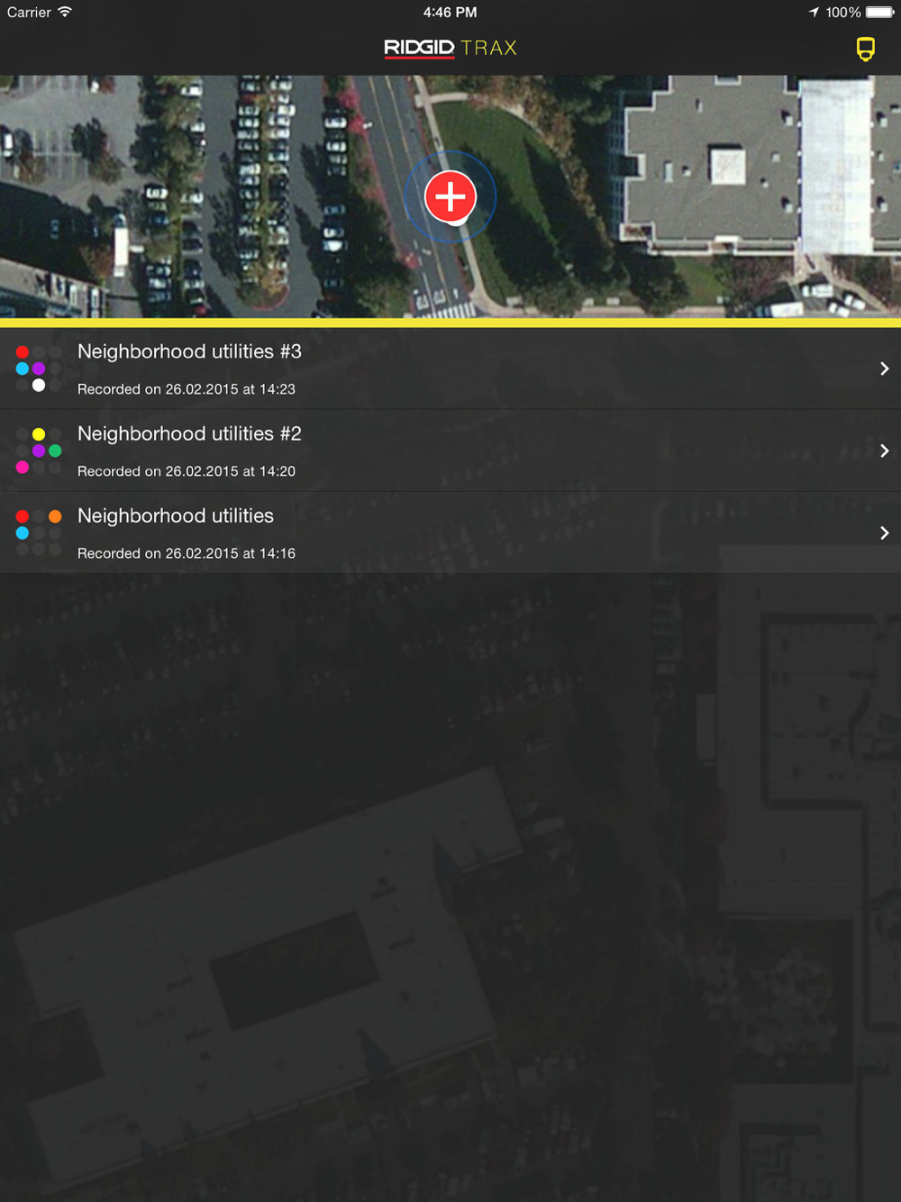
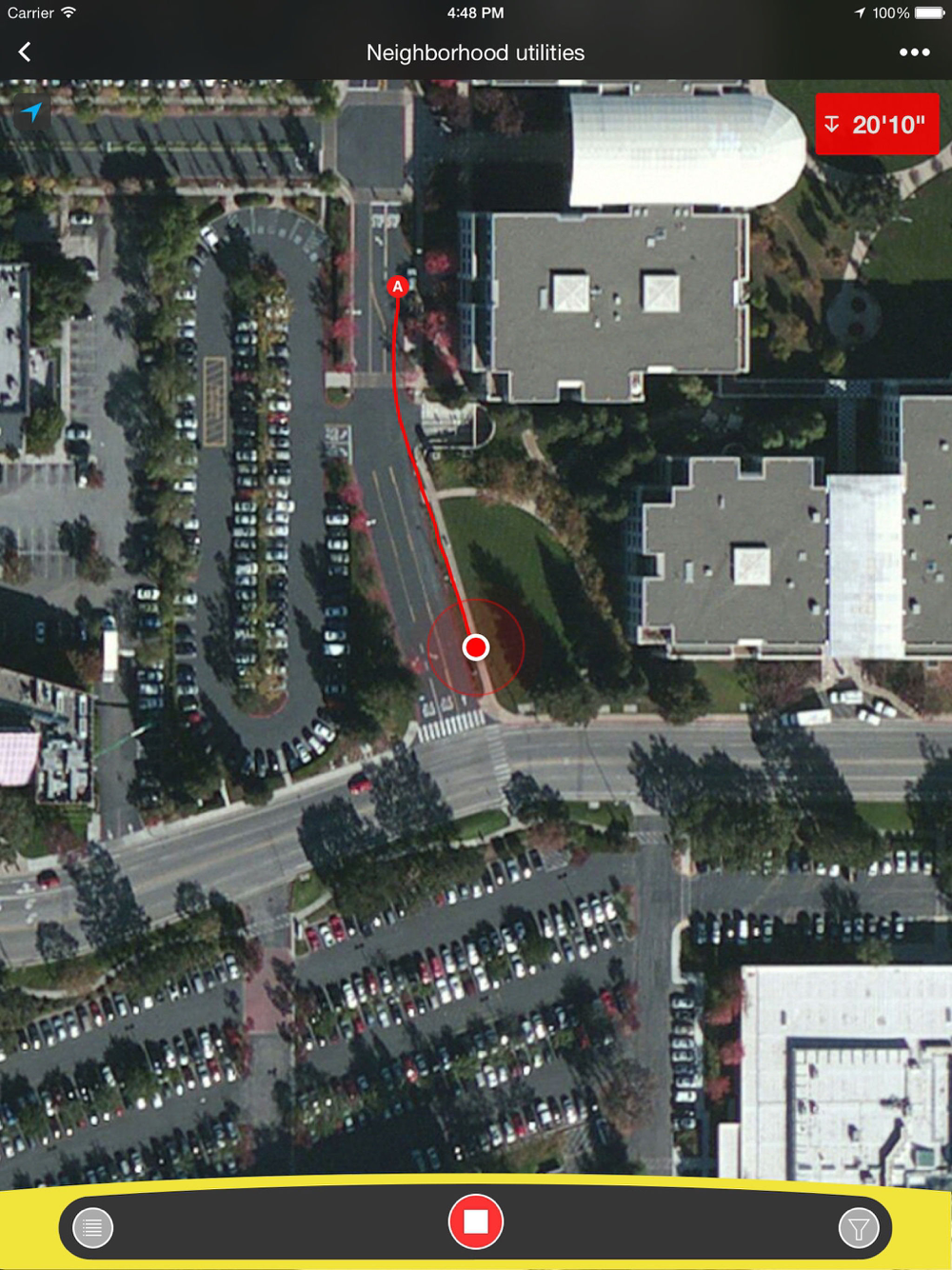
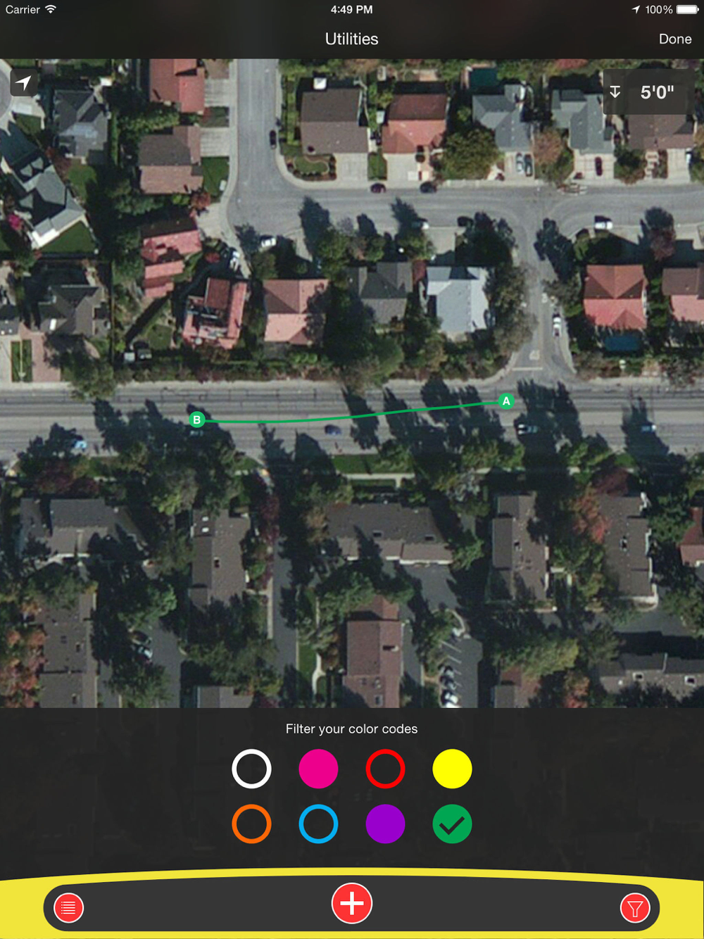
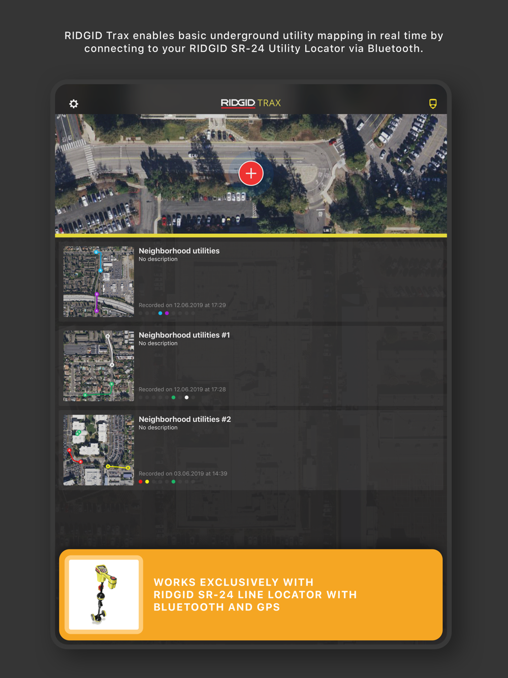
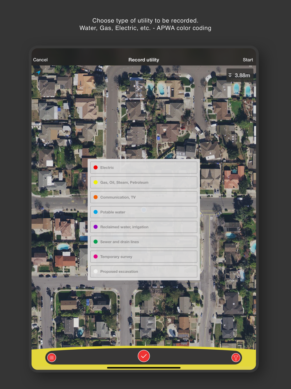
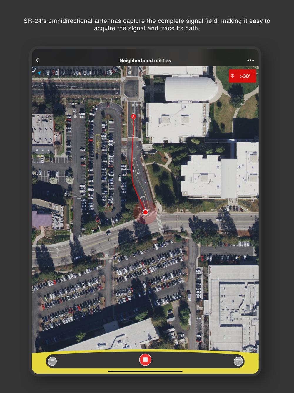
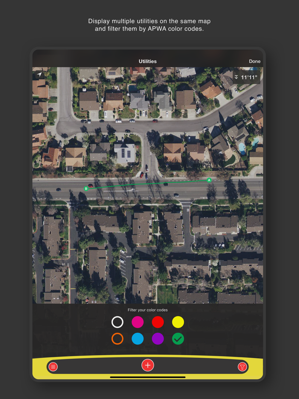
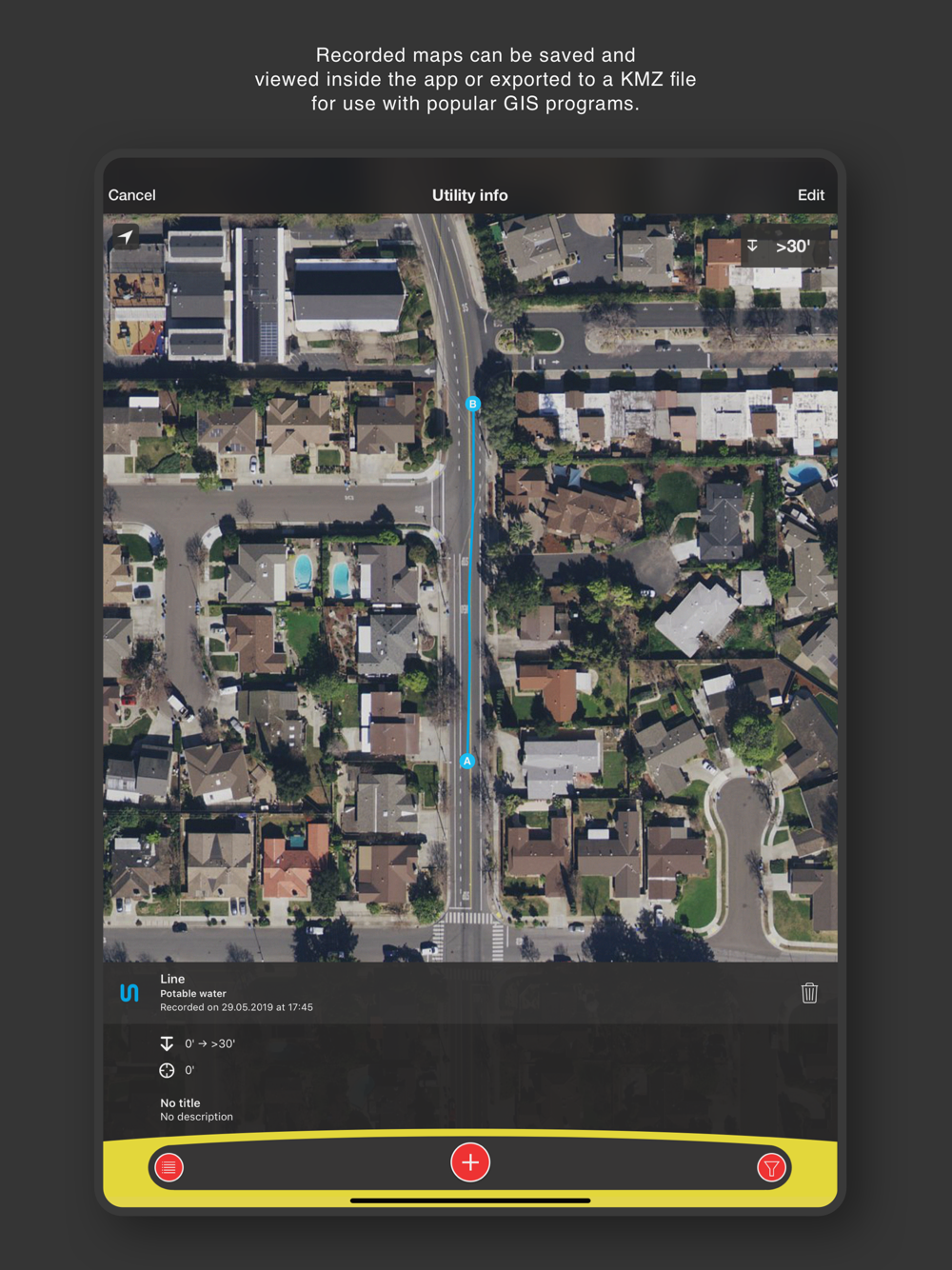
RIDGID Trax enables basic underground utility mapping in real time. Connect an iOS device wirelessly with Bluetooth to a RIDGID SR-24 Utility Locator and RIDGID Trax will display GPS position and depth of the target utility. A user can identify the type of utility (water, gas, electric, etc.) and display multiple utilities on the same map. A finished map can be saved and viewed inside the app or exported to a *.KML file for use with popular GIS programs.

Note: Continued use of GPS running in the background can dramatically decrease battery life.
Show More
Show Less
RIDGID Trax 1.3.8 Update
2020-08-10 Version History
- Fixed issue that occurs when creating single points on the map

~RIDGID Software Solutions
More Information about: RIDGID Trax
Price: FREE
Version: 1.3.8
Compatibility: Requires Requires iOS 9 or later
Bundle Id: com.ridgid.softwaresolutions.trax
Size: 33.9 MB
Genre: Utilities
Release Date: 2014-06-04
Last Update: 2020-08-10
Content Rating: 4+
Developer: RIDGID Software Solutions
Language: English - Simplified Chinese -


Whatsapp
Vkontakte
Telegram
Reddit
Pinterest
Linkedin
Hide