Unleash the navigation potential of your iPhone or iPad with SailGPS NZ! Turn your device into a high-performance GPS receiver with NZ Mariner Nautical Charts, even without a cell signal!
Caught in a storm on the water and your chart plotter fails? Don't worry! Download this app now and regain full navigation capabilities to safely return to port. Better yet, buy iSailGPS today ensuring you're prepared for any situation, even in areas with no cell service.
iSailGPS NZ eliminates sign-ups, ads, subscriptions and in-app purchases, making it more affordable, hassle-free & respectful of your privacy.
Unrivaled Features to Enhance Your Journey:
TRACKS, WAYPOINTS & ROUTES
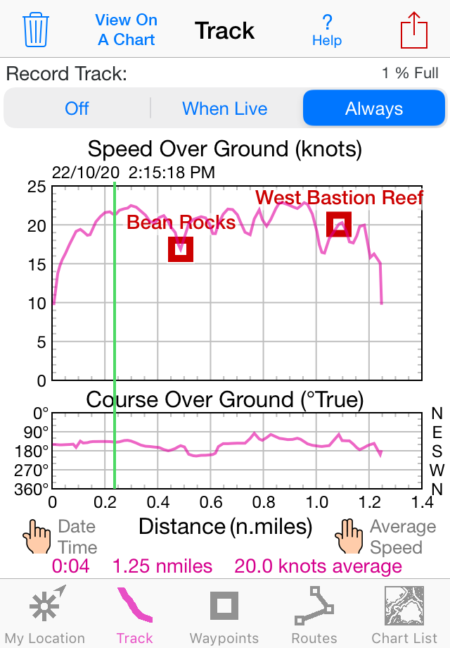
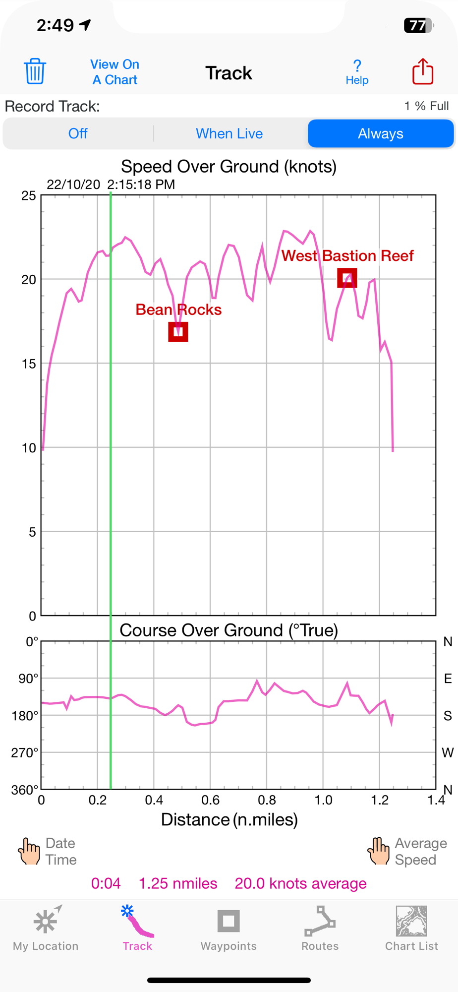
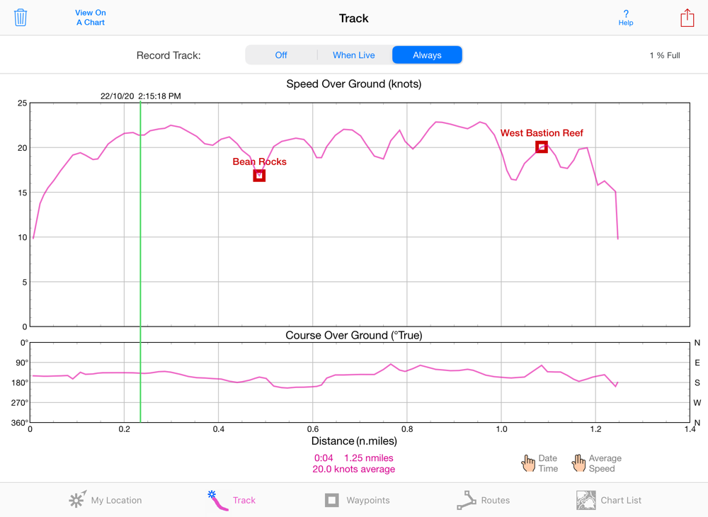
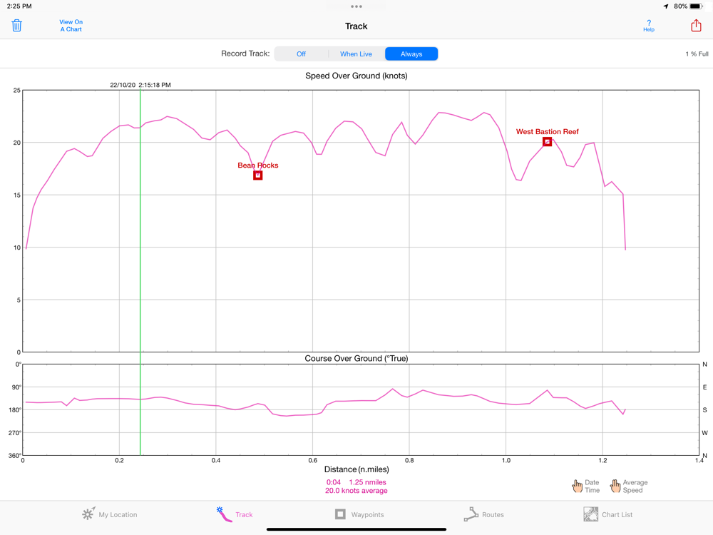
Record tracks as you sail, even in the background. View them on the chart and in a Speed & Course Over Ground graph.
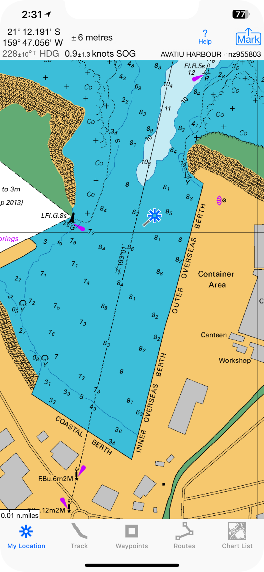
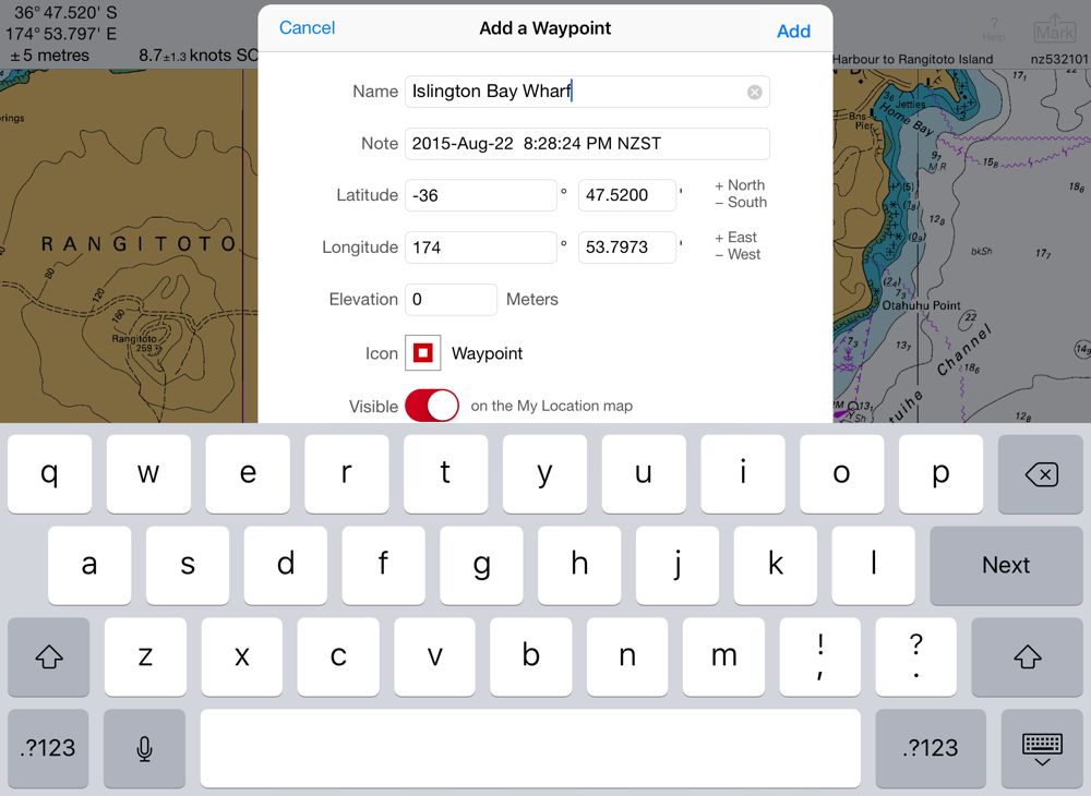
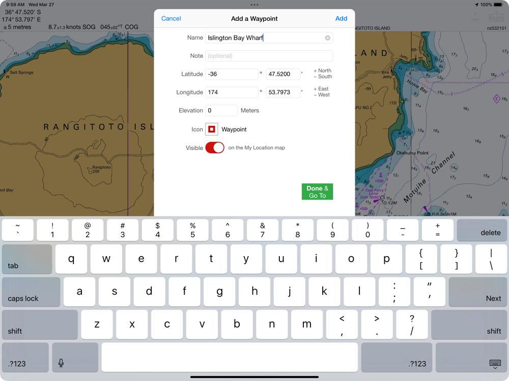
Mark waypoints precisely using topo or satellite maps, place names or addresses, geotagged photos, or by projecting from a known point.
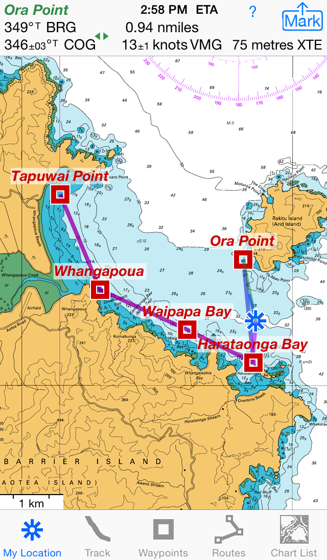
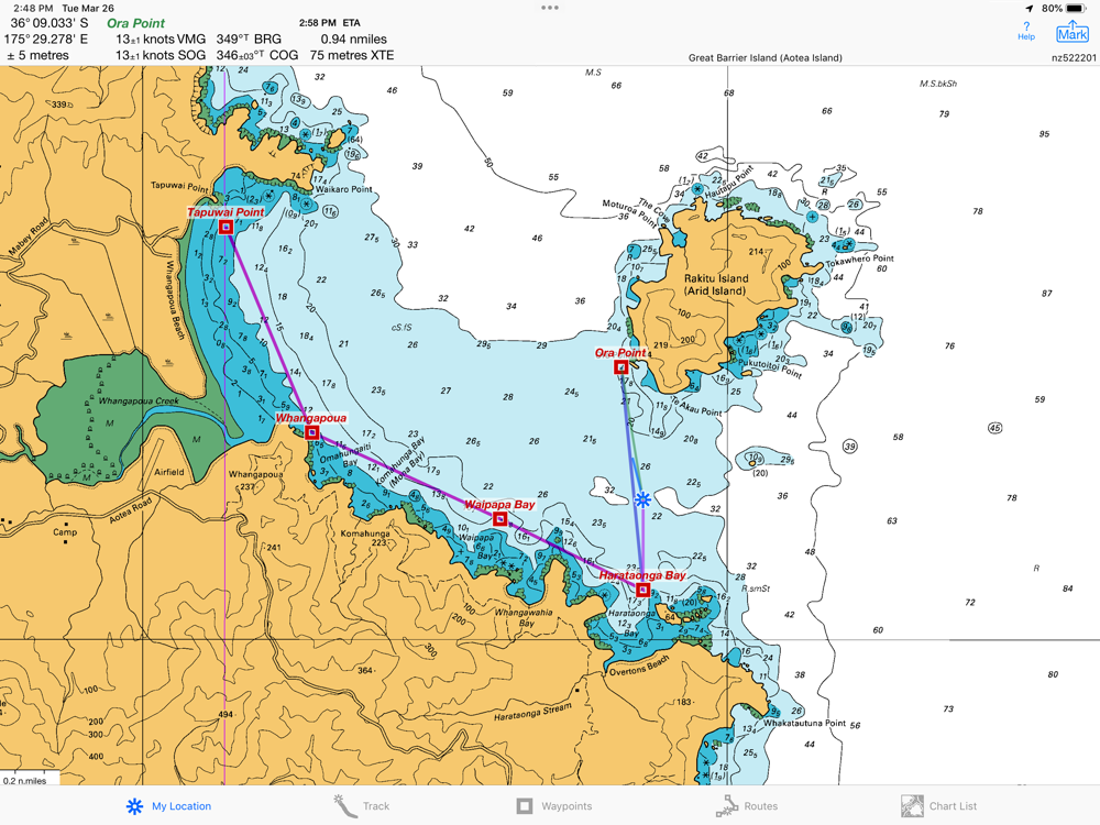
Set a quick GoTo waypoint or a full route and see the course (COG), heading (HDG), bearing (BRG), direction, distance, cross track error (XTE), Velocity Made Good (VMG) and Estimated Time of Arrival (ETA) at your destination and intermediate points. Perfect for racing enthusiasts.
In a Man Overboard (MOB) emergency a single button press marks your current position & starts navigating to it.
Create customized routes using waypoints, recorded tracks, or imported GPX, KML or TCX files. Advanced route editing.
Send GPX and KML waypoint, route, track and map list files via AirDrop, eMail, Messages, or iCloud Drive.
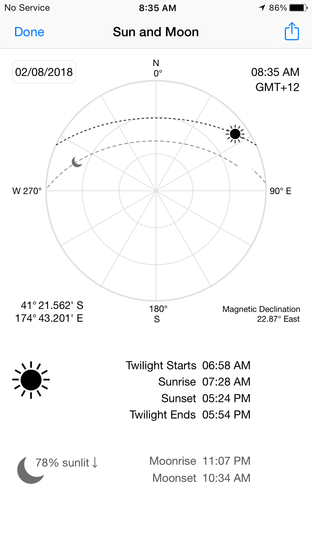
View the sun & moon position, rise times & set times for any date and place on earth.
Send data to other apps such as Google Earth.
LAND INFORMATION NEW ZEALAND NZ MARINER CHARTS
Access all LINZ NZ Mariner Raster Nautical Charts with no extra charge. Download using WiFi or cell service.
Our charts are optimized to download faster & use less storage memory. Store a few charts or charts for the whole country to use anytime at sea without cell service.
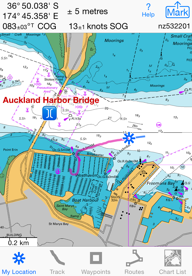
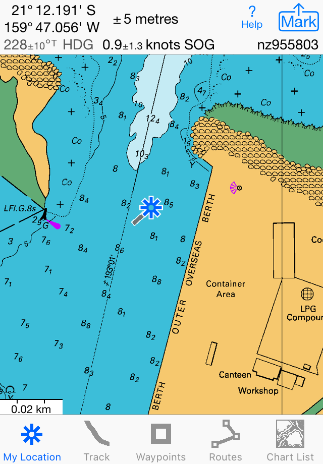
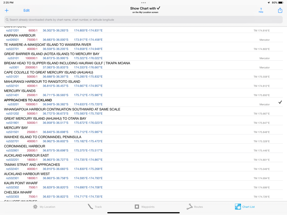
Stitches Mercator charts & automatically switches between downloaded charts as you sail. Choose detailed or overview charts.
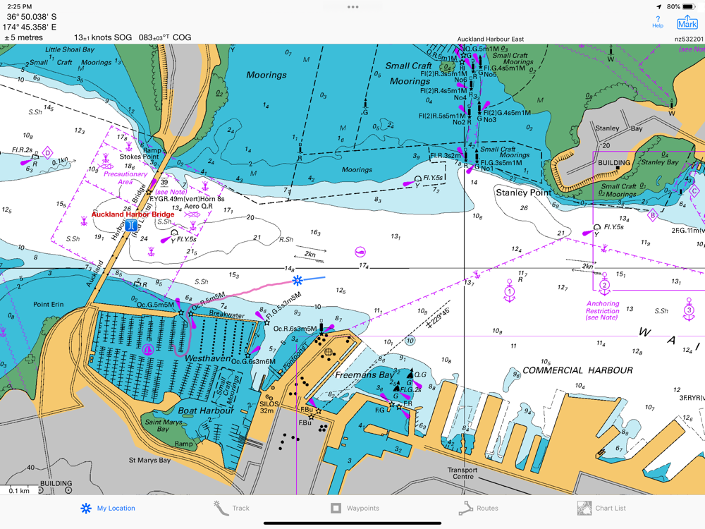
Enjoy the high resolution and what's-all-around detail of the NZMariner Raster Nautical Charts (RNC). They are a welcome advantage over Vector Charts, which only show a coastline, depths, navigation aids, and minimal details.
Print and Share chart images overlaid with waypoints, routes & tracks.
Measure distance between any two points.
USE THE UNITS YOU PREFER
Kilometers, Miles, or Nautical Miles.
Meters or Feet.
Degrees, Degrees/Minutes, Degrees/Minutes/Seconds, UTM, or NZTM2000 grid.
°True or °Magnetic.
HOW TOS
Tap Help in the app.
Online Manual: iSailGPS.com/nz
Email developer:
[email protected]
RASTER CHARTS VS. VECTOR CHARTS
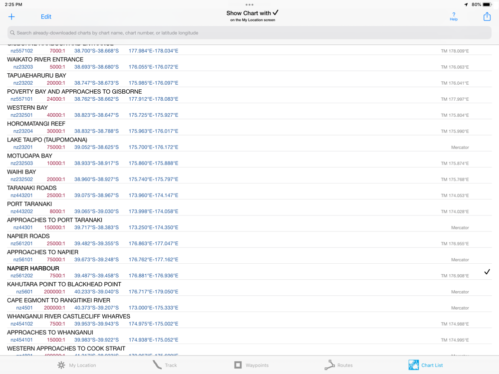
The Land Information New Zealand raster nautical charts in iSailGPS NZ differ from computer-drawn vector charts in that each chart covers a specific area, the same way a paper nautical chart does. Switches automatically to a new chart when your boat leaves the area covered by the previous chart. For many locations, there are multiple charts at different scales with different levels of detail & areas of coverage.
Paper charts can contain multiple panels, each showing a different area or scale. Each digital panel is individually displayed by iSailGPS NZ with a north-up orientation.
iSail GPS NZ is priced to make it readily available to all boating enthusiasts.
DEVICE REQUIREMENTS
Use iSailGPS on any iOS device even if you don't have a cellular data plan for it. iPhones & WiFi+cellular iPads support full navigation. For WiFi-only iPads & iPod touch, an iOS-compatible external GPS receiver is required to show your location on the water & record tracks. However, you can view charts using the iOS device alone.
Discover a safer and more enjoyable sailing experience with iSailGPS NZ!