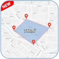
An electronic field map is the basis of the ANT information system. Using the “My Fields” application, you can visualize the contours of fields with reference to the terrain on the map, as well as display information about production sites in a table. Timely updating of sown areas allows for accurate planning and application of the required amount of seeds, fertilizers and plant protection products, and thereby optimize the costs necessary for cultivating crops.
The application allows you to import and export field maps in .KML and .SHP formats, as well as create and adjust it using the results of satellite imagery and surveying from unmanned aerial vehicles.
Using the application, you can see the difference between the actual sown area and the area used according to the documents.