Venusia Maps Experience is an application that allows you to explore the remains of the ancient city of Venusia, from its origins in the Republican era to the Middle Ages. The system offers a digital visit experience that integrates orientation, in-depth study, and historical narration.
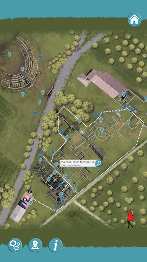
The app features an interactive georeferenced map that locates the user within the archaeological park. The location, detected via GPS, is indicated by a marker that allows you to immediately locate your current location. The map allows you to access various points of interest, each accompanied by text and audio content that illustrates the archaeological and historical evidence in detail.
The system also includes an alert function: during the visit, when approaching the sites, the application automatically signals the presence of points of interest with an audible alert and the opening of the relevant information sheet. This ensures a seamless and seamless visit experience, without the need for further action on the part of the user.
In addition to map navigation, content can also be accessed by scanning QR codes on information panels throughout the park.
Venusia Maps Experience thus represents an integrated digital tool for enhancing and understanding the archaeological park, combining technology and cultural heritage in an experience accessible directly from your smartphone.