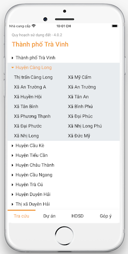
- Look up the latest updated Tra Vinh city planning information
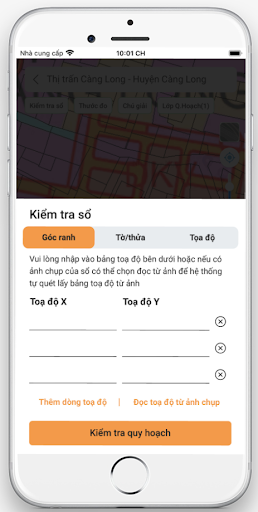
- Look up planning information according to the VN2000 boundary corner coordinates on the red book.
- Look up planning information by sheet number - plot number of the red book.
- Map of detailed land use planning by district/district - ward.
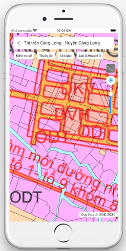
- Support to view satellite & traffic planning maps.
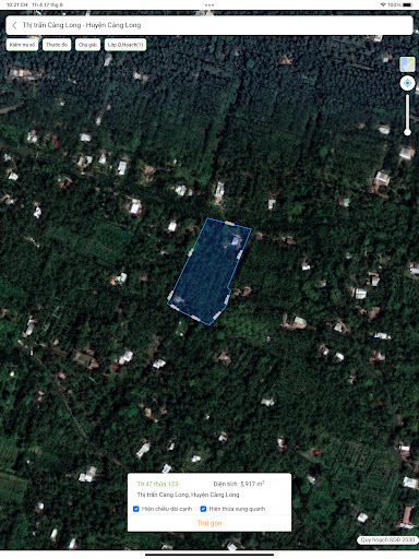
- Easily capture population density, roads with satellite view.
- Link directions on google map.
- Measurement
- See the list of adjacent parcels.