We develop and provide this application free of charge to help you evacuate in the event of a disaster.
In addition, we have created this application offline, assuming that a failure such as the Internet will occur in the event of a disaster.
We have updated the latest information as much as possible, but please check the official information from the homepage of the municipality. Please use it as reference information only.
* It can also be used for information on surrounding flood hazards when purchasing an apartment.
Major features:
1. 1. No internet connection required. Available anytime, anywhere.
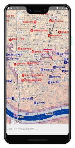
2. 2. High resolution. Easy to identify station names and place names.
3. 3. Since it can be enlarged or reduced, the characters can be enlarged.
4. Intuitively designed and easy to use.
5. All free.
App content:
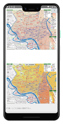
+ Arakawa (estimated inundation area map, inundation duration)
+ Tone River (estimated inundation area map, inundation duration)
+ Edo River (estimated inundation area map, inundation duration)
+ Nakagawa (estimated inundation area map, inundation duration)
+ Ayase River (estimated inundation area map, inundation duration)
+ Shiba River / Shin Shiba River (Inundation area map)