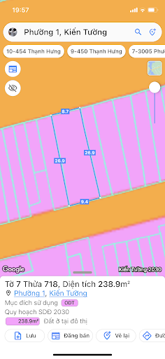
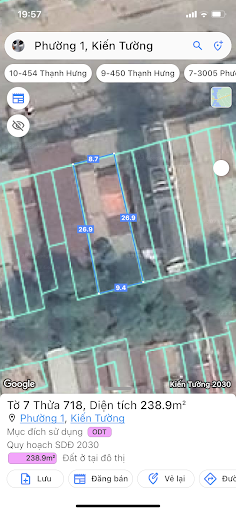
Main functions of the application:
1. Locate the user's current parcel of land in the planning category or not.
2. Look up planning information by:
• Enter the number of map sheets and land parcel on the land use right certificate and other relevant documents.
• Enter information of the coordinates of the parcel of land that the user wants to look up
• Take a photo of the coordinates of the parcel of land that the user wants to look up
3. View information by clicking directly on the map.
4. Save parcel information.