For Surveyors, Engineers, Navigators and Students of Geodesy...
Geodesy Earth Tools is the easiest way to make geographic calculations.
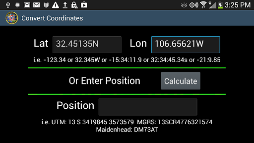
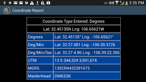
* Coordinate conversion tool with error checking: Convert Degrees, Deg/Min, Deg/Min/Sec, UTM, MGRS, Maidenhead.
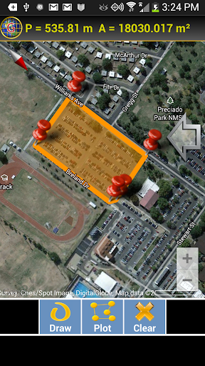
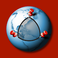
* Draw any free-form closed shape on a map or point-plot a perimeter to get the enclosed area. Great if you just want to know the area of your neighbor's back yard or the area and perimeter of the continental U.S. Useful for construction planning, gardening, or any other task that requires area measurements.
* Plot 2 points on a map and get the altitudes, distance and altitude difference between them along with reverse geocoded locality information.
* Solutions for the direct and indirect geodetic problem.
* Lots of screens for making distance, area, heading and altitude calculations including, for the technically minded, a geodetic problem calculator for inverse and direct geodetic problems. Choose your geoid (DATUM).
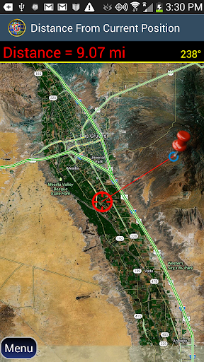
* Distance from your position to any position on the globe.
* Magnetic field tools including A COMPASS with a magnetic declination indicator.
* Time measurements.
* Excellent documentation with easy to follow help.