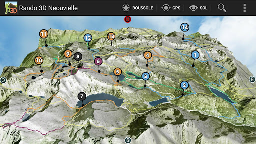
Massif of Néouvielle
Hautes Pyrenees - 65
3D map Gèdre sector (Le Sausset) Fabian
Barèges Artigues (Le Garet).
Néouvielle reserve.
LIST OF HIKING
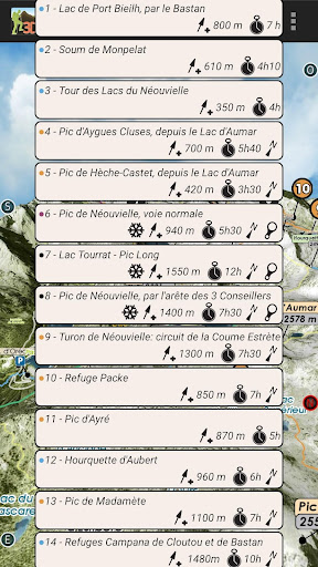
1 - Shelters Oule and Bastan - Lake Port Bieilh by the Bastan
2 - Soum of Monpelat
3 - Lakes Tour Neouvielle
4 - Pic Aygues Cluses, from the Lac d'Aubert
5 - Peak Heche-Castet, from the Lac d'Aubert
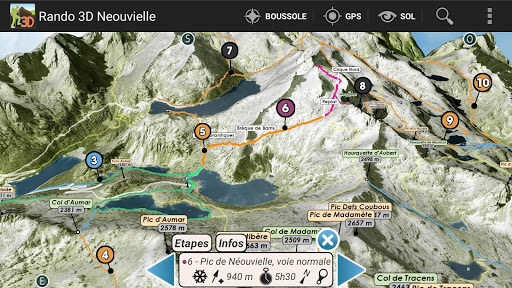
6 - Peak Neouvielle normal route
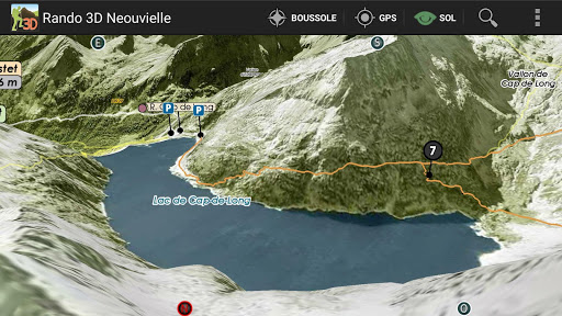
7 - Lake Tourrat - Pic Long, in 2 days.
8 - Pic Néouvielle, by the edge of the 3 Consultants
9 - Turon of Néouvielle: circuit of Coume Estrète
10 - Refuge Packe
11 - Pic Ayré
12 - Aubert Hourquette
13 - Peak Madamète
14 - Campana Refuges Cloutou and Bastan, from Garet
Sheets and photos of Lakes, Sheds and Shelters
with the assistance of:
www.pyrenees-refuges.com
www.lacsdespyrenees.com
3D Hiking Guide
interactive and immersive application.
Take full advantage of this embedded hiking guide and map realistic.
The description of routes is detailed in dynamic 3D illustration.
All features are easy to use and accessible OFFLINE mountain oblige.
Good hiking at all.
IMMERSIVE 3D FEATURES
○ intuitive and precise controls ... fingertips.
○ Aerial View, overview
○ View and taxiing
○ Compass
○ Geolocation
& DESIGN GUIDE
○ precise descriptions, text and visuals
○ Steps
○ Live View in 3D
GPS
The GPS of your phone is used for geolocation on the map area, it is particularly useful to see its position in the terrain, especially in poor visibility on the ground.
COMPASS
The compass mode is integrated in 3D, the cardinal points are oriented according to the manual movements or map automatically orients the north by activating the compass mode directly from the 3D.
RELIEF IN SIGHT & 3D SOL
The aerial view and floor to illustrate the general view raised to a level of precision optimized, it is displayed on the screen depending on the definition of the relief and texture chosen to launch the application automatically loaded or select according to device capabilities used.
The movement of the floor camera can appreciate the details of the route to follow and total immersion in the relief.
TRACKS
Besides hiking described, mapped trails, variations and alternative routes, you can import your tracks in GPX 3D map ..
3D Interactive Application hiking guide - Facing the South TOPOMAP3D ® ® www.faceausud.com
Trademark and patented models 486299 08082013 - 12 3953606 © All rights reserved - No copying
With the kind of Helge Foerster JPCT 3D engine ® www.jpct.net Copyright © 2010