GPS Camera – Photo Map, Location & Time Stamp On Photos
GPS Maps: Photo Map Camera is a map camera and navigation app that lets you capture photos with location stamps, time stamp, and date stamps while also offering maps, and route planner tools. It combines GPS camera, navigation, and travel utilities in one app for daily use, outdoor activities, and trips.
With GPS Maps: Photo Map Camera, you can take photos that automatically include location, time, and date stamps. At the same time, the gps map camera & navigation app provides navigation features like voice-guided routes, satellite maps, speedometer, parking saver, and fuel calculator, all in one place. Whether you’re traveling, exploring, or recording your daily activities, gps camera app keeps everything organized and accessible.
This GPS camera app is built to make your trips smarter. From saving routes and finding nearby places to checking air quality and measuring speed, it brings together tools you need for both travel and daily life.
Key Features of GPS Maps: Photo Map Camera
Timestamp, Map Camera
Gps camera app lets you take photos with automatic GPS coordinates, address, date, and time stamped directly on them for records or memories.
Route Planner
GPS camera, map & navigation app lets you plan and follow routes with turn-by-turn navigation. GPS navigation lets you navigate cities or outdoor trails with ease.
Satellite Map
Switch to satellite view to see detailed landscapes, and locations from above for better route planning and exploration.
Nearby Finder
Search for nearby restaurants, hotels, gas stations, hospitals, and more.
Voice Navigation
GPS camera & navigation app offers hands-free navigation with voice-guided directions, making your driving and travel experience easier.
Fuel Calculator
Estimate fuel costs for your trips by calculating distance, mileage, and fuel requirements before you start your journey.
Speedometer
Map camera app lets users monitor their real-time speed while driving or cycling. Stay aware of your speed limits and travel safely.
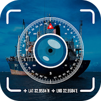
Compass
Use the built-in compass to navigate directions easily, whether you are hiking, camping, or exploring outdoors.
Parking Saver
Save your parking location to easily find your vehicle later, especially in crowded or new areas.
My Location
GPS map camera & navigation app lets you see your live GPS location and keep friends or family updated while you travel.
Air Quality Index
Stay informed about the air quality in your area or travel destinations to plan safe outdoor activities.
Save Routes
Save frequently used routes for quick access, making your daily commute or regular trips faster and more convenient.
Why Choose GPS Maps: Photo Map Camera?
GPS Map Camera is more than just a gps camera or navigation app—it’s a travel companion. From capturing photos with accurate location details to navigating routes and finding nearby places, it gives you all the tools you need in one app.
Download GPS Maps: Photo Map Camera today and make your journeys easier, smarter, and more organized.