Description:
This application converts a user-specified area of a GeoTiff geoid model into the ISG text file format. It's designed to create a usable geoid model for GNSS surveying in regions where official data is unavailable.
Important Note:
This app only performs the file conversion. To calculate geoid heights, you will need a separate surveying application that can process ISG format geoid models.
Instructions:
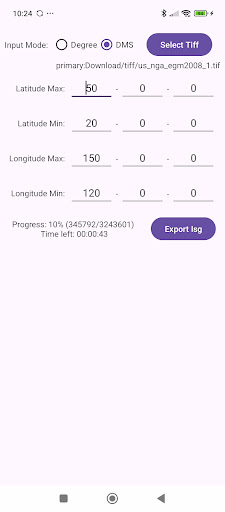
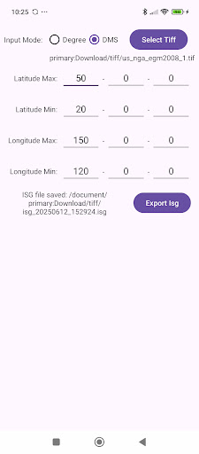
1. Select Units
Choose the coordinate format for defining the area.
Degree : Decimal Degrees (e.g., 35.6812)
DMS : Degrees, Minutes, Seconds, e.g., 35° 40' 52.3")
2. Select Source File (Select Tiff Button)
Click the button below to select the source file.
Note: Only rectangular GeoTiff files are supported.
3. Define Export Area
Enter the latitude and longitude boundaries for the area you want to export.
4. Export to ISG File (Export Isg Button)
Click the export button to name your file and start the conversion.
Conversion Status:
The conversion may take some time. Please wait until the process is complete.