DronePilotApp – Your Digital Copilot 🧭🚁
DronePilotApp is the app designed for drone pilots – professionals, hobbyists and content creators – to plan, fly and collaborate safely. With an interactive map, real-time notifications and advanced tools, it accompanies you through every phase of the flight, from preparation to return.
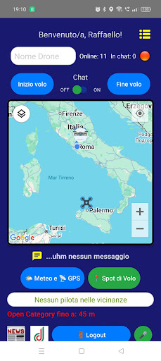
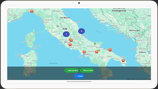
🗺️ Live interactive map
View your position and that of other pilots in real time on the Google map.
Check no-fly zones (NOTAM, ATM09, NFZ), report take-off points, and receive GNSS and weather alerts at a glance.
🗣️ Intelligent voice assistant
Ask by voice: “Can I fly my drone here?”
The assistant analyses the flight restrictions in your current position in real time (including NOTAM and altitude limits) and gives you a clear and immediate answer.
🎙️ Just a touch or a voice command to know if you are in a safe area.
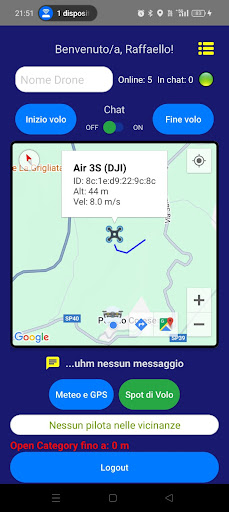
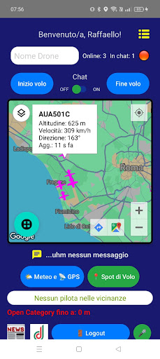
📡 Nearby drone detection (OpenDroneID)
Compatible with the OpenDroneID standard, the app receives broadcast signals from DJI drones and other aircraft via Bluetooth LE and WiFi Aware.
👀 See models, position, altitude, direction and speed of drones around you.
🧑✈️ Pilot and associated drones tab
Each pilot can create and customize their own public profile, complete with biography, profile photo and drones used.
🔗 View the profile of other pilots from the map or chat, find out which models they use and share yours too!
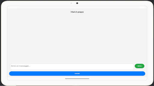
💬 Chat between pilots
Communicate with other pilots in real time. Report critical issues, coordinate activities or simply share your flight experience.
An integrated messaging system with sound alerts and indication of availability in chat.
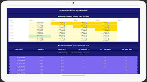
🌦️ Advanced Weather
View current conditions, hourly forecasts and professional meteograms (Meteoblue).
📡 Also included is the TEC (Total Electron Content) index to plan reliable GNSS flights.
🌅 Sunrise and sunset times included for creators who fly "golden hour"!
🧠 Augmented Reality (AR)
🆕 New AR feature!
View in augmented reality the drones detected around you and discover tourist points of interest in the area, for creative ideas and spectacular shots.
🔍 Dynamic labels in overlay, distance and orientation updated in real time.
📘 DJI Flight Log
Upload your DJI Fly App .txt logs to get:
• ✈️ Full route on map
• 📊 Altitude, speed, distance and duration
• 📍 Save to Firebase and share with the community
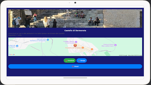
📍 Shared take-off spots
Report new take-off points, confirm suggested ones and consult the most voted ones.
👥 A participatory network to always find the right place to fly.
🔐 Security & Privacy
• No ads
• HTTPS encrypted connections
• Data saved on Firebase in compliance with GDPR
✅ Free, lightweight and always updated
DronePilotApp is completely free, optimized for Android 11+ devices and is constantly evolving thanks to community feedback.
📧 Support & Info
📬 Email:
[email protected]
🔐 Privacy policy: raffaello-kwos.github.io/DronePilotApp/privacy.html
🚀 DronePilotApp is your ally in the skies. Download it now and fly informed, safe, connected.