By Monte Asturias, it offers a guide to the major mountain routes, trails and access to shelters Asturias and neighboring provinces, both to your mobile device as Android tablet.
There are three distinct sections:
- Mountains: The objective of this section is to show a series of proprietary data every mountain, such as the coordinates of the summit, altitude, prominence, etc., and the most common route or routes to gain access to the summit. This route is a new section that provides a brief description of it, indicating the slope, length, length, etc., a small gallery and an online viewer with map and route taken.
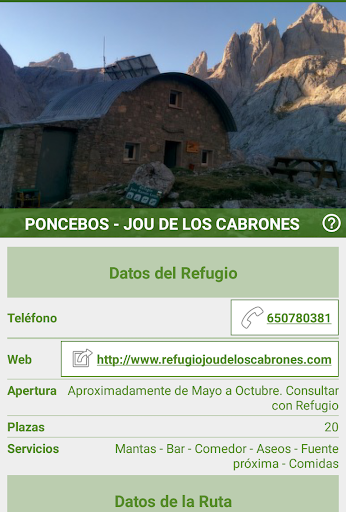
- Shelter: The goal is to show a unified way, the main characteristics of each refuge, such as the number of places, coordinates, contact information, etc. and also the main route to reach it. This route is a new section, which describes in a similar way as you would on a mountain path, displaying a brief description of it, a small gallery and an online viewer with map and proposed route.
- Hiking trails or paths: the unified path information in question is displayed. Among others, the duration, slope, length, place start / end, etc. There is also a section to show a small photographic gallery and online map viewer and the proposed route.
Currently, a total of 102 routes divided as follows:
- 68 mountain routes
- 24 hiking trails
- 10 tours to access the main mountain huts of Asturias and neighboring provinces.
There are routes that run through the whole territory of Asturias, from West to East.
The application is not intended for use as a GPS, mainly because maps require network connection.