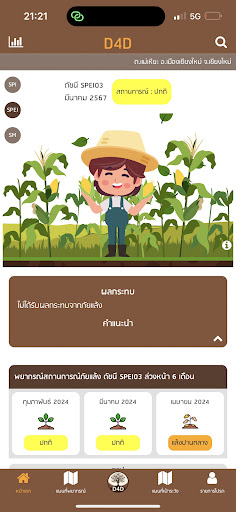
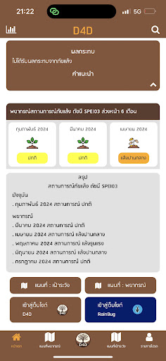
D4D is an application for monitoring and forecasting droughts both spatially and temporally. Able to analyze drought situations from the past to the present. (going back more than 40 years) and forecasting droughts 6 months in advance. Users can browse spatial data for both sub-districts, districts, provinces, main river basins, and tributary river basins. Covers the northern region of Thailand. which presents the results of the analysis of the drought situation in both time series formats (Time-series) Map (Map) including impact assessment and preliminary recommendations Users can use data to support decision-making for effective drought management, especially in agriculture and water resources.
The D4D application reports the results of the drought situation analysis with the drought index imported from the WRF-CFS numerical weather model, which still has uncertainty, especially the forecast data where the uncertainty will increase. According to the forecast period This is considered a limitation of current knowledge in atmospheric science that requires continuous development. Users are requested to use the information with awareness of such limitations. And the development team reserves responsibility for any damages that may occur from using this application in making various decisions.