GPS Map: Live Earth Camera is a helpful app that lets you view maps, get directions, and explore places in a simple way. Whether you’re going somewhere or just want to see what a place looks like, this app gives you useful tools like GPS navigation, satellite view, and street-level maps. It's designed to help you move around and learn about different locations directly from your phone.
Key features of the gps map live earth camera app:
🛰️ Live Satellite View gives you a clear view of the world from above. You can look at real places from a satellite map and see how different areas look in real time.
🗺️ With Multiple Map Modes, you can switch between standard, satellite, terrain, and hybrid views. Each map mode helps you understand the area better, depending on what you need.
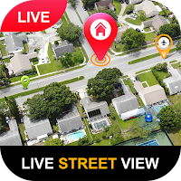
🏢 3D Street View Map lets you see streets and buildings as if you are there. This is helpful when checking places before visiting or just exploring from your phone.
🚘 The GPS Map & Navigation feature helps you find routes and follow directions to your destination. You can track your current location and get turn-by-turn guidance easily.
🚦 Use the Real Time Traffic Map to see road traffic, possible delays, and areas to avoid. It can help you choose better routes based on the current road conditions.
📸 Explore Famous Places allows you to view well-known landmarks and tourist spots around the world. You can see them on the map, read basic information, and explore them visually.
GPS Map: Live Earth Camera is a simple app that combines many helpful features into one place. It is suitable for daily travel, trip planning, and discovering new areas on the map. You don’t need to be an expert - just open the app and start exploring.
Download GPS Map: Live Earth Camera to use useful map tools and learn more about the places around you.