Zip code search, weather forecast and map can be used at the same time in one app and it is practical.
It has a set of functions such as favorite district registration, favorite zip code, use of search history, map, and nearest station.
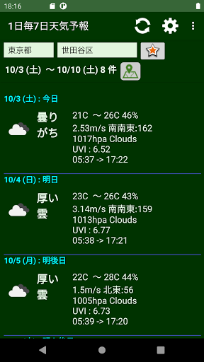
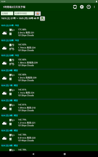
Three types of weather forecasts are available.
You can quickly switch between favorite districts because you can select them from the menu.
You can choose the theme color as you like.
===========
Feature overview
===========
You can search for a flight number by specifying the city.
You can see the weather forecast by specifying the city.
You can see a map of the city, zip code, and district.
Maps can be selected from Google and Mapbox.
You can switch between many types of maps in Mapbox.
You can add or delete the searched city / ward / town / village to your favorites list.
You can add or delete the searched zip code to your favorites list.
Three types of weather forecasts are available.
You can see the demographics by specifying the city.
===========
How to use
===========
--List screen -
You can add or delete your favorite districts with the button next to the city selection.
You can display the map with the map icon next to the search result display.
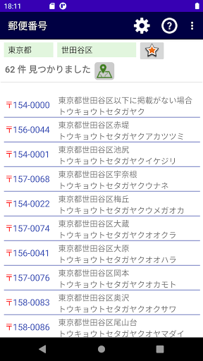
You can display the map by tapping the item in the zip code list.
You can copy or share by long-pressing the item in the zip code list.
You can copy or share by long-pressing the item in the weather forecast list.
--Menu -
You can select and search for the districts you have registered as favorites from "Favorite districts".
You can make a note of the zip code that you often use in "Favorite zip code".
In "Change list type", you can select whether to use the zip code or the weather forecast.
You can save and reuse the search contents in "Search history".
You can see the current status of your device in "System Information".
Tap the setting icon to open the setting screen, where you can set the map type, color scheme, and zip code place name display format.
You can see the annual transition of each in "Population composition" and "Population movement".
===============
About data
===============
Prefectures use the API of Cabinet Office RESAS.
Municipalities use the Postcode JP API.
The zip code uses the API of teraren.com.
The weather forecast uses the OpenWeatherMap API.
The map uses the API of Google Map.
The geocoder uses the API of the Geographical Survey Institute and Heart Rails.
Demographics use the API of the Cabinet Office RESAS.
===============
version
===============
jparea 1.1