The framework was developed by Team ShubhiTech. An ISO Certified Software Development Company using a self-made simulation environment.
All the navigation data coming from a commercially available as navigation system were recorded synchronously together with a video stream from a digital camera mounted in the camera. These data repetitively served as the simulation input for the initial AR navigation system running on a personal mobile phone.
The framework architecture provides a variety of input interfaces for receiving the required data from the navigation system. Most navigation systems are equipped with a GPS receiver for locating the current position.
Once the current position and orientation are known, the system is ready to calculate the virtual path representing the designated route. The route from the navigation system is provided by a sequence of geographical points in the 3D space.
Primarily, it uses the following three key technologies to integrate virtual content with the real world as seen through your phone’s camera:
1. Motion tracking: It allows the phone to understand and track its position relative to the outer surroundings.
2. Environmental understanding: This allows the phone to detect the size and location of all type of surfaces: horizontal, vertical, and angled surfaces like the ground, a table, or walls.
3. Light estimation: This allows the phone to estimate the environment’s current lighting conditions to form more realistic looking virtual overlays.
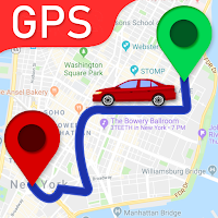
Navigation applications are possibly the most natural fit of augmented reality with our everyday lives. Enhanced GPS systems use augmented reality to make it easier to get from point A to point B. Using the smartphone's camera in combination with the GPS, users see the selected route over the live view of what is in front of the car.
AR rolled out its second wave and nowadays is mostly related to the interactive concept. 3D models are directly projected onto physical things or fused together in real-time
AR can augment the effectiveness of navigation devices. Information can be displayed on an automobile's windshield indicating destination directions and meter, weather, terrain, road conditions and traffic information as well as alerts to potential hazards in their path
With the help of GPS in phones pinpoint the location. Augmentation is happening in real-time and within the context of the environment.
The AR navigation system is built upon a core framework where state-of-the-art positioning systems (primarily GPS) are used for keeping track
GPS is one of the existing technologies in the navigation space; however, it cannot provide accurate positioning inside a building. It’s relatively accurate in large and low-rise buildings, such as airports; but it can’t determine finer details such as the floor number, and the only way to achieve this is to do it manually, like the way it’s done with Apple & Google Maps. The takeaway here is GPS works but it’s not a viable solution.