Enhance Your Tactical Awareness with the SkyFi TAK Plugin!
Seamlessly integrate SkyFi’s satellite imagery ordering and tasking capabilities directly into your CIVTAK or ATAK ecosystem. Gain on-demand access to critical geospatial intelligence and make fast, informed decisions in the field.
🔍 Why Choose the SkyFi TAK Plugin?
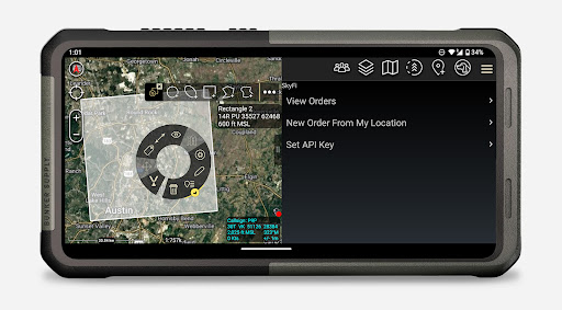
🛰️ Effortless Satellite Imagery Ordering
Define your Area of Interest (AOI) directly on your TAK map. Customize resolution, cloud cover, and acquisition windows — all within the familiar TAK interface.
🚀 On-Demand Satellite Tasking
Need real-time insights? Task satellites instantly to capture fresh imagery and maintain your advantage in dynamic operational environments.
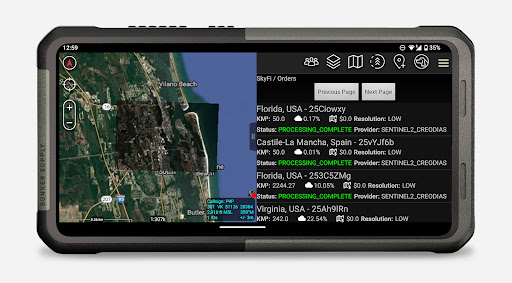
📡 Real-Time Order Tracking
Track the status of your imagery orders and tasking requests live. Get transparent updates for efficient mission management.
📥 Seamless Imagery Streaming
Automatically stream available imagery to your device — no need for manual downloads or file imports.
🗺️ Precise Georeferenced Overlays
SkyFi imagery is perfectly aligned with your TAK map, integrating smoothly with your existing geospatial data for accurate and contextual analysis.
📱 Optimized for Mobile Operations
Built for the TAK mobile environment, ensuring efficient data transfer and performance, even in low-bandwidth scenarios.
Download the SkyFi TAK Plugin today and elevate your tactical operations with real-time satellite imagery at your fingertips.