Manage your farms intelligently with our complete application for recording, viewing and sharing geographic data.
🔍 Main features:
✅ Creating and managing farms
✅ Importing and uploading reports
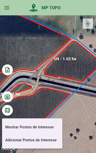
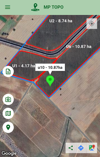
✅ Importing and viewing KMZ and KML files
✅ Adding custom geographic points
✅ Saving points with description and location
✅ Sharing points and map images
🌐 Practical application:
Field surveys
Monitoring areas and rural assets
Managing and documenting properties
Sharing georeferenced data
📲 Why use this app?
Our app was designed to be lightweight, efficient and straight to the point. If you need to record a location accurately, view mapped areas or share field information in a practical way, it is the ideal tool.
Additionally, support for KMZ/KML files and sharing of images with coordinates allows you to integrate visual and technical data in one place.