Simple and Easy to Add GPS Location, Map & Timestamp to Your Camera Photos
Capture your moments with full details using the smart and easy GPS Camera - Location & Map app. You can add GPS camera location stamp, live maps, time stamp, and custom notes to your photos. You can add accurate data every time you capture photos of your trip, fieldwork, or site.
? Why You’ll Love It
Use this camera to auto-tag photos with GPS map camera location stamp, date, compass, and address. Designed for surveyors, engineers, students, travelers, and professionals, it’s perfect for logging every detail. This is more than just a GPS camera — it’s a complete GPS map location camera app for precise visual records.
The GPS Camera - Location & Map app gives you ready-made templates to quickly stamp photos with location, date, and other details. You can also create your own custom template with the information you need. Add fields like coordinates, address, time, and notes. It’s perfect for both quick use and full customization.
From vacation photos to work documentation, your pictures will always carry complete info with time, location, and visual references. The intuitive design makes it easy for anyone to capture and share meaningful images.
? Smart Geo Tagging Features
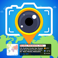
• Add an accurate geotagged location added on photos with one tap
• Works as a full geotag camera with location and map layers
• Choose from Normal, Satellite, Hybrid, or Terrain map views
• Use the GPS photomaps location stamp to track every journey
• Add geo location stamps or photo location stamps to your reports
• Customize every image with a short location on the photo and compass direction
• Use the automatic location picker on the image for real-time accuracy
• Tag each photo with address, coordinates, and map info automatically
? Professional Tagging Tools
• Add GPS stamps to camera photos automatically with full precision
• Capture GPS camera location and time stamp without editing
• Auto-add GPS map stamp camera pictures for construction and field work
• Embed GPS location map, photo info, elevation, and project tags
• Try satellite map stamp on your photos for better terrain context
• Use GPS map camera stamps for legal, travel, or survey documentation
• Get full GPS map location on live photos to never lose track of a place
• Easily add geolocation to camera photos while shooting in real-time
• Add detailed data using GPS map camera and stamps with accuracy
? Perfect For:
• Civil engineers, construction teams, and surveyors need proof of location
• Professionals who rely on the GPS camera location stamp for daily site work
• Students and researchers documenting field activities with visual evidence
• Content creators, bloggers, and photographers who share location-tagged photos
• Anyone wanting to keep track of where and when photos were taken using GPS photomaps
? What's all included in the App?
• GPS Map Camera feature – Add precise location data (latitude and longitude) along with live map views to your photos.
• QR code scanner and QR code – Easily scan or create QR codes for fast and secure data sharing.
• Custom note fields – Add personalized notes directly onto your photo stamps.
• Adjustable camera tools – Customize camera settings like aspect ratio, flash, focus, filters, and grid overlay.
• Map Data – Include short addresses, time zones, and compass directions on your images.
• Images on Map – View and organize your geotagged photos directly on a map interface.
• Offline Support – Works as a reliable GPS map location camera app even in remote areas.
? Download “GPS Camera - Location & Map” – the easy way to add GPS location and maps to your photos. Perfect for travel journals, field reports, and photo documentation with smart geo tagging.