Drainage Geotagging by Vasundhara IT Pvt Ltd is a citizen-driven geotagging and reporting platform that enables users to easily report drainage issues, potholes, and open manholes with precise location and visual evidence. By using the app, communities can collaboratively help improve infrastructure by identifying, tracking, and updating the status of critical urban issues.
⸻
? Key Features:
? Easy Reporting:
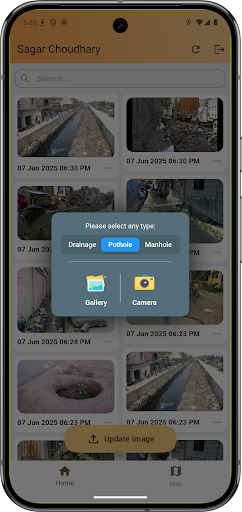
Quickly report drainage blockages, potholes, and open manholes by capturing photos directly from your mobile device and submitting them with a few taps.
? Accurate Geotagging:
Automatically records the GPS location of where the image was captured and where it was uploaded from — ensuring accuracy for both field workers and authorities.
?️ Map-Based Visualization:
All reports appear as image markers on an interactive map, giving you and others a clear visual overview of problem areas across the city or region.
? Community Awareness:
View other users’ reports in real-time. Stay informed about nearby issues or contribute updates if you notice an issue has been resolved or worsened.
✅ Status Updates:
Reports can be updated when the problem is fixed or improved. Mark issues as “Resolved” with follow-up images for public transparency and progress tracking.
? Before & After Comparison:
Upload a new image for a resolved issue to show improvements — great for both public satisfaction and accountability.
? Offline Image Capture:
Capture images and report even in areas with low connectivity. The app retains location info and uploads it when you’re back online.
? Secure & Lightweight:
Fast, secure, and easy to use. Your reports are stored safely and used to build a cleaner, safer environment for everyone.
⸻
? Why Use Drainage Geotagging?
• For Citizens: Empower yourself to make a difference in your neighborhood. See and report issues around you that need government attention.
• For Civic Authorities: A live, location-aware dashboard of issues reported by the public — making it easier to plan, prioritize, and resolve problems.
• For NGOs & Volunteers: Monitor urban sanitation and public safety issues to raise awareness and assist communities.
⸻
? Use Cases:
• Reporting clogged or overflowing drainage.
• Documenting dangerous potholes on roads.
• Flagging open or damaged manholes.
• Checking if previously reported issues are resolved.
• Building a local map of recurring problem zones.
⸻
? Developed By:
Vasundhara IT Pvt Ltd — Building smart, data-driven civic tools for a better tomorrow.
We believe in enabling smart cities through participatory technology, helping every citizen become a watchdog and contributor toward urban improvement.
⸻
? Get Started Now:
Download Drainage Geotagging today and be part of the change. Your report could save lives, prevent accidents, and help create a cleaner city!