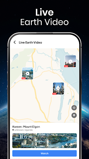
Live Earth Map Satellite View brings the world to your fingertips with detailed satellite imagery and interactive maps. Explore famous landmarks, cities, and remote places using high-quality satellite views and street-level perspectives.
With an easy-to-use interface, the app allows you to navigate different locations, zoom in on places of interest, and experience the Earth from above. Whether you’re curious about global geography, planning a trip, or simply exploring the planet, Live Earth Map Satellite View offers a smooth and engaging experience.