Airport Map is a flight planning tool designed for pilots and aviation enthusiasts.
GREAT CIRCLE CALCULATIONS
Calculate the shortest distance between airports using great circle navigation. View initial and final bearings, distance in nautical miles, statute miles, or kilometers, and estimated flight time based on your cruise speed.
MULTI-LEG ROUTE PLANNING
Plan complex routes with multiple waypoints. See individual leg distances and times, plus total route summary with fuel estimates when an aircraft is selected.
ROUTE PLANNING WITH ETP
Advanced route planning features including:
• Equal Time Point (ETP) calculation
• Headwind/tailwind compensation
• Great circle distance compensation
• SID/STAR distance adjustments
• Taxi time configuration
• Block time calculations
AIRCRAFT MANAGEMENT
Create custom aircraft profiles with:
• Average speed or three-phase (climb/cruise/descent) configurations
• Fuel consumption rates
• Fuel type and pricing for cost estimates
AIRPORT INFORMATION
Access detailed airport information including:
• Coordinates and elevation
• Local time and timezone
• Sunrise, sunset, civil dawn, and civil dusk times
• Live METAR weather reports
• TAF forecasts
• NOTAMs (Notices to Airmen)
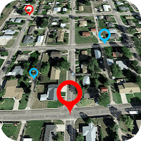
INTERACTIVE MAPS
Visualize your routes on interactive maps. See nearby airports along your route to help with diversion planning.
FREE & AD-FREE
Airport Map is completely free with no advertisements. Support development through voluntary donations if you find the app useful.