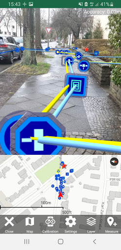
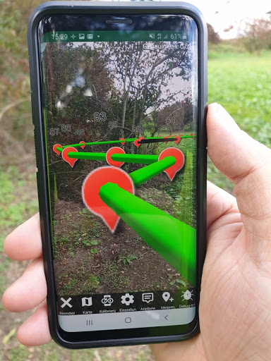
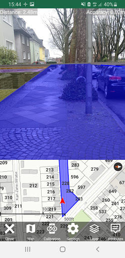
The new Augmented Reality App from frox is the ideal solution for virtually combining the existing and visible world with your data. You will receive a comprehensive view of your data in the locality at a glance. Using sensors and camera image of your smartphone, property boundaries, boundary stones, canals, underground pipes, drill points, soil estimates etc. become visible. You can see pipes, channels and objects that are not visible below the surface of the earth, as well.
FX Reality is available in the following expansion levels:
- View – Visual control in the locality
- Collect – Visual control and attributive care in the locality
- Survey – Control, maintenance and geometric recording
FX Reality is available in the following packages:
S - Single 1 User
M - Group 5 User
L - Team 10 User
XL - Crew 20 User
XXL - Organization 50 User
XXXL - Organization Pro 100 User
AR in the field of supply, networks, utilities
Have you ever seen fitters on site looking at decades-old installed technology? Often all you hear them say is "whew" with which fitters, civil engineers or electricians express that they cannot immediately understand what was being built at the time. Augmented Reality can be used simultaneously with the specialist departments to determine what kind of pipe systems, ducts or electrical lines are installed, where they run and how for example, a modernization solution might look like. Especially for public services, network operators, surveyors and external specialist companies, there is potential for optimized services with significantly greater transparency and speed.
AR in the field of planning, cadastre, surveying
Did you ever had to search for boundary stones or the course of the former border? By using Augmented Reality, you can display the boundary stones, boundary courses, stake-outs and parcel courses virtually in front of the camera image of your smartphone in the locality. This will give you and your staff a first impression of the situation in the location described in your survey plans.
AR in the field of marketing, urban planning, real estate
Show your investors the future planning status or inform the citizens in your community with the relevant information on the current development of the area/neighborhood. The FX Reality App can be customized and it will be made available in the Playstore or alternatively as a download.