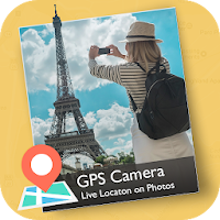
Capture photos with exact GPS Location details! GPS MapCam: Timestamp Camera is the ultimate tool for adding GPS map, address, latitude/longitude, and date time stamps to your photos and videos automatically.
Whether you are a traveler documenting memories or a professional conducting field work, this app ensures every photo tells the complete story.
📸 Why Choose GPS MapCam? Traditional cameras only capture the image. We capture the where and when. Perfect for civil engineers, surveyors, real estate agents, and construction professionals who need verifiable photo evidence for their reports.
🌍 Key Features:
📍 Advanced GPS Stamp Camera
Auto-Location: Automatically fetch and add your current address, city, and state.
Coordinates: Display precise Latitude and Longitude (Lat/Lng) on your images.
Maps Overlay: Choose from Normal, Satellite, Terrain, or Hybrid map types to stamp directly onto your photo.
⌚ Date & Time Stamper
Never forget when a moment happened. Keep a perfect record with customizable date and time formats.
"Timestamp Camera" functionality is built-in, allowing you to add current timestamps accurate to the second.
🧭 Compass & Direction
Add a digital compass to your photos to show orientation (North, South, East, West).
Essential for geologists and architects needing directional context.
👷 Perfect for Professionals (Work & Survey)
Construction: Document site progress with geotagged photos.
Real Estate: Show exact location context to clients.
Field Sales: Prove your visit location with tamper-proof timestamps.
Marine & Aviation: Record unique geotags for water and air travel.
🎨 Custom Information
Add custom notes or project names to your stamps.
Change font colors and transparency to match your style.
How it Works:
Open the GPS MapCam app.
The app automatically fetches your GPS location, compass direction, and time.
Take a photo! The Geotag, Map, and Timestamp are instantly added to the image.
Download GPS MapCam: Timestamp Camera now and start capturing the world with precision details!