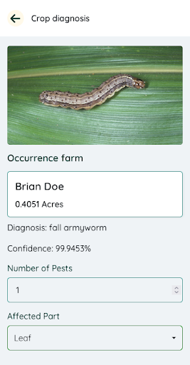
CropDig is a tool developed by Geospatial Research International in conjunction with other stakeholders, to give farmers precise and accurate information with regard to crop health. The tool is able to analyze photos of crops taken by farmers and provide any diseases or pests on the crop. The tool also provides information derived from satellite data, which gives farmers a view of their farms while highlighting areas that have been potentially attacked by crops and diseases.