Easily calculate area, distance, and land size with the GPS Area Measure app. Whether you want to measure fields, plots, routes, or property boundaries, this smart tool gives you accurate results with just a few taps.
With GPS Fields Area Measure, marker-based measurement, and live camera earth view, this app is perfect for farmers, landowners, engineers, real estate agents, and travelers who need fast and reliable measurement tools.
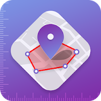
✨ Key Features – GPS Area Measure
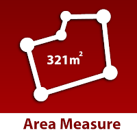
1. Area Measure on Map 🗺️
Easily calculate the land area of fields, plots, and properties by placing points on the map in multiple units (acres, square feet, etc.).. Whether you are a farmer measuring farmland, a real estate agent calculating property size,
2. Distance Measure Tool 📏
Measure the exact distance between two or multiple points on the map. Ideal for checking the length of roads, walking paths, cycling routes, or travel distances. This tool is great for surveyors, travelers, and outdoor explorers who need quick and precise results.
3. Live Camera Earth View 🌍
Experience the world in real-time with our live earth camera & satellite view. See streets, landmarks, and terrain in 2D, 3D, and street view modes. Perfect for travelers who want to explore new destinations, find routes, or virtually visit places worldwide. It's like having a satellite map in your hand.
4. GPS Fields Area Measure 🚜
The most popular feature for professionals. Designed especially for farmers and land surveyors, this tool helps measure construction site, farmland, agricultural plots, and crop fields accurately. Get the exact land size to plan farming activities, irrigation, fencing, or land distribution with ease.
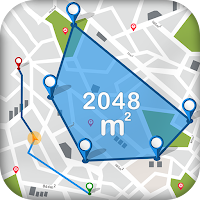
5. Marker Measure 📍
Create custom shapes and areas by placing markers on the map. This is useful for irregular-shaped plots, gardens, sports fields, or construction sites. The app calculates the total area and perimeter automatically for precise results.
6. Smart GPS Compass 🧭
Navigate like a pro with the built-in digital GPS compass. It helps you find true north, directions, and bearings easily. Ideal for hiking, trekking, road trips, and outdoor navigation, even in areas with weak signals.
7. Measurement Converter 🔄
Instantly convert area, length, and units into your preferred format. Supports meters, kilometers, miles, feet, yards, acres, and hectares. No need for external calculators—get everything in one app.
🌟 Benefits of GPS Area Measure
• Perfect for farmers, surveyors, architects, engineers, travelers, and property dealers
• Combines area calculator, distance tracker, compass, and live earth view in a single app
• Saves time with accurate GPS-based land measurement tools
• Easy-to-use interface for both professionals and casual users
📲 Try Now GPS Area Measure today – the ultimate tool for land area measurement, distance tracking, field survey, and live map exploration!
Disclaimer: GPS Area Measure provides approximate measurements for general use only. It does not replace professional surveying. Map data and views are powered by third-party providers like Google Maps™ and OpenStreetMap.