📍 “Camera Map: GPS Geotag Photos” is the ultimate app for capturing and saving your photo memories with precise “GPS location tagging”. Whether you're traveling, exploring, or documenting moments, this “GPS Camera” app makes it super easy to “geotag” your photos and view them on the “gps map” — all in one place!
Take control of your photo memories with smart “GPS camera” features. Discover where each picture was taken, organize photos by location, and never forget your favorite spots again.
Perfect for travelers, photographers, vloggers, hikers, and adventure lovers!
🌟 Key Features:
📸 “GPS Camera” for “Location Tagging”
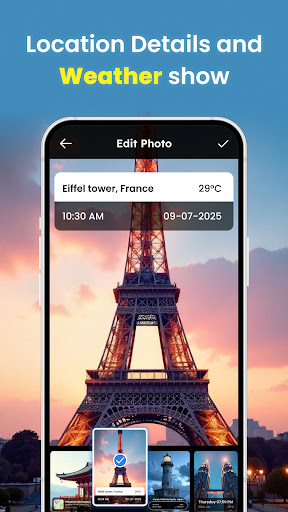
Automatically adds “GPS location” , latitude, longitude, altitude & time details to every photo you take with the in-app camera. No manual tagging needed!
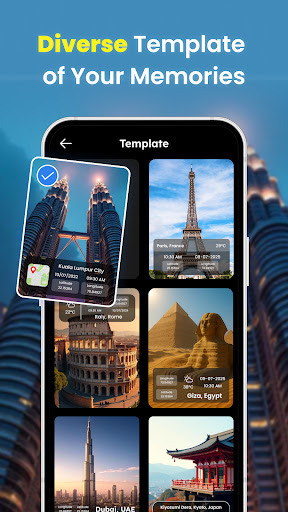
🗺️ “Map View” of Photos
• Captures accurate latitude, longitude, altitude, and even direction for truly detailed photo information..
📸 Photo Location Editor
•Need to adjust a location or add one to an existing photo? Our easy-to-use editor lets you modify EXIF data with precision.
🌐 Offline GPS Support Functionality
• Basic “geotagging” works even without an internet connection, perfect for remote travel.
🧭 Photo Location Tracker
• Keep a visual journey of where your photos were taken.
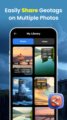
📤 Share with Location Info
• Share your geotagged photos with friends and family, letting them see exactly where your amazing moments happened.
🧳 Travel Diary Companion
• Turn your adventures into a visual travel log with GPS-embedded photos.
“Camera Map” is more than just a camera; it's your personal travel companion and memory keeper.
Download “Camera Map: GPS Geotag Photos” now capture, tag, map, and start building a truly unforgettable visual diary of your life's journey. It's the perfect “GPS photo” tool for travel, adventure tracking, work, or everyday moments!