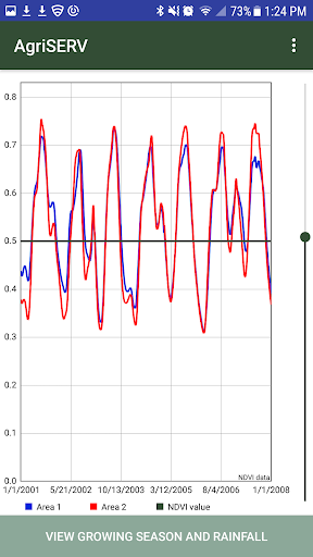
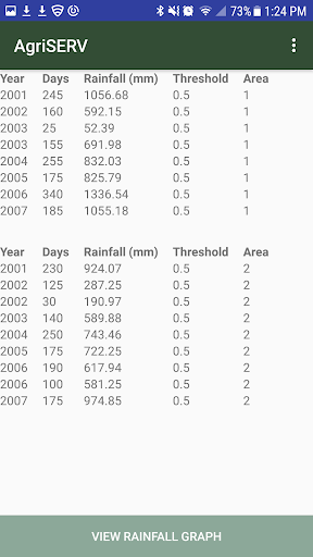
AgriSERV is a user-friendly, web-based tool that provides decision makers access to satellite- and model-derived products that can aid in assessing the impact of agriculture interventions. Two widely used datasets -- eMODIS Normalized Difference Vegetation Index (NDVI) and Climate Hazards Group InfraRed Precipitation with Station data (CHIRPS) rainfall data -- provide the basis for the analysis. (For more information on these datasets, refer to the relevant sections below.) This tool allows users to draw (delineate) two areas of interest: one control area with no intervention and another area that has experienced intervention. A time period can be specified ranging back to the year 2000. Then, an on-demand comparative analysis can be performed. The user is presented with side-by-side charts and summary data that highlight the differences of the two areas in terms of vegetation health, derived growing season lengths, and rainfall. The analysis is based on an area weighted average of the gridded NDVI and rainfall data. The users can download the summary data table as well as the full dataset for the period specified.