🛰️ EyeRadar – Monitor the terrain with InSAR satellite technology
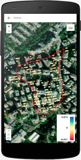
EyeRadar is the official Detektia app, a professional tool for viewing and tracking ground deformation data based on InSAR (Satellite Radar Interferometry) technology.
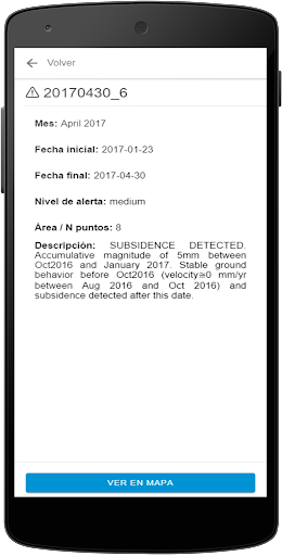
Designed for engineers, technicians and infrastructure managers, EyeRadar allows you to access deformation maps, analyze time series and receive personalized alerts about movements detected in critical areas.
🧠 Main features:
✔ Display of strain rate maps (mm/year)
✔ Access to time series by checkpoint
✔ Alerts for abnormal movements in key locations
✔ Comparison of satellite geometries (ascending and descending)
✔ Tracking by scenario and project
✔ Clear, fast and accessible interface from anywhere
🌍 Applications
✔ Monitoring of unstable slopes and slopes
✔ Monitoring of linear infrastructures (roads, railways, canals)
✔ Control of urban or industrial subsidence
✔ Supervision of underground works or tunnels
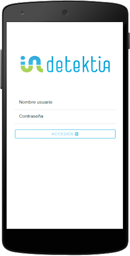
🔒 Privacy and security
EyeRadar is linked to authorized Detektia accounts. To access data, you need to log in with valid credentials.