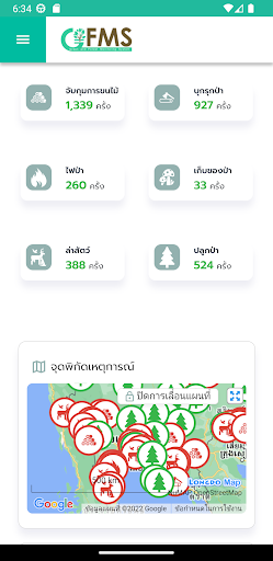
GIS in the forest (GISTDA Forest Monitoring System: GFMS) as shown in the satellite imagery and geospatial information. Related to forest resources As well as check the status of the target area. To support planning and decision-making in the management of forest resources in the country.
featured
- the satellite images during close today. And geospatial information on the timber.
- Statistics show the forest area in the country, region and province.
- search the area along the township, district and province.
- determining the position of the target area on a map coordinate system GCS and UTM.
- Check the status of the land on the target area of the state.
- Navigate to the target area.