Orienteering without the need to set out controls points!
Draw the course in the smartphone, run the course and evaluate the race directly using the smartphone. You can see a result table, your route on map and a result profile. You can also replay the race and compare with one or more opponents.
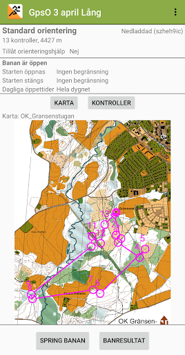
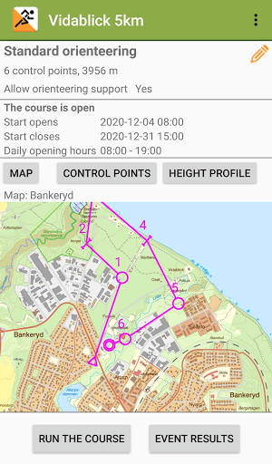
The GPS will detect when you are at the controlpoint and will automatically punch. All you need is a map in jpg/png/gif-format.
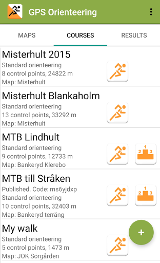
It is simple to arrange a training event with the GPS Orienteering app. Just publish a course (and map) inside the app. The participants can download the course, run the course and upload their result. Everyone can then download the results and see a result table for the event, view and replay the tracks and more. All within the app!
The courses can be one of four different types: standard orientering, free order orienteering, rogaining or scatter orienteering.
A unique feature is maze orienteering! You can overlay a random, virtual maze to your course. Export the map to get a printable version. You will get an audible feedback when your are close to a maze wall and when you cross a wall.
Voice assistance during the race gives you a spoken message when you punch. It also tells you the remaining time at rogaining races every fifth minute.
Orienteering support during a race can show your position on the map, show distance/direction to next control point, voice message distance/direction to next control point and/or course drift voice message (at a configured interval) of your course relative to the straight course by a spoken message such as 'On course' or 'Drift 23 meters left'.
Georeference maps using a world file or kml-file. World files are for example created at export of maps from OCAD 10/11/12. Kml-files can be created when georeferencing a map in Google Earth. You can also import maps in kmz-format, for example maps exported from MapAnt.fi.
Import courses i gpx or kml format. OCAD can export courses in gpx-format that can be imported by the app.
Download course height data from Google. View course height profile course climb. The height data is also used to calibrate the height data measured by the smartphone during a race.
Upload training results to Strava!
Export course maps to jpg-files for printing on a colour printer.