Fegu Mbeund is an innovative mobile application that allows you to easily identify areas without flood risks in Senegal, whether to buy land, set up a business or find secure housing.
Main features:
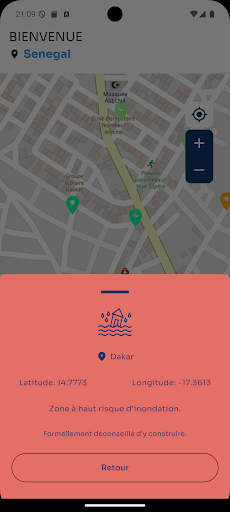
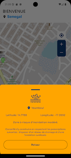
Interactive map ?️: Navigate an intuitive map to explore the level of flood risk in the areas that interest you.
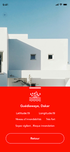
Precise coordinates: Enter the coordinates (latitude and longitude) directly to obtain a precise assessment of the flood risk.
Image Capture ?: Take a photo or choose an image from your gallery for personalized area information.
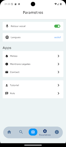
Feedback in multiple formats: Receive text and audio information in French or Wolof for better accessibility.
Current regional coverage
Data ? is currently available for the areas most exposed to flooding in Senegal, including:
Dakar
Touba
Kaolack
Matam
Kedougou
Kolda
Tambacounda
We are gradually expanding coverage to include other regions as new data becomes available.
With Fegu Mbënd, make informed decisions for a calm and secure investment.