TopoTool Topographic Mapper
Install Now
TopoTool Topographic Mapper

TopoTool Topographic Mapper

This app allows you to survey land-surfaces and create digital raster models

Developer: 2metric
App Size: Varies With Device
Release Date: Apr 29, 2021
Price: Free
Price
Free
Size
Varies With Device

Screenshots for App

Mobile
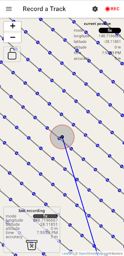
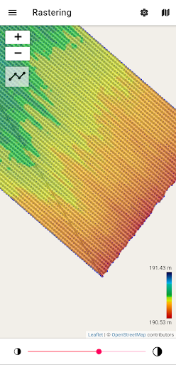
This application allows you to survey land-surfaces with your android device. This data will be converted into a digital raster model which is useful for land analysis/simulation/design. Those raster models can be exported and for example, used in QGIS

supported inputs:
- internal GPS
- Bluetooth GNSS (RTK) receiver (NMEA)
- USB-Serial GNSS (RTK) receiver (NMEA)
- CSV files (EPSG:4326) with latitude, longitude, and elevation
- GPX file

supported outputs:
- GPX file
- Ascii Grid (EPSG:3857, EPSG:4326, UTM)
- Image (.png) and world file (.pgw)
Show More
Show Less
More Information about: TopoTool Topographic Mapper
Price: Free
Version: 0.0.144
Downloads: 9359
Compatibility: Android 8.1
Bundle Id: topographic.survey.mapper
Size: Varies With Device
Last Update: 2023-04-16
Content Rating: Everyone
Release Date: Apr 29, 2021
Content Rating: Everyone
Developer: 2metric


Whatsapp
Vkontakte
Telegram
Reddit
Pinterest
Linkedin
Hide