Earthquake IGTL mobile application is aimed to disseminate information in real-time of all earthquakes occurred particularly in the Timor-Leste. This application is provided to public, who interest to the earthquake, they will receive earthquake information directly from IGTL.
Features of application:
1. Map of epicenter for all event
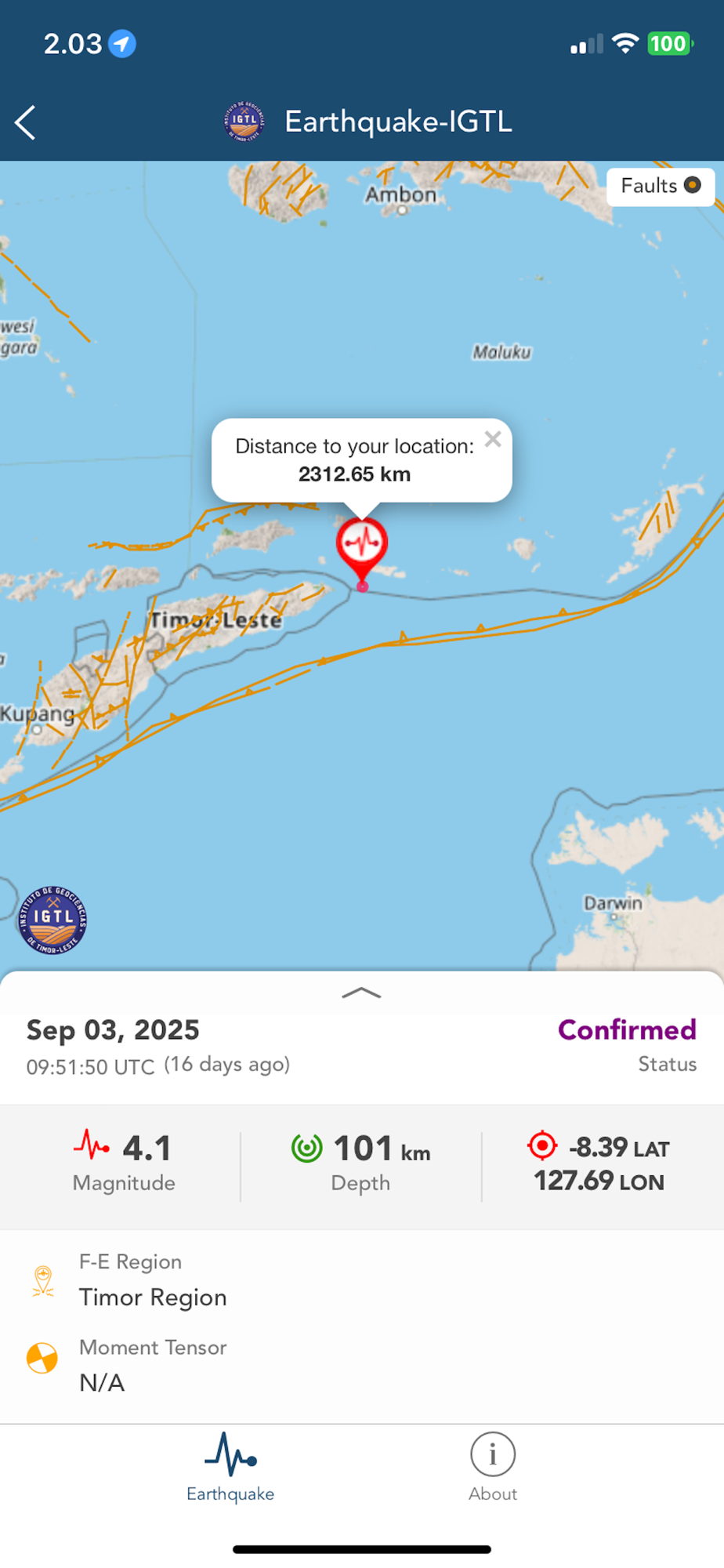
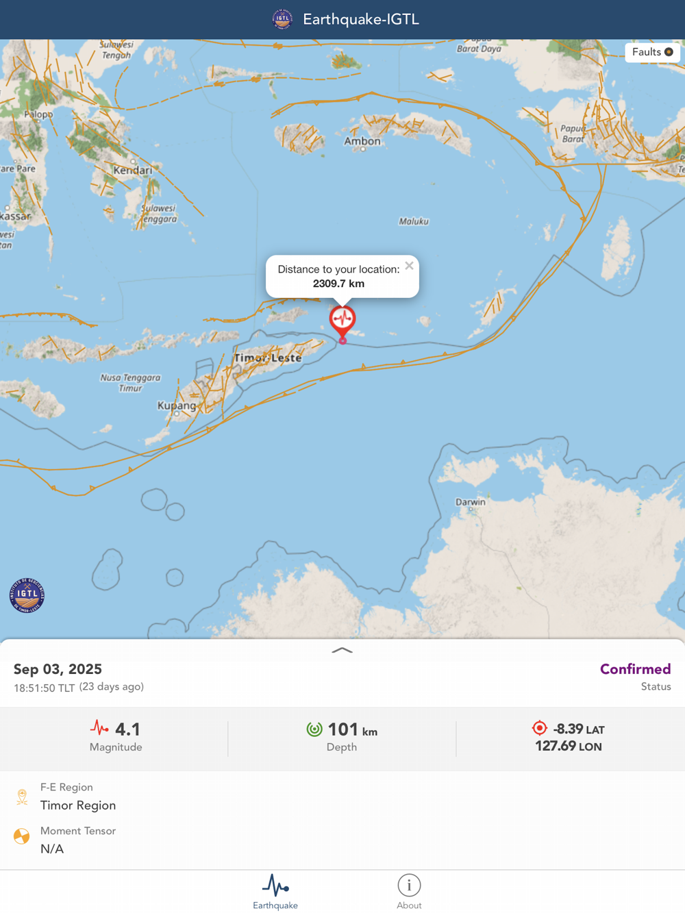
2. Map of epicenter for each event
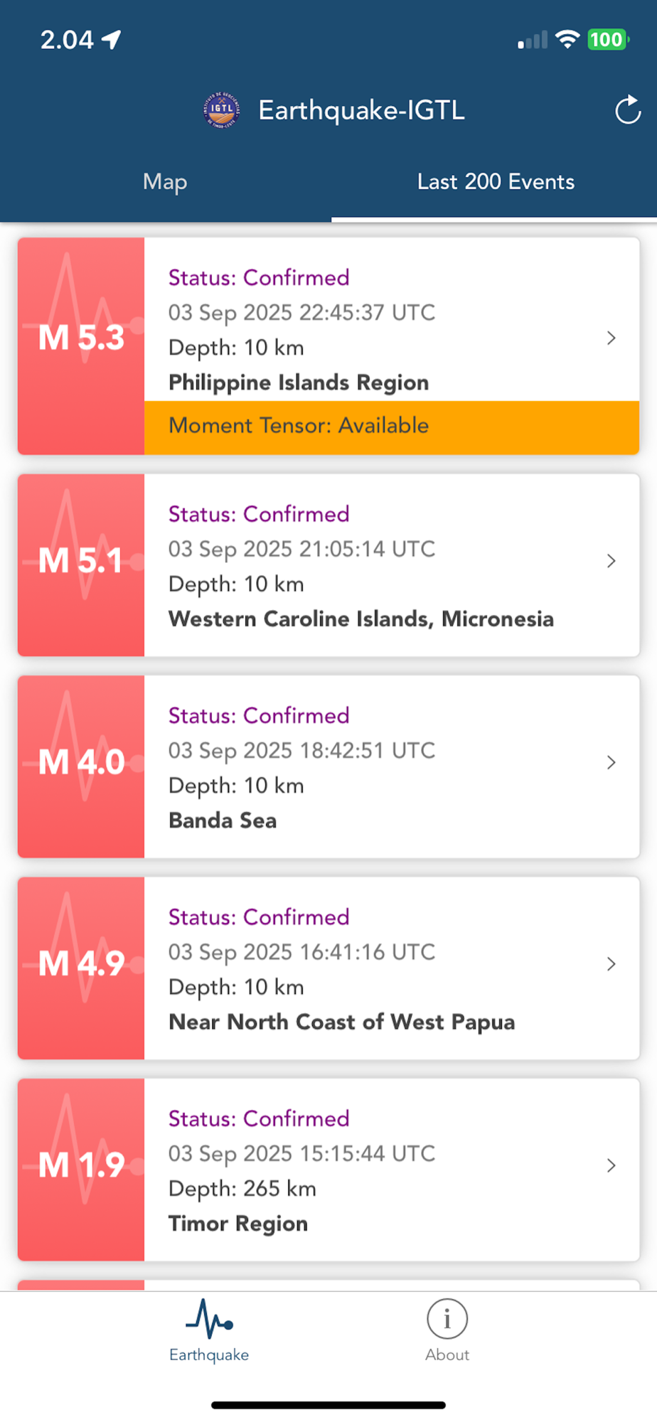
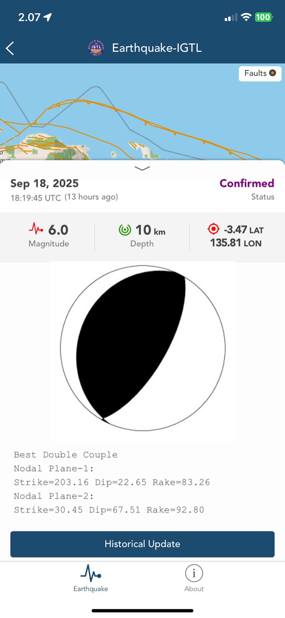
3. Earthquake parameters including OT, latitude, longitude, depth, and magnitude
4. List of past 200 events
5. Fault plot
6. Status of earthquake event analysis
7. Moment Tensor information if available
8. Historical update of earthquake parameter since first location
9. Epicenter distance from user location
10. Event age
11. App Glossary
12. About application
13. Sound notification and popup alert with magnitude, epicenter, origin time, and Flinn-Engdahl region
© Instituto de Geociências de Timor-Leste - Instituto Público (IGTL)
City 8, CBD Piso 2, Rua Has Laran, Manleuana, Dili, Timor-Leste