Be prepared! Plan your next trip to one of the great Virginia parks. Download maps and guides before you venture into the WiFi free wilderness.
Discover
- 80+ national parks, state parks, monuments, forests
- 60+ neatly folded maps by the National Park Service, Bureau of Land Management, United States Forest Services, and other agencies.
- 500+ campgrounds and campsites
- 2,600+ trails and trailheads
- 73,000+ points of interests
Plan
- Download maps, park brochures, and newspapers. These downloads are ready when you are offline and off the grid in the great outdoors.
- Download arbitrary map sections as offline packs.
- Photo galleries, panorama views.
- Share links to parks and maps with friends
Have fun
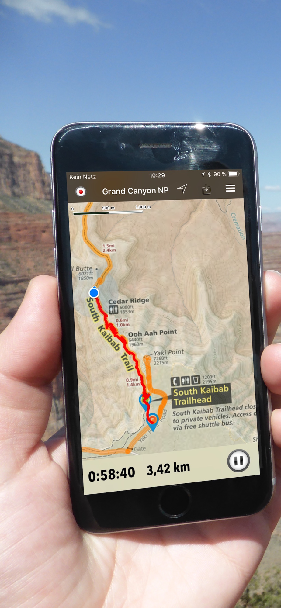
- GPS and GPX support: record your hikes, import GPX routes, tracks and waypoints for your hiking trails.
- Detailed national park information: alerts, news, visitor centers, campgrounds, driving directions, weather.
- Open your favorite maps app to get a route to the selected park.
- Current weather conditions, easy access to multi-day forecasts, sunrise and sunset times.
- Push notifications for park alerts, park news, weather warnings
So download maps and guides for:
Appalachian
Assateague Island
Bear Creek Lake
Belle Isle
Blue Ridge
Booker T. Washington
Caledon
Cedar Creek & Belle Grove
Chippokes Plantation
Claytor Lake
Colonial
Cumberland Gap
Douthat
Fairy Stone
False Cape
First Landing
Fort Monroe
Fredericksburg & Spotsylvania
George Washington
Grayson Highlands
Harpers Ferry
High Bridge
Holliday Lake
Hungry Mother
James River
Jamestowne
Jefferson
Kiptopeke
Lake Anna
Leesylvania
Machicomoco
Manassas
Mason Neck
Natural Bridge
Natural Tunnel
New River Trail
Occoneechee
Overmountain Victory
Petersburg
Pocahontas
Potomac Heritage
Prince William Forest
Richmond
Seven Bends
Shenandoah
Shenandoah River
Sky Meadows
Smith Mountain Lake
Staunton River
Westmoreland
Widewater
York River
There are additional useful information and brochures for:
Appalachian Trail, Appomattox Court House, Arlington House, Breaks, Cape Henry Memorial, Chesapeake Bay, Civil War Defenses of Washington, Claude Moore Colonial Farm, George Washington Birthplace, Great Falls, Green Springs, Journey Through Hallowed Ground, Maggie L. Walker, Shenandoah Valley Battlefields, Star-Spangled Banner, Wolf Trap National Park for the Performing Arts, Yorktown Battlefield and many more exiting parks.
- FULL ACCESS is available for a for $3.49/three month (after a free 3-days trial period) or $2.49/two months or $7.49/year. You can subscribe and pay through your iTunes account. The account will be charged for renewal within 24-hours prior to the end of the current period, and identify the cost of the renewal. Your subscription will automatically renew unless canceled at least 24 hours before the end of the current period. Auto-renew can be turned off anytime by going to your Account Settings in iTunes after purchase.
- Continued use of GPS running in the background can dramatically decrease battery life.
LEGAL
Terms of Use: https://www.icoat.de/pocketmaps/terms
Privacy Policy: https://www.icoat.de/pocketmaps/privacy