Mapics is an innovative iOS app that brings your photo memories to life by displaying them on an interactive map based on their GPS coordinates. Whether you're documenting a vacation, tracking your daily adventures, or simply organizing your photo collection geographically, Mapics creates stunning visual narratives of your journeys.
GPS Photo Mapping:
- Choose from Standard, Satellite, and Hybrid map views with customizable appearance settings including light and dark modes.
- Connect your photo locations with straight lines, curved paths, or even walking routes to visualize your journey paths.
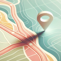
- Personalize your map with different marker icons, colors, and sizes to make your photo locations stand out.
- Easily select photos from your library with intelligent duplicate detection and metadata extraction for accurate timestamps.
- Capture beautiful screenshots of your mapped photos to share your journeys with friends and family.