A simple APP for working with Latitude Longitude, UTM coordinates, Maps and GPS. Register points to be displayed on a map or stored in a database complete with readable address data (geocoding). Capture photo with a watermark containing point name, coordinates and address information. Export saved data to CSV format or locate points in the field using your built-in device's compass and GPS.
Register Points
UTM Maps allows you to register points and stored in database to display on the map or export to a CSV file. Stored point data will automatically completed with UTM coordinates and readable address (geocoding requires internet access).
Measure Area And Distance
No need to go to the field anymore; now you can measure area and distance with various units using this application. Stores line and polygon data in database and displays it on a map. Export lines and polygons data to KML file.
Data Properties / Point Details
Each data displayed on the map has its own properties, making it easier to navigate and understand. Simply click on a point and the data properties will automatically appear.
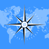
Find Point On The Field / Stake Out
Now you can find coordinates or location in the field easily, the application will direct you to the desired coordinate point with the help of the built-in compass on your device or using Direction Route.
Add Photo
Add a photo from camera or library complete with a watermark containing name, coordinates and address information.
Data List & Export
The data list is designed to view data stored in the database, delete unnecessary data, find the location of data in the field or export data to a file. Point data can be exported to CSV files, while line and polygon data can be exported to KML files for use in other software or other devices.